
1773 Map of South Carolina - Vintage Map Wall Art - American Revolution South Carolina Map Poster - Old South Carolina Map Art - Vintage South Carolina Map Print
Key item features
- Size: 24 x 24 Inches
- Museum-quality giclee print
- Printed using archival ink on premium heavyweight acid-free matte paper
- Shipped in a sturdy cardboard tube
- Makes a perfect gift
Specs
- Size24" x 24"
- ThemeGeometric
- FramedN
- BrandHISTORIX
- Photo paper finish configurationMatte
- Pieces1
- Free shipping
 Free 30-day returns
How do you want your item?
About this item
Product details
Feature Points
- VINTAGE MAP REPRODUCTION: You’ll love this high quality historic reproduction of 1773 Map of South Carolina. Our museum quality maps are archival grade, which means it will look great and last without fading for over 100 years. Our print to order maps are made in the USA and each map is inspected for quality. This beautiful artwork is a perfect addition to your themed decor. Vintage maps look great in the home, study or office. They make a perfect gift as well.
- MUSEUM QUALITY: This high quality map print will be a great addition to your vintage-themed wall. Don't waste money on cheap-looking, thin paper posters. We use thick, fine art print quality matte paper. Our professional’s choice matte paper displays artwork in high detail without glare. The color is vibrant and text is easy to read. When framed, this map looks absolutely stunning.
- A LOOK BACK AT HISTORY: This is an impressive, historic reproduction of 1773 Map of South Carolina. This print is from an original found in the maps and geography division of the US Library of Congress. A true piece of history. See our product description section for more fascinating information about this historic map and its significance.
- READY TO FRAME: This print includes a 0.2 inch border for a perfect frame fit and look. Our maps are designed to fit easy-to-find standard frame sizes, saving you money from having to pay for a custom frame. Each map is inspected for quality and shipped in a rigid tube.
- HISTORIX: We love history and art. Sometimes old maps have tears, folds, separations and other blemishes. We digitally restore and enhance maps while keeping its historical character. All our maps are proudly made in the USA. Customers all over the world love our vintage maps and we know you will too.
Additional Information
Published just two years before the American Revolution broke out, this depiction of what would become South Carolina is highly detailed and would have been a valued resource at the time. By illustrating not just the towns and counties, but also topographical information, this map serves as a real link to the past and an authentic piece of cartographical history.
This era in South Carolina, and the other twelve colonies, saw tensions rising against colonial rule by Great Britain, and the Boston Tea Party occurred in the same year this map was produced. Charlestown, the oldest and most populated city in South Carolina, was a valuable port and the busiest hub of Atlantic trade between the colonies and England. In addition, the huge amount of business that occurred in Charlestown made it the most prosperous city in North America at this time. Tobacco exports flourished, and the state developed widespread rice cultivation in its marshy lowlands.
South Carolina’s rich history goes back to the first settlers of the land who found fertile ground for farming as well as valuable marine life and the ability to establish deepwater ports. Five years after the publication of this map South Carolina would be the first state to ratify the Articles of Confederation and would go on to become the eighth state to join the fledgling nation.
During the American Revolution, the state saw nearly a third of all conflicts on its land, more than any other state, as residents endured invasion by the English.
Our museum quality giclee print comes printed with archival ink on premium heavyweight matte paper. Shipped in a sturdy cardboard tube your print will arrive ready to be framed. This eye-catching vintage map print makes the perfect gift for anyone that loves history and imagery.
- Size: 24 x 24 Inches
- Museum-quality giclee print
- Printed using archival ink on premium heavyweight acid-free matte paper
- Shipped in a sturdy cardboard tube
- Makes a perfect gift
Specifications
Size
Theme
Framed
Brand
Warranty
Warranty information
Similar items you might like
1879 Utah State Map - Utah State Vintage Map Wall Art - Old Historic Map of Utah Poster Showing Towns Counties Indian Reservations and Natural Features $39.99
 2 optionsAvailable in additional 2 options$3999current price $39.99
1879 Utah State Map - Utah State Vintage Map Wall Art - Old Historic Map of Utah Poster Showing Towns Counties Indian Reservations and Natural Features
South Carolina Home Poster Print $12.95
 $1295current price $12.95
South Carolina Home Poster Print
Grand Teton National Park Hand-Drawn Map Poster 18x24", Vintage-Style Wall Art, Lithographic Print with Soy-Based Inks, Gift for History Buffs, Travelers, Teachers, Made in USA $42.98
 $4298current price $42.98
Grand Teton National Park Hand-Drawn Map Poster 18x24", Vintage-Style Wall Art, Lithographic Print with Soy-Based Inks, Gift for History Buffs, Travelers, Teachers, Made in USA
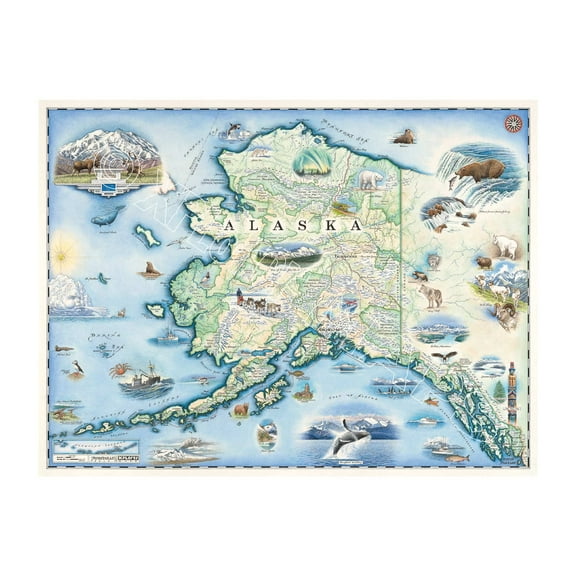
Alaska Map Wall Art Poster - Authentic Hand Drawn Maps in Old World, Antique Style - Art Deco for Home Office Décor - Lithographic Print $32.99 Was $37.27
 $3299current price $32.99, Was $37.27$37.27
Alaska Map Wall Art Poster - Authentic Hand Drawn Maps in Old World, Antique Style - Art Deco for Home Office Décor - Lithographic Print
HISTORIX Vintage 1902 Eureka California Map Poster - 18x24 Inch Old Bird's Eye View of Eureka Humboldt County Map of California Poster Wall Art Print $39.99
 2 optionsAvailable in additional 2 options$3999current price $39.99
HISTORIX Vintage 1902 Eureka California Map Poster - 18x24 Inch Old Bird's Eye View of Eureka Humboldt County Map of California Poster Wall Art Print
Superstock SAL255423762 USA South Carolina Charleston Street Scene Poster Print, 18 x 24 $40.61
 2 optionsAvailable in additional 2 options$4061current price $40.61
Superstock SAL255423762 USA South Carolina Charleston Street Scene Poster Print, 18 x 24
24"x36" Gallery Poster, map of Barnwell District, South Carolina 1825 $52.95
 $5295current price $52.95
24"x36" Gallery Poster, map of Barnwell District, South Carolina 1825
HISTORIX Vintage 1889 Paducah Kentucky Map Poster - Bird's Eye View of Paducah KY Map - Vintage Map of Kentucky Poster Wall Art Print $39.99
 2 optionsAvailable in additional 2 options$3999current price $39.99
HISTORIX Vintage 1889 Paducah Kentucky Map Poster - Bird's Eye View of Paducah KY Map - Vintage Map of Kentucky Poster Wall Art Print
HISTORIX Vintage 1879 Denton County Texas Map Print - History Map of the County of Denton Texas Wall Art - Vintage Texas Map Poster $39.99
 2 optionsAvailable in additional 2 options$3999current price $39.99
HISTORIX Vintage 1879 Denton County Texas Map Print - History Map of the County of Denton Texas Wall Art - Vintage Texas Map Poster
HISTORIX Vintage 1869 Kankakee Illinois Map Poster - 18x24 Inch Old Map of Kankakee Illinois Wall Art - Bird's Eye View History Map of Illinois Poster $39.99
 2 optionsAvailable in additional 2 options$3999current price $39.99
HISTORIX Vintage 1869 Kankakee Illinois Map Poster - 18x24 Inch Old Map of Kankakee Illinois Wall Art - Bird's Eye View History Map of Illinois Poster
Vintage 1781 Cape Fear River Region Map Vintage Map of Wilmington and Brunswick County North Carolina - New Hanover NC Vintage Map Wall Art - American Revolution Map $16.99
 3 optionsAvailable in additional 3 options$1699current price $16.99
Vintage 1781 Cape Fear River Region Map Vintage Map of Wilmington and Brunswick County North Carolina - New Hanover NC Vintage Map Wall Art - American Revolution Map
24"x36" Gallery Poster, map of Newberry District, South Carolina 1820 $52.95
 $5295current price $52.95
24"x36" Gallery Poster, map of Newberry District, South Carolina 1820
HISTORIX Vintage 1867 Saginaw City Michigan Map Poster - Bird's Eye View of Saginaw Michigan Wall Art Print - Vintage Michigan Map History $39.99
 2 optionsAvailable in additional 2 options$3999current price $39.99
HISTORIX Vintage 1867 Saginaw City Michigan Map Poster - Bird's Eye View of Saginaw Michigan Wall Art Print - Vintage Michigan Map History
1867 Green Bay Wisconsin Map - Vintage Green Bay Map- Old Bird's Eye VIew of Green Bay and Fort Howard Wisconsin - History Map of Green Bay Wall Art Poster $39.99
 2 optionsAvailable in additional 2 options$3999current price $39.99
1867 Green Bay Wisconsin Map - Vintage Green Bay Map- Old Bird's Eye VIew of Green Bay and Fort Howard Wisconsin - History Map of Green Bay Wall Art Poster
HISTORIX Vintage 1868 Iowa City Map - 18x24 Inch Bird's Eye View History Map of Iowa Poster - Old Iowa City Johnson County Iowa Map Poster Print $39.99
 2 optionsAvailable in additional 2 options$3999current price $39.99
HISTORIX Vintage 1868 Iowa City Map - 18x24 Inch Bird's Eye View History Map of Iowa Poster - Old Iowa City Johnson County Iowa Map Poster Print
1868 Grand Rapids Michigan Map - Vintage Grand Rapids Wall Art - Old Map of Grand Rapids MI Poster - Historic Bird's Eye View of Grand Rapids Michigan Map Poster $39.99
 2 optionsAvailable in additional 2 options$3999current price $39.99
1868 Grand Rapids Michigan Map - Vintage Grand Rapids Wall Art - Old Map of Grand Rapids MI Poster - Historic Bird's Eye View of Grand Rapids Michigan Map Poster
1860 York County Pennsylvania Map - Vintage Map of York Pennsylvania - History Map of York County PA - Old York County Map from Actual Surveys Wall Art Poster $37.99
 2 optionsAvailable in additional 2 options$3799current price $37.99
1860 York County Pennsylvania Map - Vintage Map of York Pennsylvania - History Map of York County PA - Old York County Map from Actual Surveys Wall Art Poster
1990 Great Smoky Mountains Trail Map Poster - Smoky Mountains Map - Appalachian Trail Poster - North Carolina Poster - Tennessee Poster - Smoky Mountains Poster $39.99
 2 optionsAvailable in additional 2 options$3999current price $39.99
1990 Great Smoky Mountains Trail Map Poster - Smoky Mountains Map - Appalachian Trail Poster - North Carolina Poster - Tennessee Poster - Smoky Mountains Poster
HISTORIX Vintage 1880 Fort Worth Map Print - Vintage Map of Fort Worth Texas and Vicinity - Historic Fort Worth Texas Map Wall Art Poster $39.99
 2 optionsAvailable in additional 2 options$3999current price $39.99
HISTORIX Vintage 1880 Fort Worth Map Print - Vintage Map of Fort Worth Texas and Vicinity - Historic Fort Worth Texas Map Wall Art Poster
HISTORIX Vintage 1890 Tacoma Washington Map Poster - 18x24 Inch Historic Bird's Eye View of Tacoma City of Washington State Map Wall Art Print $39.99
 2 optionsAvailable in additional 2 options$3999current price $39.99
HISTORIX Vintage 1890 Tacoma Washington Map Poster - 18x24 Inch Historic Bird's Eye View of Tacoma City of Washington State Map Wall Art Print
Customer ratings & reviews

Related pages
- Alabama State Map Cities
- North Alabama Maps
- Chicago World's Fair Map
- Alabama Map
- Washington Dc Museum Map
- Mi State Parks Map
- National Parks Posters
- Central America Travel Books, Maps & Guides
- Midwest United States Travel Books, Maps & Guides
- General South America Travel Books, Maps & Guides
- Northeast United States Travel Books, Maps & Guides
- Southern United States Travel Books, Maps & Guides