
Hero image 0 of C-MAP Reveal Coastal Great Lakes to Nova Scotia, 0 of 7
C-MAP Reveal Coastal Great Lakes to Nova Scotia
(No ratings yet)
Key item features
- Detailed Navigation: Features full-featured vector charts derived from official Hydrographic Office information for accurate and up-to-date navigation.
- Advanced Seafloor Imagery: Includes Shaded Relief with 3D rendered land and underwater elevation, plus Ultra-High-Res Bathy seafloor imagery for anglers.
- Customizable Depths: Offers Custom Depth Shading to set safety depths, maintain a paper-like view, or create personalized shading.
- Enhanced Routing: Provides Easy Routing to automatically plot the shortest, safest route based on detailed chart data and vessel information.
- Visual Overlays: Incorporates Aerial Photography and Satellite Overlay for additional detail and information about surroundings in unfamiliar areas.
- Port Specifics: Details thousands of marinas with precise layouts, including slip spaces and restricted areas, along with comprehensive harbor and approach details.
- Dynamic Water Data: Shows Tides & Currents projections for water level and direction, aiding in planning for cruising, angling, or sailing.
Generated by AI
Specs
- Map typeNautical
- SizeGreat Lakes to Nova Scotia
- BrandC-MAP
- MaterialPaper
- FormBooks
- ColorMulticolor
Current price is USD$260.00
Price when purchased online
- Free shipping
 Free 30-day returns
How do you want your item?
Ships to
Arrives by Thu, Jun 18
.Order within 11 hr 31 min
|Sold and shipped by Boating Store
4.656276326874473 stars out of 5, based on 1187 seller reviews(4.7)1187 seller reviews
Free 30-day returns
About this item
Product details
C-MAP M-NA-Y201-MS Reveal Coastal GREAT LAKES TO NOVA SCOTIAModel: M-NA-Y201-MSShaded Relief — bring the world around you to life, with 3D rendered land and underwater elevation — including areas of Ultra-High-Res Bathy seafloor imagery, previously only available in MAX-N+ Reveal a game changer for anglers.Full-Featured Vector Charts — making navigation easy by giving you accurate, up-to-date vector chart detail derive from official Hydrographic Office information.High-Res Bathy — helps you identify shallow areas, drop-offs, ledges, holes or humps. Now includes compiled and quality-controlled Genesis® detail as part of singular HRB layer.Custom Depth Shading — set a clear safety depth, maintain a paper-like view or create your own custom shading.Dynamic Raster Charts — providing the traditional chart look and feel, coupled with easy access to all objects on the chart.Easy Routing™ — helps you automatically plot the shortest, safest route based on detailed chart data and your personalized vessel information.Aerial Photography — a collection of thousands of photos of marinas, harbors, inlets and other notable navigational features included to offer an additional level of detail.Satellite Overlay — satellite imagery gives information about the surroundings when you find yourself in an unfamiliar place.Tides & Currents — shows projections of water level and direction of tides to help plan your day out, cruising, angling or sailing.Detailed Marina Port Plans — docking in an unfamiliar port is no problem when you have precise layouts of thousands of marinas, including slip spaces, restricted areas and other valuable navigation information.Harbor & Approach Details — unprecedented level of detail. Approach any harbor and inlet with confidence. The perfect conclusion to a long voyage, sailing adventure or an exciting day of fishing.Online Updates — keep your chart up to date, with 12 months’ free online updates.Cruising, fishing or sailing, C-MAP® REVEAL™ Coastal charts offer the very best of C-MAP. With Shaded Relief, including game-changing Reveal Seafloor Imagery, Aerial Photography, Satellite Overlay and Dynamic Raster Chart presentation added to the core C-MAP features found in DISCOVER™ — full-featured Vector Charts, with Custom Depth Shading, Tides & Currents and subscription-free Easy Routing™. It also includes the very best of C-MAP High-Res Bathy, including integrated Genesis® data. Purchase includes a full 12 months of free online updates. Compatible with Lowrance, Simrad & B&G Chartplotters.
- C-MAP Reveal Coastal Great Lakes to Nova Scotia M-NA-Y201-MS
-
C-MAP M-NA-Y201-MS Reveal Coastal GREAT LAKES TO NOVA SCOTIA
Model: M-NA-Y201-MS
- Shaded Relief — bring the world around you to life, with 3D rendered land and underwater elevation — including areas of Ultra-High-Res Bathy seafloor imagery, previously only available in MAX-N+ Reveal a game changer for anglers.
- Full-Featured Vector Charts — making navigation easy by giving you accurate, up-to-date vector chart detail derive from official Hydrographic Office information.
- High-Res Bathy — helps you identify shallow areas, drop-offs, ledges, holes or humps. Now includes compiled and quality-controlled Genesis® detail as part of singular HRB layer.
- Custom Depth Shading — set a clear safety depth, maintain a paper-like view or create your own custom shading.
- Dynamic Raster Charts — providing the traditional chart look and feel, coupled with easy access to all objects on the chart.
- Easy Routing™ — helps you automatically plot the shortest, safest route based on detailed chart data and your personalized vessel information.
- Aerial Photography — a collection of thousands of photos of marinas, harbors, inlets and other notable navigational features included to offer an additional level of detail.
- Satellite Overlay — satellite imagery gives information about the surroundings when you find yourself in an unfamiliar place.
- Tides & Currents — shows projections of water level and direction of tides to help plan your day out, cruising, angling or sailing.
- Detailed Marina Port Plans — docking in an unfamiliar port is no problem when you have precise layouts of thousands of marinas, including slip spaces, restricted areas and other valuable navigation information.
- Harbor & Approach Details — unprecedented level of detail. Approach any harbor and inlet with confidence. The perfect conclusion to a long voyage, sailing adventure or an exciting day of fishing.
- Online Updates — keep your chart up to date, with 12 months’ free online updates.
Cruising, fishing or sailing, C-MAP® REVEAL™ Coastal charts offer the very best of C-MAP. With Shaded Relief, including game-changing Reveal Seafloor Imagery, Aerial Photography, Satellite Overlay and Dynamic Raster Chart presentation added to the core C-MAP features found in DISCOVER™ — full-featured Vector Charts, with Custom Depth Shading, Tides & Currents and subscription-free Easy Routing™. It also includes the very best of C-MAP High-Res Bathy, including integrated Genesis® data. Purchase includes a full 12 months of free online updates. Compatible with Lowrance, Simrad & B&G Chartplotters.
- Shaded Relief — bring the world around you to life, with 3D rendered land and underwater elevation — including areas of Ultra-High-Res Bathy seafloor imagery, previously only available in MAX-N+ Reveal a game changer for anglers.
- Full-Featured Vector Charts — making navigation easy by giving you accurate, up-to-date vector chart detail derive from official Hydrographic Office information.
- High-Res Bathy — helps you identify shallow areas, drop-offs, ledges, holes or humps. Now includes compiled and quality-controlled Genesis® detail as part of singular HRB layer.
- Custom Depth Shading — set a clear safety depth, maintain a paper-like view or create your own custom shading.
- Dynamic Raster Charts — providing the traditional chart look and feel, coupled with easy access to all objects on the chart.
- Easy Routing™ — helps you automatically plot the shortest, safest route based on detailed chart data and your personalized vessel information.
- Aerial Photography — a collection of thousands of photos of marinas, harbors, inlets and other notable navigational features included to offer an additional level of detail.
- Satellite Overlay — satellite imagery gives information about the surroundings when you find yourself in an unfamiliar place.
- Tides & Currents — shows projections of water level and direction of tides to help plan your day out, cruising, angling or sailing.
- Detailed Marina Port Plans — docking in an unfamiliar port is no problem when you have precise layouts of thousands of marinas, including slip spaces, restricted areas and other valuable navigation information.
- Harbor & Approach Details — unprecedented level of detail. Approach any harbor and inlet with confidence. The perfect conclusion to a long voyage, sailing adventure or an exciting day of fishing.
- Online Updates — keep your chart up to date, with 12 months’ free online updates.
- M-NA-Y201-MS
info:
We aim to show you accurate product information. Manufacturers, suppliers and others provide what you see here, and we have not verified it.
Specifications
Map type
Nautical
Subject
Coastal Great Lakes to Nova Scotia
Size
Great Lakes to Nova Scotia
Brand
C-MAP
Warranty
Warranty information
One year product warranty
Please be aware that the warranty terms on items offered for sale by third party Marketplace sellers may differ from those displayed in this section (if any). To confirm warranty terms on an item offered for sale by a third party Marketplace seller, please use the 'Contact seller' feature on the third party Marketplace seller's information page and request the item's warranty terms prior to purchase.
Please be aware that the warranty terms on items offered for sale by third party Marketplace sellers may differ from those displayed in this section (if any). To confirm warranty terms on an item offered for sale by a third party Marketplace seller, please use the 'Contact seller' feature on the third party Marketplace seller's information page and request the item's warranty terms prior to purchase.
Warnings
Similar items you might like
Based on what customers bought
C-MAP Reveal Coastal British Columbia and Puget Sound M-NA-Y207-MS $260.00
 2 optionsAvailable in additional 2 options$26000current price $260.00
C-MAP Reveal Coastal British Columbia and Puget Sound M-NA-Y207-MS
Rand McNally State Maps: Alabama and Florida (2 Maps) $17.95
 $1795current price $17.95
Rand McNally State Maps: Alabama and Florida (2 Maps)
Xplorer Maps MAP_NC North Carolina State Hand-Drawn Map $16.26
 $1626current price $16.26
Xplorer Maps MAP_NC North Carolina State Hand-Drawn Map
C-MAP 4D NA-D028 - Alaska - Full Content $355.94
 $35594current price $355.94
C-MAP 4D NA-D028 - Alaska - Full Content
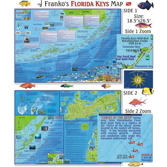
Franko Maps - Florida Keys Map $9.98
 $998current price $9.98
Franko Maps - Florida Keys Map
C-MAP Reveal X Coastal Gulf of Mexico and Bahamas microSD $260.00
 $26000current price $260.00
C-MAP Reveal X Coastal Gulf of Mexico and Bahamas microSD
48x60 Missouri State Official Executive Laminated Wall Map $117.56
 $11756current price $117.56
48x60 Missouri State Official Executive Laminated Wall Map
CMAP US Lakes South East Inland Chart $201.02
 $20102current price $201.02
CMAP US Lakes South East Inland Chart
Xplorer Maps MAP_UT Utah State Hand-Drawn Map $37.26
 $3726current price $37.26
Xplorer Maps MAP_UT Utah State Hand-Drawn Map
39.5 x 18.5 in. North Carolina State Raised Relief Map, Framed - Large $193.62
 $19362current price $193.62
39.5 x 18.5 in. North Carolina State Raised Relief Map, Framed - Large
Franko Maps - Kauai Reef Fish ID $9.98
 $998current price $9.98
Franko Maps - Kauai Reef Fish ID
BLUE RIVER, COLORADO GPS MAP $7.95
 $795current price $7.95
BLUE RIVER, COLORADO GPS MAP
BIGHORN RIVER, MONTANA GPS MAP $7.95
 $795current price $7.95
BIGHORN RIVER, MONTANA GPS MAP
Franko Maps Grenada Reef Creatures Fish ID-Card $23.02
 $2302current price $23.02
Franko Maps Grenada Reef Creatures Fish ID-Card
Bartram Trail, Geogia Map $14.88
 $1488current price $14.88
Bartram Trail, Geogia Map
Franko Maps Pacific Humpback Whale Migration Card $23.07
 $2307current price $23.07
Franko Maps Pacific Humpback Whale Migration Card
Central Sierra Trail Map $11.95
 $1195current price $11.95
Central Sierra Trail Map
Franko Maps - Coronados Islands (Mexico) Fish ID $9.98
 $998current price $9.98
Franko Maps - Coronados Islands (Mexico) Fish ID
Pymatuning Lake Fishing Map $29.47
 $2947current price $29.47
Pymatuning Lake Fishing Map
Xplorer Maps PLCD_CR Costa Rica Map Playing Cards $15.33 Was $25.31
 $1533current price $15.33, Was $25.31$25.31
Xplorer Maps PLCD_CR Costa Rica Map Playing Cards
Customer ratings & reviews
0 ratings|0 reviews
This item does not have any reviews yet
