
Hero image 0 of NA-D940 C-MAP 4D NA-940 Cape Cod, Long Island & Hudson River, 0 of 2
NA-D940 C-MAP 4D NA-940 Cape Cod, Long Island & Hudson River
(No ratings yet)
Key item features
C-MAP 4D NA-D940 Cape Cod, Long Island & Hudson River
The next evolution in navigation solutions. C-MAP 4D adapts to your boating
needs because it's the only digital chart that offers advanced features and
lets you add data and services as they become available.
Full 4D Content
When you choose Full 4D content you will experience the latest in navigation
data and technology such as:
4D cartography is compatible with the Furuno 1670F / 1870F, and Standard CPN 7000i, and CPN1010i units.
The next evolution in navigation solutions. C-MAP 4D adapts to your boating
needs because it's the only digital chart that offers advanced features and
lets you add data and services as they become available.
Full 4D Content
When you choose Full 4D content you will experience the latest in navigation
data and technology such as:
- 3D Chart View - The world has three dimensions.
When you add the 4th dimension of time - meaning consistent, periodic
updates - you combine the most detailed 3D height and depth worldwide
database with a continuous update process to give you a personalized
navigation experience with up-to-date data for safe navigation. - High-Resolution Satellite Imagery - See the real world on your
screen.
C-MAP 4D includes a navigational perspective with high-resolution coastal
imagery overlaid on the most accurate and up-to-date vector data, plus
thousands of extraordinary photos for the most popular marinas and areas of
interest. - Digital Raster Charts - Innovate tradition.
With raster charts, you have an additional reference source for navigational
awareness. Get "at-a-glance" information using the nautical paper charts
overlaid on the multi-dimensional shaded relief to have a new visual
experience. - Easy Routing - Automatically create a route.
Enter start and end points along with specific boat parameters and
automatically receive waypoints of the shortest route; highlights potential
hazards and displays varying levels of alerts for each segment of the route,
allows you to manually adjust the route. - Guardian Alarm - An extra layer of safety.
When activated, Guardian Alarm performs an automatic forward-scanning check
for obstacles. Use the feature as an added backup to alert you should you
head toward a potentially harmful object. - Detailed NavAids
- Route Check
- Detailed Marina Charts
- C-Marina Ports Database
- Multi-Language Capability
- Dynamic Tides & Currents
- Photos & Diagrams
- Depths & Land Elevations
- Perspective View
4D cartography is compatible with the Furuno 1670F / 1870F, and Standard CPN 7000i, and CPN1010i units.
Specs
- BrandC-MAP
- MaterialPaper
- Year2013
- ColorMulticolor
- Pieces1
- Age groupAdult, Teen
Current price is USD$195.01
Price when purchased online
Out of stock
How do you want your item?
Out of stock
About this item
Product details
C-MAP 4D NA-D940 Cape Cod, Long Island & Hudson River
The next evolution in navigation solutions. C-MAP 4D adapts to your boating
needs because it's the only digital chart that offers advanced features and
lets you add data and services as they become available.
Full 4D Content
When you choose Full 4D content you will experience the latest in navigation
data and technology such as:
4D cartography is compatible with the Furuno 1670F / 1870F, and Standard CPN 7000i, and CPN1010i units.
Product : C-MAP 4D NA-D940 FULL CAPE COD LONG ISLAND & HUDSON RIVER
Manufacturer : C-MAP
Manufacturer Part No : NA-D940
UPC : 686074021761- SKU: CW50308
The next evolution in navigation solutions. C-MAP 4D adapts to your boating
needs because it's the only digital chart that offers advanced features and
lets you add data and services as they become available.
Full 4D Content
When you choose Full 4D content you will experience the latest in navigation
data and technology such as:
- 3D Chart View - The world has three dimensions.
When you add the 4th dimension of time - meaning consistent, periodic
updates - you combine the most detailed 3D height and depth worldwide
database with a continuous update process to give you a personalized
navigation experience with up-to-date data for safe navigation. - High-Resolution Satellite Imagery - See the real world on your
screen.
C-MAP 4D includes a navigational perspective with high-resolution coastal
imagery overlaid on the most accurate and up-to-date vector data, plus
thousands of extraordinary photos for the most popular marinas and areas of
interest. - Digital Raster Charts - Innovate tradition.
With raster charts, you have an additional reference source for navigational
awareness. Get "at-a-glance" information using the nautical paper charts
overlaid on the multi-dimensional shaded relief to have a new visual
experience. - Easy Routing - Automatically create a route.
Enter start and end points along with specific boat parameters and
automatically receive waypoints of the shortest route; highlights potential
hazards and displays varying levels of alerts for each segment of the route,
allows you to manually adjust the route. - Guardian Alarm - An extra layer of safety.
When activated, Guardian Alarm performs an automatic forward-scanning check
for obstacles. Use the feature as an added backup to alert you should you
head toward a potentially harmful object. - Detailed NavAids
- Route Check
- Detailed Marina Charts
- C-Marina Ports Database
- Multi-Language Capability
- Dynamic Tides & Currents
- Photos & Diagrams
- Depths & Land Elevations
- Perspective View
4D cartography is compatible with the Furuno 1670F / 1870F, and Standard CPN 7000i, and CPN1010i units.
Product : C-MAP 4D NA-D940 FULL CAPE COD LONG ISLAND & HUDSON RIVER
Manufacturer : C-MAP
Manufacturer Part No : NA-D940
UPC : 686074021761- SKU: CW50308
C-MAP 4D NA-D940 Cape Cod, Long Island & Hudson River
The next evolution in navigation solutions. C-MAP 4D adapts to your boating
needs because it's the only digital chart that offers advanced features and
lets you add data and services as they become available.
Full 4D Content
When you choose Full 4D content you will experience the latest in navigation
data and technology such as:
4D cartography is compatible with the Furuno 1670F / 1870F, and Standard CPN 7000i, and CPN1010i units.
The next evolution in navigation solutions. C-MAP 4D adapts to your boating
needs because it's the only digital chart that offers advanced features and
lets you add data and services as they become available.
Full 4D Content
When you choose Full 4D content you will experience the latest in navigation
data and technology such as:
- 3D Chart View - The world has three dimensions.
When you add the 4th dimension of time - meaning consistent, periodic
updates - you combine the most detailed 3D height and depth worldwide
database with a continuous update process to give you a personalized
navigation experience with up-to-date data for safe navigation. - High-Resolution Satellite Imagery - See the real world on your
screen.
C-MAP 4D includes a navigational perspective with high-resolution coastal
imagery overlaid on the most accurate and up-to-date vector data, plus
thousands of extraordinary photos for the most popular marinas and areas of
interest. - Digital Raster Charts - Innovate tradition.
With raster charts, you have an additional reference source for navigational
awareness. Get "at-a-glance" information using the nautical paper charts
overlaid on the multi-dimensional shaded relief to have a new visual
experience. - Easy Routing - Automatically create a route.
Enter start and end points along with specific boat parameters and
automatically receive waypoints of the shortest route; highlights potential
hazards and displays varying levels of alerts for each segment of the route,
allows you to manually adjust the route. - Guardian Alarm - An extra layer of safety.
When activated, Guardian Alarm performs an automatic forward-scanning check
for obstacles. Use the feature as an added backup to alert you should you
head toward a potentially harmful object. - Detailed NavAids
- Route Check
- Detailed Marina Charts
- C-Marina Ports Database
- Multi-Language Capability
- Dynamic Tides & Currents
- Photos & Diagrams
- Depths & Land Elevations
- Perspective View
4D cartography is compatible with the Furuno 1670F / 1870F, and Standard CPN 7000i, and CPN1010i units.
info:
We aim to show you accurate product information. Manufacturers, suppliers and others provide what you see here, and we have not verified it.
Specifications
Subject
Cape Cod,Long Island & Hudson River
Size
card format = microsd/sd | port plans = yes
Brand
C-MAP
Material
Paper
Warranty
Warranty information
Y
Please be aware that the warranty terms on items offered for sale by third party Marketplace sellers may differ from those displayed in this section (if any). To confirm warranty terms on an item offered for sale by a third party Marketplace seller, please use the 'Contact seller' feature on the third party Marketplace seller's information page and request the item's warranty terms prior to purchase.
Please be aware that the warranty terms on items offered for sale by third party Marketplace sellers may differ from those displayed in this section (if any). To confirm warranty terms on an item offered for sale by a third party Marketplace seller, please use the 'Contact seller' feature on the third party Marketplace seller's information page and request the item's warranty terms prior to purchase.
Warnings
Warning Text
proposition 65 reasons:titanium dioxide, other chemicals
Similar items you might like
Based on what customers bought
C-MAP Reveal US Lakes South East $179.00
 $17900current price $179.00
C-MAP Reveal US Lakes South East
15 out of 5 Stars. 1 reviewsC-MAP M-NA-D963 4D Local Hawaiian Islands $241.96
 $24196current price $241.96
C-MAP M-NA-D963 4D Local Hawaiian Islands
C-MAP Reveal US Lakes South Central Map, 5.79x4.13 $184.00
 $18400current price $184.00
C-MAP Reveal US Lakes South Central Map, 5.79x4.13
Franko Maps - Hawaii Dive Map $9.98
 $998current price $9.98
Franko Maps - Hawaii Dive Map
RXMEKW United States Map 2,025 Map Update, Including U.S. Bay and Mckinley Mountain 12In*18In $7.00

 $700current price $7.00
RXMEKW United States Map 2,025 Map Update, Including U.S. Bay and Mckinley Mountain 12In*18In
C-MAP Reveal US Lakes West $179.00
 $17900current price $179.00
C-MAP Reveal US Lakes West
Xplorer Maps MAP_FLX Finger Lakes Hand-Drawn Map $43.39
 $4339current price $43.39
Xplorer Maps MAP_FLX Finger Lakes Hand-Drawn Map
Rand McNally State Maps: Arizona and California (2 Maps) $19.95
 $1995current price $19.95
Rand McNally State Maps: Arizona and California (2 Maps)
FISH-N-MAP Coeur D'ALENE/Priest Lake $18.74
 $1874current price $18.74
FISH-N-MAP Coeur D'ALENE/Priest Lake
C-map Max Na-m024 - U.s. West Coast & Hawaii - Sd™ Card $295.89
 $29589current price $295.89
C-map Max Na-m024 - U.s. West Coast & Hawaii - Sd™ Card
Franko's Northern San Diego County Bikeways & Trails Map $8.88
 $888current price $8.88
Franko's Northern San Diego County Bikeways & Trails Map
Rand McNally State Maps: Montana/Wyoming and North Dakota/South Dakota (2 Maps) $19.95
 $1995current price $19.95
Rand McNally State Maps: Montana/Wyoming and North Dakota/South Dakota (2 Maps)
Stafford and Telford (Cassini Old Series Historical Map) (Map) $40.02
 $4002current price $40.02
Stafford and Telford (Cassini Old Series Historical Map) (Map)
Franko Maps - Cozumel Dive Map $9.98
 $998current price $9.98
Franko Maps - Cozumel Dive Map
National Geographic Destination Map Pocono Mountains Map, (Paperback) $24.11
 $2411current price $24.11
National Geographic Destination Map Pocono Mountains Map, (Paperback)
Franko Maps - Kauai Reef Fish ID $9.98
 $998current price $9.98
Franko Maps - Kauai Reef Fish ID
BIGHORN RIVER, MONTANA GPS MAP $7.95
 $795current price $7.95
BIGHORN RIVER, MONTANA GPS MAP
Xplorer Maps PLCD_CR Costa Rica Map Playing Cards $25.31
 $2531current price $25.31
Xplorer Maps PLCD_CR Costa Rica Map Playing Cards
BITTERROOT RIVER, MONTANA GPS MAP $7.95
 $795current price $7.95
BITTERROOT RIVER, MONTANA GPS MAP
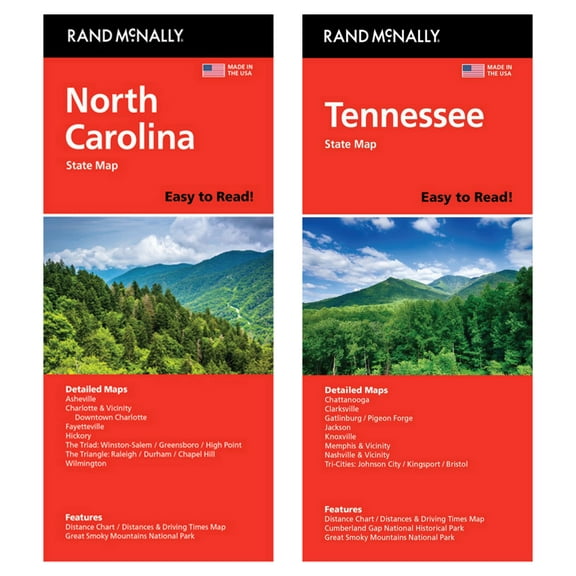
Rand McNally State Maps: North Carolina andTennessee (2 Maps) $17.95
 $1795current price $17.95
Rand McNally State Maps: North Carolina andTennessee (2 Maps)
Customer ratings & reviews
0 ratings|0 reviews
This item does not have any reviews yet
