
B & H Publishing Group 469617 Map - Israel In The Time Of Jesus - 19.25 x 26 in.
Key item features
- Subject 1: Supplies
- Subject 2: Church
- Subject 3: Maps and Charts
- Format:
- Category 1:
- Category 2:
Specs
- FeaturesTrade Paper
- BrandB&H Publishing Group
- ColorMulticolor
How do you want your item?
About this item
Product details
Brand new from B&H come these exciting classroom resources! These are the first in a series of new maps and charts detailing important events, journeys, and people from the Bible. Each 19 3/8 x 26 in. map or chart is in full-color on the front, and includes black & white text on the back, giving all the important information and explanations needed. All text on the back of the maps is written by Dr. Tommy Brisco, Professor of Old Testament and Archaeology at Baylor University. Maps and charts are fully laminated, so they will be durable and easy to use. All information is the most up-to-date, and the maps and charts are taken from the Holman Bible Atlas or the Holman Book of Biblical Charts, Maps, and Reconstructions. Titles of maps are - Modern States and the Ancient Near East; Paul's Missionary Journeys; Ministry of Jesus; Modern Political Divisions of Ancient Palestine. Titles of charts are - Prophets & Other Leaders and Books of the Bible. Each map or chart comes flat in a polybag with a full-color, hole-punched header card.
Features- Trim Size - Maps and Charts - 19 3/8 x 26 in.
- CPC Super - Supplies
- CPC Primary - Church
- CPC Sub - Maps and Charts
- Author - Broadman & Holman
- Publisher - B & H Publishing Group
- Subject 1: Supplies
- Subject 2: Church
- Subject 3: Maps and Charts
- Format:
- Category 1:
- Category 2:
Specifications
Features
Brand
Color
Warranty
Warranty information
Warnings
Warning Text
Similar items you might like
Based on what customers bought
Clearance RXMEKW United States Map 2,025 Map Update, Including U.S. Bay and Mckinley Mountain 12In*18In $7.00
Clearance
 $700current price $7.00
RXMEKW United States Map 2,025 Map Update, Including U.S. Bay and Mckinley Mountain 12In*18In
Adventuremaps: Canada East - Folded Map $12.60
 $1260current price $12.60
Adventuremaps: Canada East - Folded Map
Harry Potter Marauder's Map Mini- Warner Bros Limited Edition $14.40
 $1440current price $14.40
Harry Potter Marauder's Map Mini- Warner Bros Limited Edition
15 out of 5 Stars. 1 reviewsUSA Wall map 28' inches x 40' inches,Paper History World Wall Map $10.99
 $1099current price $10.99
USA Wall map 28' inches x 40' inches,Paper History World Wall Map
15 out of 5 Stars. 1 reviewsANIMAS RIVER, COLORADO GPS MAP $7.95
 $795current price $7.95
ANIMAS RIVER, COLORADO GPS MAP
Bartram Trail, Geogia Map $14.88
 $1488current price $14.88
Bartram Trail, Geogia Map
Reduced price World Wonders Map - 36 x 24 in. $21.00
Reduced price $2100current price $21.00
World Wonders Map - 36 x 24 in.
COOPHYA World Map for Classroom Uv Paper 1 Set 19.65X13.76In $13.67
 $1367current price $13.67
COOPHYA World Map for Classroom Uv Paper 1 Set 19.65X13.76In
Cool Owl Maps Mexico, Central America & Caribbean Wall Map - Paper 40"x30" $44.99
 $4499current price $44.99
Cool Owl Maps Mexico, Central America & Caribbean Wall Map - Paper 40"x30"
2 Pack - Laminated World Map Poster & USA Map Set - Equal Earth world map design shows continents at true relative size - US Map 18” x 29” $19.82
 $1982current price $19.82
2 Pack - Laminated World Map Poster & USA Map Set - Equal Earth world map design shows continents at true relative size - US Map 18” x 29”
CS:GO de_Vertigo Map Poster; Gaming Wall Art $14.99
 7 optionsAvailable in additional 7 options$1499current price $14.99
CS:GO de_Vertigo Map Poster; Gaming Wall Art
48x70 Wisconsin State Official Executive Laminated Wall Map $89.95
 $8995current price $89.95
48x70 Wisconsin State Official Executive Laminated Wall Map
Franko Maps - Mini Egyptian Red Sea Fish ID $8.99
 $899current price $8.99
Franko Maps - Mini Egyptian Red Sea Fish ID
Historic State Map - United States North Eastern Canada - Black 1867 - Vintage Wall Art $36.95
 4 optionsAvailable in additional 4 options$3695current price $36.95
Historic State Map - United States North Eastern Canada - Black 1867 - Vintage Wall Art
Topographical Map - Threemile Creek Reservoir Wyoming Quad - USGS 1984 - Vintage Wall Art $36.95
 4 optionsAvailable in additional 4 options$3695current price $36.95
Topographical Map - Threemile Creek Reservoir Wyoming Quad - USGS 1984 - Vintage Wall Art
4 Foot United States Map with Flags [72116] $22.99
![4 Foot United States Map with Flags [72116]](https://i5.walmartimages.com/asr/8833907b-671e-4608-ba73-103c8f1379da.18e29dae1be105a1542fd65296dfc579.jpeg?odnHeight=576&odnWidth=576&odnBg=FFFFFF) $2299current price $22.99
$2299current price $22.994 Foot United States Map with Flags [72116]
Topographical Map - Saratoga Wyoming Quad - USGS 1961 - Vintage Wall Art $36.95
 4 optionsAvailable in additional 4 options$3695current price $36.95
Topographical Map - Saratoga Wyoming Quad - USGS 1961 - Vintage Wall Art
Topographical Map - Bates Knolls Utah Quad - USGS 1966 - 23 x 30.64 - Vintage Wall Art $40.95
 4 optionsAvailable in additional 4 options$4095current price $40.95
Topographical Map - Bates Knolls Utah Quad - USGS 1966 - 23 x 30.64 - Vintage Wall Art
Topographical Map - Carthage East Illinois Quad - USGS 1974 - 23 x 30.07 - Vintage Wall Art $45.95
 $4595current price $45.95
Topographical Map - Carthage East Illinois Quad - USGS 1974 - 23 x 30.07 - Vintage Wall Art
Big Sky Maps East Klickitat GMU Map 382 $14.97
 $1497current price $14.97
Big Sky Maps East Klickitat GMU Map 382
Check out these related products
Historic State Map - Texas Republic - Meyer 1846 - Vintage Wall Art $36.95
 $3695current price $36.95
Historic State Map - Texas Republic - Meyer 1846 - Vintage Wall Art
Railroad Map - Texas and Pacific Railway Connections - Woodward 1903 - Vintage Wall Art $36.95
 $3695current price $36.95
Railroad Map - Texas and Pacific Railway Connections - Woodward 1903 - Vintage Wall Art
Historic State Map - Texas - Colton 1881 - Vintage Wall Art $36.95
 $3695current price $36.95
Historic State Map - Texas - Colton 1881 - Vintage Wall Art
Historic Nautical Map - British Global Naval Chart - Newnes 1907 - Vintage Wall Art $36.95
 $3695current price $36.95
Historic Nautical Map - British Global Naval Chart - Newnes 1907 - Vintage Wall Art
Historic Map - Egypt Japan West Africa China Import Export - Bartholomew 1907 $36.95
 $3695current price $36.95
Historic Map - Egypt Japan West Africa China Import Export - Bartholomew 1907
Historic State Map - Indian Country Expedition - Schoolcraft 1832 - 23 x 26 - Vintage Wall Art $40.95 $40.95/count
 $4095current price $40.95$40.95/count
Historic State Map - Indian Country Expedition - Schoolcraft 1832 - 23 x 26 - Vintage Wall Art
Historic Map - British Posessions West - Bartholomew 1907 - 23 x 27.03 - Vintage Wall Art $40.95
 4 optionsAvailable in additional 4 options$4095current price $40.95
Historic Map - British Posessions West - Bartholomew 1907 - 23 x 27.03 - Vintage Wall Art
Historic State Map - United States Central - Baltimore 1873 - 23 x 36 - Vintage Wall Art $40.95
 $4095current price $40.95
Historic State Map - United States Central - Baltimore 1873 - 23 x 36 - Vintage Wall Art
Historic Nautical Map - Florida Louisiana Gulf Coast - Sartine 1778 - Vintage Wall Art $36.95
 $3695current price $36.95
Historic Nautical Map - Florida Louisiana Gulf Coast - Sartine 1778 - Vintage Wall Art
Topographical Map - Gloucester Massachusetts Quad - USGS 1984 - Vintage Wall Art $36.95
 4 optionsAvailable in additional 4 options$3695current price $36.95
Topographical Map - Gloucester Massachusetts Quad - USGS 1984 - Vintage Wall Art
Historic State Map - North Carolina - Henshaw 1828 - Vintage Wall Art $36.95
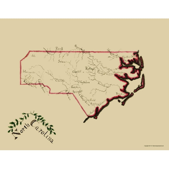 $3695current price $36.95
Historic State Map - North Carolina - Henshaw 1828 - Vintage Wall Art
Historic State Map - Washington Territory Public Survey - Giddings 1865 - Vintage Wall Art $36.95
 $3695current price $36.95
Historic State Map - Washington Territory Public Survey - Giddings 1865 - Vintage Wall Art
Historic State Map - Kentucky Tennessee - Asher 1874 - Vintage Wall Art $36.95
 4 optionsAvailable in additional 4 options$3695current price $36.95
Historic State Map - Kentucky Tennessee - Asher 1874 - Vintage Wall Art
Historical Civil War Map - Geographical Divisions Departments June 1862 - Bien 1895 - WallArt $36.95
 $3695current price $36.95
Historical Civil War Map - Geographical Divisions Departments June 1862 - Bien 1895 - WallArt
Historical Civil War Map - Virginia Theatre - Disturnell 1861 - Vintage Wall Art $36.95
 $3695current price $36.95
Historical Civil War Map - Virginia Theatre - Disturnell 1861 - Vintage Wall Art
Historic State Map - Georgia Alabama Florida - Colton 1858 - Vintage Wall Art $36.95
 4 optionsAvailable in additional 4 options$3695current price $36.95
Historic State Map - Georgia Alabama Florida - Colton 1858 - Vintage Wall Art
15 out of 5 Stars. 1 reviewsHistoric Mine Map - Nevada Lincoln County Tectonic Mines - USGS 1998 - Vintage Wall Art $36.95
 4 optionsAvailable in additional 4 options$3695current price $36.95
Historic Mine Map - Nevada Lincoln County Tectonic Mines - USGS 1998 - Vintage Wall Art
Historic Nautical Map - Cape Lookout Cape Fear North Carolina - USCS 1864 - 23 x 24 - Vintage Wall Art $40.95 $40.95/count
 $4095current price $40.95$40.95/count
Historic Nautical Map - Cape Lookout Cape Fear North Carolina - USCS 1864 - 23 x 24 - Vintage Wall Art
Historic Map - Palestine Israel - Strobridge 1881 - Vintage Wall Art $36.95
 $3695current price $36.95
Historic Map - Palestine Israel - Strobridge 1881 - Vintage Wall Art
Historic Map - World Chart - Cram 1888 - Vintage Wall Art $36.95
 $3695current price $36.95
Historic Map - World Chart - Cram 1888 - Vintage Wall Art
