
Garmin 010-C1290-00 Navionics Vision+ Nvus006r U.s. South
Key item features
- Integrated Mapping: Combines Garmin and Navionics content for comprehensive coverage, clarity, and detail across coastal waters, lakes, and rivers in the U.S. South region.
- Dynamic Updates: Access daily chart updates easily via Navionics Chart Installer software or wirelessly through the Plotter Sync feature with the Navionics Boating app.
- Advanced Guidance: Utilizes Navionics dock-to-dock route guidance technology to suggest optimal paths based on boat settings, chart data, and frequently traveled routes.
- Detailed Bathymetry: Features SonarChart HD bathymetry maps with up to 1-foot (0.5 meters) contours for a highly detailed depiction of bottom structures, aiding fishing and navigation.
- Customizable Shading: Includes fishing range and shallow water shading features, allowing users to highlight specific depth ranges for improved fishing and safer navigation.
- Real-time Mapping: SonarChart Live mapping enables boaters to create and display new personal 1-foot HD bathymetry maps in real-time on compatible plotters.
- Broad Compatibility: Supports a wide range of Garmin chartplotters, including Echomap UHD, Echomap Ultra, and various GPSmap series models.
Specs
- BrandGARMIN
- SeriesVision+
- Model name010C129000
- Has written warrantyNo
- Free shipping
 Free 30-day returns
How do you want your item?
More seller options (6)
About this item
Product details
Garmin Navionics Vision+™ NVUS006R U.S. South
Get the world’s No. 1 choice in marine mapping (based on 2020 reported sales) — with the best, most up-to-date Navionics®+ cartography on your compatible chartplotter. This all-in-one solution offers detail-rich integrated mapping of coastal waters, lakes, rivers, and more for offshore or inland waters. Get SonarChart™ 1’ (0.5 meters) HD bathymetry maps, advanced features such as dock-to-dock route guidance technology (depending on the chartplotter model), live mapping, and Plotter Sync to provide wireless access to daily updates. The Navionics® Chart Installer software also ensures the freshest chart data every time out. Navionics route guidance solutions give you a suggested dock-to-dock path to follow through channels, inlets, marina entrances, and more. (Route guidance is for planning purposes only and does not replace safe navigation operations.) Multiple shading options aid in shallow water navigation and make it easy to highlight a target depth range for the best fishing spots.
Features:
- Integrated Garmin and Navionics® content provides exceptional coverage, clarity, and detail in a familiar look and feel
- Easy access to daily chart updates is available via the Navionics® Chart Installer software or wirelessly via the Plotter Sync feature with the Navionics Boating app (The Plotter Sync feature requires the use of the Navionics Boating app on your compatible smart device with an active subscription of the same area.)
- Navionics® advanced dock-to-dock route guidance technology uses your boat settings, along with chart data and frequently traveled routes, to calculate a suggested path to follow (Route guidance is for planning purposes only and does not replace safe navigation operations.)
- Download the Community Edits content layer to any Navionics® card, and view this valuable, local information — contributed by Navionics Boating app users — on your compatible chartplotter
- For improved fishing and navigation, SonarChart™ HD bathymetry maps display up to 1’ (0.5 meters) contours, providing a more detailed depiction of the bottom structure
- Fishing range advanced feature lets you highlight a user-defined target depth range
- To aid in navigation, the shallow water shading advanced feature highlights depths up to a user-defined level
- SonarChart™ Live mapping feature allows boaters to create new personal 1’ HD bathymetry maps that display in real time on the screens of their compatible plotters while navigating
- Worldwide coverage available
- Available on microSD™ cards; cartography updates are available via annual renewable subscription (the first year of updates is included)
Compatibility
- Echomap UHD (7/9)
- Echomap Ultra (10/12)
- GPSmap 10X2/12X2)
- GPSmap 12X2 Touch
- GPSmap 7X2, 9X2, 12X2 Plus
- GPSmap 7X3/9X3/12X3
- GPSmap 8400/8600
- GPSmap 8700 Black Box
- Integrated Garmin and Navionics® content provides exceptional coverage, clarity, and detail in a familiar look and feel
- Easy access to daily chart updates is available via the Navionics® Chart Installer software or wirelessly via the Plotter Sync feature with the Navionics Boating app (The Plotter Sync feature requires the use of the Navionics Boating app on your compatible smart device with an active subscription of the same area.)
- Navionics® advanced dock-to-dock route guidance technology uses your boat settings, along with chart data and frequently traveled routes, to calculate a suggested path to follow (Route guidance is for planning purposes only and does not replace safe navigation operations.)
- Download the Community Edits content layer to any Navionics® card, and view this valuable, local information — contributed by Navionics Boating app users — on your compatible chartplotter
- For improved fishing and navigation, SonarChart™ HD bathymetry maps display up to 1’ (0.5 meters) contours, providing a more detailed depiction of the bottom structure
- Fishing range advanced feature lets you highlight a user-defined target depth range
- To aid in navigation, the shallow water shading advanced feature highlights depths up to a user-defined level
- SonarChart™ Live mapping feature allows boaters to create new personal 1’ HD bathymetry maps that display in real time on the screens of their compatible plotters while navigating
- Worldwide coverage available
- Available on microSD™ cards; cartography updates are available via annual renewable subscription (the first year of updates is included)
- Echomap UHD (7/9)
- Echomap Ultra (10/12)
- GPSmap 10X2/12X2)
- GPSmap 12X2 Touch
- GPSmap 7X2, 9X2, 12X2 Plus
- GPSmap 7X3/9X3/12X3
- GPSmap 8400/8600
- GPSmap 8700 Black Box
Specifications
Brand
Series
Model name
Has written warranty
Warranty
Warranty information
Please be aware that the warranty terms on items offered for sale by third party Marketplace sellers may differ from those displayed in this section (if any). To confirm warranty terms on an item offered for sale by a third party Marketplace seller, please use the 'Contact seller' feature on the third party Marketplace seller's information page and request the item's warranty terms prior to purchase.
Similar items you might like
Based on what customers bought
Garmin Navionics Vision NVUS007R U.S. East [010-C1291-00] $247.43 Was $351.74
![Garmin Navionics Vision NVUS007R U.S. East [010-C1291-00]](https://i5.walmartimages.com/asr/21df24cd-c46f-4baa-a5d4-71bd57e57623.44784c80dd99fea4746c99046a5b67a5.jpeg?odnHeight=576&odnWidth=576&odnBg=FFFFFF) $24743current price $247.43, Was $351.74$351.74
$24743current price $247.43, Was $351.74$351.74Garmin Navionics Vision NVUS007R U.S. East [010-C1291-00]
Garmin 010C129020 Navionics Plus Chart for US South $132.63
 $13263current price $132.63
Garmin 010C129020 Navionics Plus Chart for US South
Garmin 010C122300 Navionics Vision NVAE025R - Papua New Guinea $192.87
 $19287current price $192.87
Garmin 010C122300 Navionics Vision NVAE025R - Papua New Guinea
Garmin 010C125320 Navionics NSEU054R - Norway $156.69
 $15669current price $156.69
Garmin 010C125320 Navionics NSEU054R - Norway
Garmin 010C121500 Japan Garmin Navionics Vision $192.87
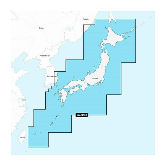 $19287current price $192.87
Garmin 010C121500 Japan Garmin Navionics Vision
Garmin 010C126920 English South Coast Garmin Navioni $166.78
 $16678current price $166.78
Garmin 010C126920 English South Coast Garmin Navioni
Garmin 010C125120 Norway Sognefjord - Svefjorden Gar $156.69
 $15669current price $156.69
Garmin 010C125120 Norway Sognefjord - Svefjorden Gar
Garmin 010C125220 Navionics NSEU053R - Norway $155.27
 $15527current price $155.27
Garmin 010C125220 Navionics NSEU053R - Norway
Garmin 010C121900 Philippines Garmin Navionics Vision $192.87
 $19287current price $192.87
Garmin 010C121900 Philippines Garmin Navionics Vision
Garmin 010C148220 Navionics Australia East & $237.96
 $23796current price $237.96
Garmin 010C148220 Navionics Australia East &
Garmin 010C126020 Navionics NSEU081R - Baltic Sea $154.59
 $15459current price $154.59
Garmin 010C126020 Navionics NSEU081R - Baltic Sea
Garmin 010C125920 Greenland Garmin Navionics $156.85
 $15685current price $156.85
Garmin 010C125920 Greenland Garmin Navionics
Garmin 010C148320 Navionics Australia West & $237.96
 $23796current price $237.96
Garmin 010C148320 Navionics Australia West &
Garmin 010C124820 Gulf Of Bothnia Garmin Navionics $169.99
 $16999current price $169.99
Garmin 010C124820 Gulf Of Bothnia Garmin Navionics
Garmin 010C122420 Africa East Garmin Navionics $156.69
 $15669current price $156.69
Garmin 010C122420 Africa East Garmin Navionics
Garmin 010C123320 Ireland West Coast Garmin Navionic $152.92
 $15292current price $152.92
Garmin 010C123320 Ireland West Coast Garmin Navionic
Garmin 010C123820 Mediterranean Sea Cen. & West Garm $169.99
 $16999current price $169.99
Garmin 010C123820 Mediterranean Sea Cen. & West Garm
Garmin 010C126000 Baltic Sea East Coast Garmin Navio $259.99
 $25999current price $259.99
Garmin 010C126000 Baltic Sea East Coast Garmin Navio
Garmin 010C125800 Navionics Vision NVEU063R - Black Sea $259.99
 $25999current price $259.99
Garmin 010C125800 Navionics Vision NVEU063R - Black Sea
Garmin 010C125300 Norway Vestfjden To Svalbard Garmi $255.14
 $25514current price $255.14
Garmin 010C125300 Norway Vestfjden To Svalbard Garmi
Check out these related products
Garmin New OEM U.K. & Ireland Lakes & Rivers - Inland Marine Charts Garmin Navionics Vision ™ | NVEU072R | microSD™/SD™ and One-year Subscription, 010-C1267-00 $259.99
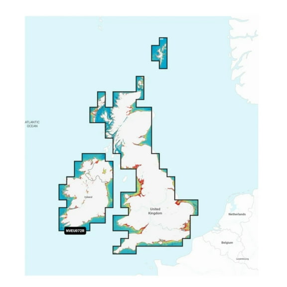 $25999current price $259.99
Garmin New OEM U.K. & Ireland Lakes & Rivers - Inland Marine Charts Garmin Navionics Vision ™ | NVEU072R | microSD™/SD™ and One-year Subscription, 010-C1267-00
Garmin 010-C1292-20 Navionics Nsus008r U.s. West $147.58 Was $164.99
 $14758current price $147.58, Was $164.99$164.99
Garmin 010-C1292-20 Navionics Nsus008r U.s. West
11 out of 5 Stars. 1 reviewsGarmin New OEM U.S. North & Great Lakes - Lakes, Rivers and Coastal Marine Charts, 010-C1289-20 $147.15
 $14715current price $147.15
Garmin New OEM U.S. North & Great Lakes - Lakes, Rivers and Coastal Marine Charts, 010-C1289-20
Garmin 010C129120 Navionics Plus Chart for US East $135.26 Was $151.39
 $13526current price $135.26, Was $151.39$151.39
Garmin 010C129120 Navionics Plus Chart for US East
Garmin Navionics Vision ; Compatible with Garmine U.S. NORTH Maps $214.63
 $21463current price $214.63
Garmin Navionics Vision ; Compatible with Garmine U.S. NORTH Maps
Navionics Platinum NPUS006R U.S. South microSD $245.31
 $24531current price $245.31
Navionics Platinum NPUS006R U.S. South microSD
11 out of 5 Stars. 1 reviewsGarmin Electronic Control Unit (ECU) Power Cable, Threaded Collar f/GHP™ 12 & GHP™ 20 $86.99
 $8699current price $86.99
Garmin Electronic Control Unit (ECU) Power Cable, Threaded Collar f/GHP™ 12 & GHP™ 20
Navionics Platinum Plus - East Gulf of Mexico - microSD/SD $268.69
 $26869current price $268.69
Navionics Platinum Plus - East Gulf of Mexico - microSD/SD
