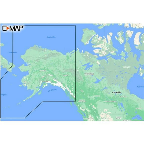
C MAP Reveal Coastal Alaska, Shaded Relief, Vector Charts, 2024, Poster, 34x22
(No ratings yet)
Key item features
- Enhanced Navigation: Features shaded relief with 3D rendered land and underwater elevations, including ultra-high-resolution bathymetric imagery for detailed seafloor insights.
- Accurate Charting: Provides full-featured vector charts derived from official Hydrographic Office information, ensuring accurate and up-to-date navigation details.
- Customizable Depths: Allows for custom depth shading to set clear safety depths, maintain a traditional paper-like view, or create personalized shading preferences.
- Automated Routing: Includes Easy Routing, which automatically plots the shortest and safest route based on detailed chart data and personalized vessel information.
- Visual Aids: Offers aerial photography and satellite overlay for additional detail on marinas, harbors, inlets, and surrounding areas.
- Marine Information: Displays tides and currents projections, along with detailed marina port plans and harbor approach details for confident navigation.
- Timely Updates: Comes with 12 months of free online updates to keep the chart information current and reliable.
Generated by AI
Specs
- Map typeNautical
- SubjectCoastal Alaska
- SizeAlaska
- BrandC-MAP
- MaterialPaper
- FormBooks
Current price is USD$257.30
Price when purchased online
Out of stock
How do you want your item?
Out of stock
About this item
Product details
C-MAP M-NA-Y208-MS Reveal Coastal AlaskaModel: M-NA-Y208-MSShaded Relief — bring the world around you to life, with 3D rendered land and underwater elevation — including areas of Ultra-High-Res Bathy seafloor imagery, previously only available in MAX-N+ Reveal a game changer for anglers.Full-Featured Vector Charts — making navigation easy by giving you accurate, up-to-date vector chart detail derive from official Hydrographic Office information.High-Res Bathy — helps you identify shallow areas, drop-offs, ledges, holes or humps. Now includes compiled and quality-controlled Genesis® detail as part of singular HRB layer.Custom Depth Shading — set a clear safety depth, maintain a paper-like view or create your own custom shading.Dynamic Raster Charts — providing the traditional chart look and feel, coupled with easy access to all objects on the chart.Easy Routing™ — helps you automatically plot the shortest, safest route based on detailed chart data and your personalized vessel information.Aerial Photography — a collection of thousands of photos of marinas, harbors, inlets and other notable navigational features included to offer an additional level of detail.Satellite Overlay — satellite imagery gives information about the surroundings when you find yourself in an unfamiliar place.Tides & Currents — shows projections of water level and direction of tides to help plan your day out, cruising, angling or sailing.Detailed Marina Port Plans — docking in an unfamiliar port is no problem when you have precise layouts of thousands of marinas, including slip spaces, restricted areas and other valuable navigation information.Harbor & Approach Details — unprecedented level of detail. Approach any harbor and inlet with confidence. The perfect conclusion to a long voyage, sailing adventure or an exciting day of fishing.Online Updates — keep your chart up to date, with 12 months’ free online updates.Cruising, fishing or sailing, C-MAP® REVEAL™ Coastal charts offer the very best of C-MAP. With Shaded Relief, including game-changing Reveal Seafloor Imagery, Aerial Photography, Satellite Overlay and Dynamic Raster Chart presentation added to the core C-MAP features found in DISCOVER™ — full-featured Vector Charts, with Custom Depth Shading, Tides & Currents and subscription-free Easy Routing™. It also includes the very best of C-MAP High-Res Bathy, including integrated Genesis® data. Purchase includes a full 12 months of free online updates. Compatible with Lowrance, Simrad & B&G Chartplotters.
C MAP Reveal Coastal Alaska, Shaded Relief, Vector Charts, 2024, Poster, 34x22
- This chart features shaded relief that brings the world to life with 3D rendered land and underwater elevations, enhancing navigation experiences
- It includes ultra high resolution bathymetric imagery, making it ideal for anglers and divers seeking detailed underwater insights
- Full featured vector charts provide accurate and up to date navigation details sourced from official Hydrographic Office information for reliable journey planning
- Custom depth shading allows users to set clear safety depths or maintain a traditional paper like view, enhancing user control and safety
- Easy Routing™ automatically plots the shortest and safest route based on detailed chart data and personalized vessel information for seamless navigation
info:
We aim to show you accurate product information. Manufacturers, suppliers and others provide what you see here, and we have not verified it.
Specifications
Map type
Nautical
Subject
Coastal Alaska
Size
Alaska
Brand
C-MAP
Warranty
Warranty information
One year product warranty
Please be aware that the warranty terms on items offered for sale by third party Marketplace sellers may differ from those displayed in this section (if any). To confirm warranty terms on an item offered for sale by a third party Marketplace seller, please use the 'Contact seller' feature on the third party Marketplace seller's information page and request the item's warranty terms prior to purchase.
Please be aware that the warranty terms on items offered for sale by third party Marketplace sellers may differ from those displayed in this section (if any). To confirm warranty terms on an item offered for sale by a third party Marketplace seller, please use the 'Contact seller' feature on the third party Marketplace seller's information page and request the item's warranty terms prior to purchase.
Warnings
Similar items you might like
Based on what customers bought
TestPlay Alaska Raised Relief Map, Unframed - Souvenir Size $14.05
 $1405current price $14.05
TestPlay Alaska Raised Relief Map, Unframed - Souvenir Size
C-MAP 4D NA-D028 - Alaska - Full Content $355.94
 $35594current price $355.94
C-MAP 4D NA-D028 - Alaska - Full Content
50" x 32" RMC Signature Edition World Wall Map - Laminated $29.90 $29.90/lb
 $2990current price $29.90$29.90/lb
50" x 32" RMC Signature Edition World Wall Map - Laminated
264.7 out of 5 Stars. 26 reviewsRand McNally State Maps: Alabama and Florida (2 Maps) $17.95
 $1795current price $17.95
Rand McNally State Maps: Alabama and Florida (2 Maps)
CMAP US Lakes South East Inland Chart $201.02
 $20102current price $201.02
CMAP US Lakes South East Inland Chart
C-MAP Reveal X Coastal Gulf of Mexico and Bahamas microSD $260.00
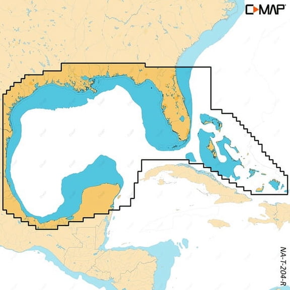 $26000current price $260.00
C-MAP Reveal X Coastal Gulf of Mexico and Bahamas microSD
Hawaii 3D Raised Relief Map $39.99
 $3999current price $39.99
Hawaii 3D Raised Relief Map
Xplorer Maps MAP_NC North Carolina State Hand-Drawn Map $16.26
 $1626current price $16.26
Xplorer Maps MAP_NC North Carolina State Hand-Drawn Map
Benchmark Maps: Baja California Peninsula Wall Map - 25 x 39 inches - Front Lamination $65.25 Was $86.04
 $6525current price $65.25, Was $86.04$86.04
Benchmark Maps: Baja California Peninsula Wall Map - 25 x 39 inches - Front Lamination
48x60 Missouri State Official Executive Laminated Wall Map $117.56
 $11756current price $117.56
48x60 Missouri State Official Executive Laminated Wall Map
Santa Catalina Island 3D Raised Relief Map $39.99
 $3999current price $39.99
Santa Catalina Island 3D Raised Relief Map
Map The Xperience Compact GPS Map, Big Hole River, Montana 0.1 x 3 in $7.95
 $795current price $7.95
Map The Xperience Compact GPS Map, Big Hole River, Montana 0.1 x 3 in
C-Map North America MicroSD $148.72
 $14872current price $148.72
C-Map North America MicroSD
Benchmark Maps: Baja California Peninsula Wall Map - 25 x 39 inches - Rolled Canvas $80.95
$8095current price $80.95Benchmark Maps: Baja California Peninsula Wall Map - 25 x 39 inches - Rolled Canvas
Map of Colorado - Laminated Wall Map Poster Print Perfect for Classrooms and Homes - Vivid Imagery with Bright Colors - 18x24 $12.99
 4 optionsAvailable in additional 4 options$1299current price $12.99
Map of Colorado - Laminated Wall Map Poster Print Perfect for Classrooms and Homes - Vivid Imagery with Bright Colors - 18x24
BLUE RIVER, COLORADO GPS MAP $7.95
 $795current price $7.95
BLUE RIVER, COLORADO GPS MAP
Franko Maps - Coronados Islands (Mexico) Fish ID $9.98
 $998current price $9.98
Franko Maps - Coronados Islands (Mexico) Fish ID
BITTERROOT RIVER, MONTANA GPS MAP $7.95
 $795current price $7.95
BITTERROOT RIVER, MONTANA GPS MAP
Topographical Map - Keyser West Virginia Maryland Quad - USGS 1920 - Vintage Wall Art $36.95
 $3695current price $36.95
Topographical Map - Keyser West Virginia Maryland Quad - USGS 1920 - Vintage Wall Art

Check out these related products
CMAP Central America & Caribbean Coastal Chart CW82672 $260.00
 $26000current price $260.00
CMAP Central America & Caribbean Coastal Chart CW82672
C-MAP Reveal Coastal Chesapeake Bay to the Bahamas M-NA-Y203-MS $260.00
 $26000current price $260.00
C-MAP Reveal Coastal Chesapeake Bay to the Bahamas M-NA-Y203-MS
C-MAP Reveal Coastal Great Lakes to Nova Scotia $260.00
 $26000current price $260.00
C-MAP Reveal Coastal Great Lakes to Nova Scotia
C-MAP Reveal Coastal Nova Scotia to Chesapeak Bay $260.00
 $26000current price $260.00
C-MAP Reveal Coastal Nova Scotia to Chesapeak Bay
C-Map CMAMNAY203MS Reveal Coastal Chesapeake Bay to the Bahamas Map $314.44
 $31444current price $314.44
C-Map CMAMNAY203MS Reveal Coastal Chesapeake Bay to the Bahamas Map
C-MAP Reveal US Lakes South Central Map, 5.79x4.13 $184.67
 $18467current price $184.67
C-MAP Reveal US Lakes South Central Map, 5.79x4.13
Customer ratings & reviews
0 ratings|0 reviews
This item does not have any reviews yet
