
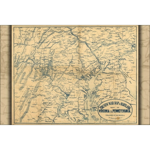
Hero image 0 of 24"x36" Gallery Poster, civil war Map of Maryland, Delaware, and parts of Pennsylvania and Virginia, 1861, 0 of 1
24"x36" Gallery Poster, civil war Map of Maryland, Delaware, and parts of Pennsylvania and Virginia, 1861
(No ratings yet)
Current price is USD$52.95
Price when purchased online
- Free shipping
- Free 30-day returns
How do you want your item?
Ships to
Arrives by Thu, Jun 25
|Sold and shipped by History Galore
4.333333333333333 stars out of 5, based on 15 seller reviews(4.3)
Free 30-day returns
About this item


Customer ratings & reviews
0 ratings|0 reviews
This item does not have any reviews yet

Related pages
- Western United States Travel Books, Maps & Guides
- Midwest United States Travel Books, Maps & Guides
- Central America Travel Books, Maps & Guides
- General South America Travel Books, Maps & Guides
- Washington Dc Museum Map
- Gettysburg Battle Map
- National Parks Posters
- Gettysburg Battle Map Day
- Gettysburg Pennsylvania Map
- Gettysburg National Park Map
- Cheyenne Wyoming Map
- General United States Travel Books, Maps & Guides