
Hero image 0 of Historic State Map - America English Plantations - 1700 - Vintage Wall Art, 0 of 4
Historic State Map - America English Plantations - 1700 - Vintage Wall Art
(No ratings yet)
Historic State Map - America English Plantations - 1700 - Vintage Wall ArtTopographical Map Ferris Lake Wyoming Quad USGS 1971 23 x 28 94 Vintage Wall ArtHistoric State Map America English Plantations 1700 30 x 23 Vintage Wall ArtHistoric State Map America English Plantations 1700 Vintage Wall ArtHistoric State Map America English Plantations 1700 30 x 23 Vintage Wall Art
Material:Matte Art
Size:21.53 X 16.00
Key item features
- BEAUTIFUL MAPS OF THE UNITED STATES - At Maps of the Past, we have all different types of US maps. From topographical to natural resources, we have exactly the type of US map you are looking for. Check out all of the different types of US maps that we have to offer. Easily find the one that is right for your needs.
- A UNITED STATES MAP FOR EVERY NEED - At Maps of the Past, we carry a variety of US maps. From exports and natural resources, to mines and railroads. We have maps of the US that cover any need. Check our wide selection of United States maps!
- ONLY ACCEPT THE BEST PRINT QUALITY FOR YOUR REPRODUCTIONS - There are many printers and print types available on the market, when purchasing a reproduction there is no finer quality reproduction than a reproduction using the Giclee Printing method. Giclee describes the technique or style of printing used, and it is revered as the highest quality printing because of the way it precisely sprays ink onto a surface. Trust nothing less than the best!
- GUARANTEED TO GET EXACTLY WHAT YOU ORDERED - All of our maps come rolled, wrapped, and shipped in a heavy gauge mailing tube to ensure it arrives intact.
- WHY CHOOSE MAPS OF THE PAST? - Maps of the Past is one of the single largest producers of different types of maps. They legally own the rights to the maps they sell, and provide them to you in clean, clear, and vibrant print. If you are looking for a high quality map print, then look no further than Maps of the Past!
Specs
 Size21.53 X 16.00
 BrandMAPS OF THE PAST
 MaterialMatte Art
 ColorMulticolor
Current price is USD$42.95
Price when purchased online
- Free shipping
 Free 30-day returns
How do you want your item?
Columbus, 43215
Arrives by Thu, Apr 30
|Sold and shipped by Maps of the Past
4.363636363636363 stars out of 5, based on 11 seller reviews(4.4)11 seller reviews
Free 30-day returns - in store or online
About this item
Product details
Old Map - Plantations of the English in America 1700 - This is an exquisite full-color Reproduction printed on gloss paper or art paper.
Sites and Townships Specific To This Map Are: New England, Connecticut River, Marimake River, Atlantic Ocean, Long Island, New York, Hudson River, New Jersey, Delaware Bay, Pennsylvania, Maryland, Sasquahana River, Chesapeak Bay, The North Sea, Virginia, James River, plus inserts showing close-ups of Carolina, Bermuda, Barbodos and Jamaica.
The following towns are featured: James Town, Norfolk, Oxford, Arondel, Baltimore, Darlington, Casilton, Elfingburg, Philadelphia, New York, Elizabeth Town, Middletown, Antioch, New Albanie, West Chester, New York, Hampton, Bedford, Fairefield, Stanford, Northampton, Hatfield, Hartford, New London, Wickford, Yarmouth, Concord, Boston, York Town and many more.
This Map is Situated in: The United States
SKU: USEC0011
Original Maps are often difficult to find and usually have fold lines, identifying stamps or markings, tears, ragged edges, and assorted other natural signs of age that detract from their beauty. All of our maps have been professionally restored to depict their original beauty, while keeping all historical data intact.
These maps are fabulous pieces of history full of information useful to Historians, Genealogists, Cartographers, Relic Hunters, & Others. They make fascinating conversation pieces and splendid works of art for the home or office.
- BEAUTIFUL MAPS OF THE UNITED STATES - At Maps of the Past, we have all different types of US maps. From topographical to natural resources, we have exactly the type of US map you are looking for. Check out all of the different types of US maps that we have to offer. Easily find the one that is right for your needs.
- A UNITED STATES MAP FOR EVERY NEED - At Maps of the Past, we carry a variety of US maps. From exports and natural resources, to mines and railroads. We have maps of the US that cover any need. Check our wide selection of United States maps!
- ONLY ACCEPT THE BEST PRINT QUALITY FOR YOUR REPRODUCTIONS - There are many printers and print types available on the market, when purchasing a reproduction there is no finer quality reproduction than a reproduction using the Giclee Printing method. Giclee describes the technique or style of printing used, and it is revered as the highest quality printing because of the way it precisely sprays ink onto a surface. Trust nothing less than the best!
- GUARANTEED TO GET EXACTLY WHAT YOU ORDERED - All of our maps come rolled, wrapped, and shipped in a heavy gauge mailing tube to ensure it arrives intact.
- WHY CHOOSE MAPS OF THE PAST? - Maps of the Past is one of the single largest producers of different types of maps. They legally own the rights to the maps they sell, and provide them to you in clean, clear, and vibrant print. If you are looking for a high quality map print, then look no further than Maps of the Past!
info:
We aim to show you accurate product information. Manufacturers, suppliers and others provide what you see here, and we have not verified it.
Specifications
Size
21.53 X 16.00
Brand
MAPS OF THE PAST
Material
Matte Art
Color
Multicolor
Warranty
Warranty information
Please be aware that the warranty terms on items offered for sale by third party Marketplace sellers may differ from those displayed in this section (if any). To confirm warranty terms on an item offered for sale by a third party Marketplace seller, please use the 'Contact seller' feature on the third party Marketplace seller's information page and request the item's warranty terms prior to purchase.
Check out these related products
Topographical Map - Burlington Lake Wyoming Quad - USGS 1968 - Vintage Wall Art $36.95
 4 optionsAvailable in additional 4 options$3695current price $36.95
Topographical Map - Burlington Lake Wyoming Quad - USGS 1968 - Vintage Wall Art
Topographical Map - Gilbert Lake Wyoming Quad - USGS 1950 - Vintage Wall Art $36.95
 4 optionsAvailable in additional 4 options$3695current price $36.95
Topographical Map - Gilbert Lake Wyoming Quad - USGS 1950 - Vintage Wall Art
Topographical Map - Poison Lake Wyoming Quad - USGS 1950 - Vintage Wall Art $36.95
 4 optionsAvailable in additional 4 options$3695current price $36.95
Topographical Map - Poison Lake Wyoming Quad - USGS 1950 - Vintage Wall Art
Topographical Map - Turquoise Lake Wyoming Quad - USGS 1965 - Vintage Wall Art $36.95
 4 optionsAvailable in additional 4 options$3695current price $36.95
Topographical Map - Turquoise Lake Wyoming Quad - USGS 1965 - Vintage Wall Art
Topographical Map - Lake Colorado Quad - USGS 1970 - Vintage Wall Art $36.95
 4 optionsAvailable in additional 4 options$3695current price $36.95
Topographical Map - Lake Colorado Quad - USGS 1970 - Vintage Wall Art
Topographical Map - Lake Como Mississippi Quad - USGS 1964 - Vintage Wall Art $36.95
 $3695current price $36.95
Topographical Map - Lake Como Mississippi Quad - USGS 1964 - Vintage Wall Art
Topographical Map - Rollover Lake Louisiana Quad - USGS 1979 - Vintage Wall Art $36.95
 $3695current price $36.95
Topographical Map - Rollover Lake Louisiana Quad - USGS 1979 - Vintage Wall Art
Topographical Map - Lake Mary Mississsippi Quad - USGS 1965 - Vintage Wall Art $36.95
 $3695current price $36.95
Topographical Map - Lake Mary Mississsippi Quad - USGS 1965 - Vintage Wall Art
Topographical Map - Beaver Lake North Dakota Quad - USGS 1948 - Vintage Wall Art $36.95
 $3695current price $36.95
Topographical Map - Beaver Lake North Dakota Quad - USGS 1948 - Vintage Wall Art
Topographical Map - Grandaddy Lake Utah Quad - USGS 1972 - Vintage Wall Art $36.95
 $3695current price $36.95
Topographical Map - Grandaddy Lake Utah Quad - USGS 1972 - Vintage Wall Art
Topographical Map - Cayman Lake Texas Quad - USGS 1969 - Vintage Wall Art $36.95
 $3695current price $36.95
Topographical Map - Cayman Lake Texas Quad - USGS 1969 - Vintage Wall Art
Topographical Map - Aspermont Lake Texas Quad - USGS 1969 - Vintage Wall Art $36.95
 $3695current price $36.95
Topographical Map - Aspermont Lake Texas Quad - USGS 1969 - Vintage Wall Art
Topographical Map - Lake Mt Sterling Illinois Quad - USGS 1981 - Vintage Wall Art $36.95
 $3695current price $36.95
Topographical Map - Lake Mt Sterling Illinois Quad - USGS 1981 - Vintage Wall Art
Topographical Map - Salt Creek Wyoming Quad - USGS 1968 - Vintage Wall Art $36.95
 $3695current price $36.95
Topographical Map - Salt Creek Wyoming Quad - USGS 1968 - Vintage Wall Art
Topographical Map - Salt Canyon Wyoming Quad - USGS 1968 - Vintage Wall Art $36.95
 $3695current price $36.95
Topographical Map - Salt Canyon Wyoming Quad - USGS 1968 - Vintage Wall Art
Historical Civil War Map - Chancellorsville James River Virginia Battlefield - Campbell 1894 $36.95
 $3695current price $36.95
Historical Civil War Map - Chancellorsville James River Virginia Battlefield - Campbell 1894
Topographical Map - Threemile Creek Reservoir Wyoming Quad - USGS 1984 - Vintage Wall Art $36.95
 $3695current price $36.95
Topographical Map - Threemile Creek Reservoir Wyoming Quad - USGS 1984 - Vintage Wall Art
Topographical Map - Gordon Creek Wyoming Quad - USGS 1967 - Vintage Wall Art $36.95
 $3695current price $36.95
Topographical Map - Gordon Creek Wyoming Quad - USGS 1967 - Vintage Wall Art
Topographical Map - Rongis Reservoir Wyoming Quad - USGS 1952 - Vintage Wall Art $36.95
 $3695current price $36.95
Topographical Map - Rongis Reservoir Wyoming Quad - USGS 1952 - Vintage Wall Art
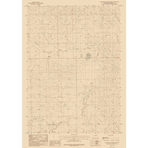
Topographical Map - Greasewood Reservoir Wyoming Quad - USGS 1984 - Vintage Wall Art $36.95
 4 optionsAvailable in additional 4 options$3695current price $36.95
Topographical Map - Greasewood Reservoir Wyoming Quad - USGS 1984 - Vintage Wall Art
Customer ratings & reviews
0 ratings|0 reviews
This item does not have any reviews yet
