Hero image 0 of Historic State Map - Kentucky Tennessee - Asher 1874 - Vintage Wall Art, 0 of 4
Historic State Map - Kentucky Tennessee - Asher 1874 - Vintage Wall Art
(No ratings yet)
Historic State Map - Kentucky Tennessee - Asher 1874 - Vintage Wall ArtMaps of the Past Exquisite Giclee Reproduction 1874 Kentucky Tennessee State Map Poster 23 00 x 32 75Historic State Map Kentucky Tennessee Asher 1874 Vintage Wall ArtHistoric State Map Kentucky Tennessee Asher 1874 23 x 32 75 Vintage Wall ArtHistoric State Map Kentucky Tennessee Asher 1874 Vintage Wall Art
Material:Glossy Photo
Size:23.00 x 32.75
Key item features
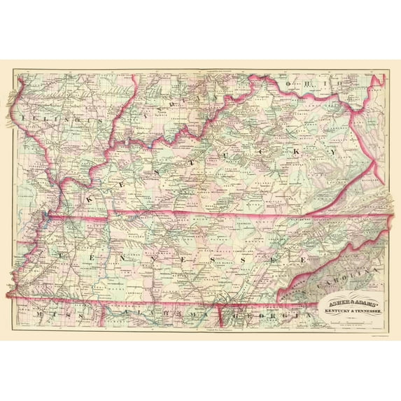
- Historic Cartography: This reproduction features an Asher and Adams 1874 map of Kentucky and Tennessee, showcasing historical geographical details.
- Detailed Inclusions: The map highlights specific sites, townships, portions of surrounding states, and historical rail lines and waterways.
- Giclee Printing: The reproduction utilizes the Giclee printing method, known for its high quality and precise ink application on gloss or art paper.
- Restored Authenticity: Professionally restored, the map depicts its original beauty while preserving all historical data, free from common age-related imperfections.
- Informative Display: Beyond decorative appeal, the map provides valuable information for historians, genealogists, cartographers, and relic hunters.
- Secure Packaging: Each map is rolled, wrapped, and shipped in a heavy gauge mailing tube to ensure its intact arrival.
Generated by AI
Specs
- ColorMulticolor
- Decor styleIndustrial
- ThemeOld State Maps
- FramedN
- ShapeRectangle
- Art typePhotography
Current price is USD$40.95
Price when purchased online
- Free shipping
 Free 30-day returns
How do you want your item?
Columbus, 43215
Arrives between May 9 - May 11
|Sold and shipped by Maps of the Past
4.363636363636363 stars out of 5, based on 11 seller reviews(4.4)11 seller reviews
Free 30-day returns - in store or online
About this item
Product details
Old State Map - Kentucky, Tennessee - Asher and Adams 1874 - This is an exquisite full-color Reproduction printed on gloss paper or art paper.
Sites and Townships Specific To This Map Are: Morganfield, Dixon, Owensboro, Hardinsbugh, Hodgensville, Campbellsville, Greensburgh, Columbia, Scottsville, Monticello, Franklin, Nashville, Carthage, Cookville, Louden, Manchester, Knoxville,, Maryville, Somerville, and others.
The following towns are featured: portions of the states of Illinois, Mississippi, Alabama, Georgia, N. Carolina, Ohio, and Indiana. Rail lines include the Nashville Great Southern RR, Nashville Chattanooga & St Louis RR, East Tennessee Virginia & Georgia RR, and many more. Waterways include the Ohio River, Mississippi River, Tennessee River, Cumberland River, and others.
This Map is Situated in: States of Kentucky (KY) & Tennessee (TN), US.
SKU: KYZZ0009
Original Maps are often difficult to find and usually have fold lines, identifying stamps or markings, tears, ragged edges, and assorted other natural signs of age that detract from their beauty. All of our maps have been professionally restored to depict their original beauty, while keeping all historical data intact.
These maps are fabulous pieces of history full of information useful to Historians, Genealogists, Cartographers, Relic Hunters, & Others. They make fascinating conversation pieces and splendid works of art for the home or office.
- OWN A STATE MAP TODAY - If you are looking for a map of your state, or another specific state, to frame and hang on your wall, then look no further! Our state maps are also great for school projects. Our maps have a variety of uses, and they come in a variety of styles. We have every state map you could need!
- STATE MAPS PROVIDE IMPORTANT INFORMATION - State maps not only show you how the different counties and/or cities are divided up and where the borders can be found within a state, but it also highlights rivers, mountains, and other natural elements. Some of them may also provide
- ONLY ACCEPT THE BEST PRINT QUALITY FOR YOUR REPRODUCTIONS - There are many printers and print types available on the market, when purchasing a reproduction there is no finer quality reproduction than a reproduction using the Giclee Printing method. Giclee describes the technique or style of printing used, and it is revered as the highest quality printing because of the way it precisely sprays ink onto a surface. Trust nothing less than the best!
- GUARANTEED TO GET EXACTLY WHAT YOU ORDERED - All of our maps come rolled, wrapped, and shipped in a heavy gauge mailing tube to ensure it arrives intact.
- WHY CHOOSE MAPS OF THE PAST? - Maps of the Past is one of the single largest producers of different types of maps. They legally own the rights to the maps they sell, and provide them to you in clean, clear, and vibrant print. If you are looking for a high quality map print, then look no further than Maps of the Past!
info:
We aim to show you accurate product information. Manufacturers, suppliers and others provide what you see here, and we have not verified it.
Specifications
Color
Multicolor
Decor style
Industrial
Theme
Old State Maps
Framed
N
Warranty
Warranty information
Please be aware that the warranty terms on items offered for sale by third party Marketplace sellers may differ from those displayed in this section (if any). To confirm warranty terms on an item offered for sale by a third party Marketplace seller, please use the 'Contact seller' feature on the third party Marketplace seller's information page and request the item's warranty terms prior to purchase.
Similar items you might like
Based on what customers bought
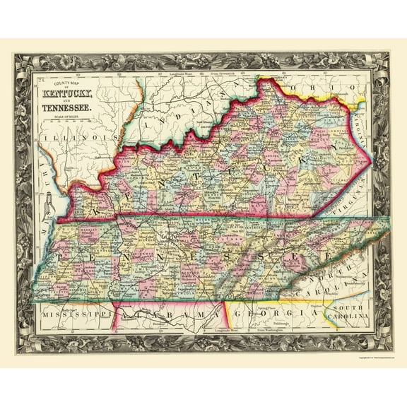
Historic State Map - Kentucky Tennessee Counties - Mitchell 1860 - Vintage Wall Art $36.95
 4 optionsAvailable in additional 4 options$3695current price $36.95
Historic State Map - Kentucky Tennessee Counties - Mitchell 1860 - Vintage Wall Art
Historic State Map - Kentucky Tennessee Counties - Hinton 1831 - Vintage Wall Art $36.95
 4 optionsAvailable in additional 4 options$3695current price $36.95
Historic State Map - Kentucky Tennessee Counties - Hinton 1831 - Vintage Wall Art
Historic State Map - Georgia Alabama - Burr 1839 - Vintage Wall Art $36.95
 4 optionsAvailable in additional 4 options$3695current price $36.95
Historic State Map - Georgia Alabama - Burr 1839 - Vintage Wall Art
Historic State Map - Kentucky Tennessee - Colton 1856 - Vintage Wall Art $36.95
 4 optionsAvailable in additional 4 options$3695current price $36.95
Historic State Map - Kentucky Tennessee - Colton 1856 - Vintage Wall Art
Historic State Map - Kentucky - Carey 1822 - Vintage Wall Art $36.95
 4 optionsAvailable in additional 4 options$3695current price $36.95
Historic State Map - Kentucky - Carey 1822 - Vintage Wall Art
Historic State Map - Missouri - Asher 1874 - Vintage Wall Art $36.95
 4 optionsAvailable in additional 4 options$3695current price $36.95
Historic State Map - Missouri - Asher 1874 - Vintage Wall Art
Historic State Map - Indiana - Mitchell 1846 - Vintage Wall Art $36.95
 4 optionsAvailable in additional 4 options$3695current price $36.95
Historic State Map - Indiana - Mitchell 1846 - Vintage Wall Art
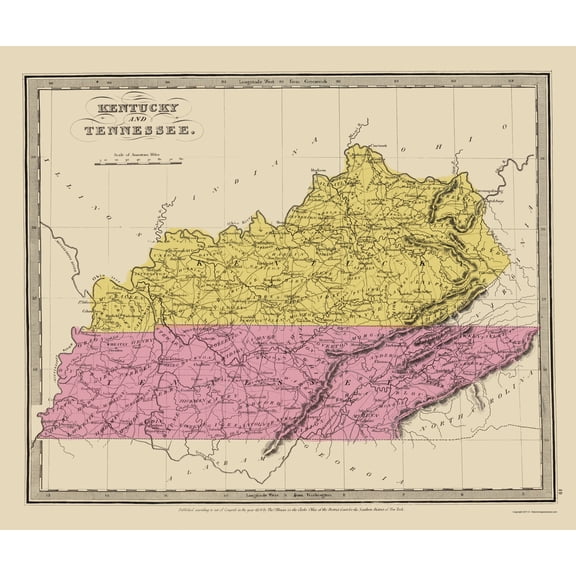
Historic State Map - Kentucky - 1845 - Vintage Wall Art $36.95
 4 optionsAvailable in additional 4 options$3695current price $36.95
Historic State Map - Kentucky - 1845 - Vintage Wall Art
Historic State Map - Iowa - Colton 1856 - Vintage Wall Art $36.95
 3 optionsAvailable in additional 3 options$3695current price $36.95
Historic State Map - Iowa - Colton 1856 - Vintage Wall Art
Historic State Map - Georgia - Colton 1855 - Vintage Wall Art $36.95
 4 optionsAvailable in additional 4 options$3695current price $36.95
Historic State Map - Georgia - Colton 1855 - Vintage Wall Art
Historic State Map - Ohio - Burr 1831 - Vintage Wall Art $36.95
 3 optionsAvailable in additional 3 options$3695current price $36.95
Historic State Map - Ohio - Burr 1831 - Vintage Wall Art
11 out of 5 Stars. 1 reviewsHistoric State Map - Georgia Alabama - Asher 1874 - Vintage Wall Art $36.95
 4 optionsAvailable in additional 4 options$3695current price $36.95
Historic State Map - Georgia Alabama - Asher 1874 - Vintage Wall Art
Historic State Map - Maryland - Finley 1831 - Vintage Wall Art $36.95
 4 optionsAvailable in additional 4 options$3695current price $36.95
Historic State Map - Maryland - Finley 1831 - Vintage Wall Art
Historic State Map - Kentucky Tennessee - Illman 1834 - Vintage Wall Art $36.95
 4 optionsAvailable in additional 4 options$3695current price $36.95
Historic State Map - Kentucky Tennessee - Illman 1834 - Vintage Wall Art
Historic State Map - Massachusetts - Boynton 1841 - Vintage Wall Art $36.95
 4 optionsAvailable in additional 4 options$3695current price $36.95
Historic State Map - Massachusetts - Boynton 1841 - Vintage Wall Art
Historic State Map - Kentucky Tennessee Counties - Rand McNally 1897 - Vintage Wall Art $36.95
 4 optionsAvailable in additional 4 options$3695current price $36.95
Historic State Map - Kentucky Tennessee Counties - Rand McNally 1897 - Vintage Wall Art
Historic State Map - Rhode Island - Strong 1841 - Vintage Wall Art $36.95
 4 optionsAvailable in additional 4 options$3695current price $36.95
Historic State Map - Rhode Island - Strong 1841 - Vintage Wall Art
Historic State Map - Illinois - Rathbun 1893 - Vintage Wall Art $36.95
 4 optionsAvailable in additional 4 options$3695current price $36.95
Historic State Map - Illinois - Rathbun 1893 - Vintage Wall Art
Historic State Map - Louisiana - Burr 1835 - Vintage Wall Art $36.95
 4 optionsAvailable in additional 4 options$3695current price $36.95
Historic State Map - Louisiana - Burr 1835 - Vintage Wall Art
Historic State Map - Maine - Colton 1855 - Vintage Wall Art $36.95
 3 optionsAvailable in additional 3 options$3695current price $36.95
Historic State Map - Maine - Colton 1855 - Vintage Wall Art
Check out these related products
Historic City Map - Glenwood Denison Hastings Iowa - Andreas 1874 - Vintage Wall Art $36.95
 $3695current price $36.95
Historic City Map - Glenwood Denison Hastings Iowa - Andreas 1874 - Vintage Wall Art
Historic City Map - Arlington Texas - Ashburn 1960 - Vintage Wall Art $36.95
 4 optionsAvailable in additional 4 options$3695current price $36.95
Historic City Map - Arlington Texas - Ashburn 1960 - Vintage Wall Art
Historic State Map - Georgia Alabama Florida - Colton 1858 - Vintage Wall Art $36.95
 4 optionsAvailable in additional 4 options$3695current price $36.95
Historic State Map - Georgia Alabama Florida - Colton 1858 - Vintage Wall Art
15 out of 5 Stars. 1 reviewsRailroad Map - Logansport and Northern Indiana Railroad 1854 - Vintage Wall Art $36.95
 $3695current price $36.95
Railroad Map - Logansport and Northern Indiana Railroad 1854 - Vintage Wall Art
Historical Civil War Map - Virginia Theatre - Disturnell 1861 - Vintage Wall Art $36.95
 $3695current price $36.95
Historical Civil War Map - Virginia Theatre - Disturnell 1861 - Vintage Wall Art
Historic State Map - Arkansas - Colton 1855 - Vintage Wall Art $36.95
 4 optionsAvailable in additional 4 options$3695current price $36.95
Historic State Map - Arkansas - Colton 1855 - Vintage Wall Art
Historic State Map - Arizona - Asher 1874 - Vintage Wall Art $36.95
 $3695current price $36.95
Historic State Map - Arizona - Asher 1874 - Vintage Wall Art
Historic County Map - Benton County Indiana - Andreas 1876 - Vintage Wall Art $36.95
 4 optionsAvailable in additional 4 options$3695current price $36.95
Historic County Map - Benton County Indiana - Andreas 1876 - Vintage Wall Art
Railroad Map - Massachusetts Rhode Island Connecticut - Colton 1853 - Vintage Wall Art $36.95
 4 optionsAvailable in additional 4 options$3695current price $36.95
Railroad Map - Massachusetts Rhode Island Connecticut - Colton 1853 - Vintage Wall Art
Historic State Map - Alabama Arkansas Louisiana Mississippi - Stedman 1873 - Vintage Wall Art $36.95
 $3695current price $36.95
Historic State Map - Alabama Arkansas Louisiana Mississippi - Stedman 1873 - Vintage Wall Art
Historic State Map - Nebraska - Asher 1874 - Vintage Wall Art $36.95
 $3695current price $36.95
Historic State Map - Nebraska - Asher 1874 - Vintage Wall Art
Topographical Map - Marion Ohio Quad - USGS 1905 - Vintage Wall Art $36.95
 $3695current price $36.95
Topographical Map - Marion Ohio Quad - USGS 1905 - Vintage Wall Art
Historic City Map - Olmsted Ohio - Titus 1876 - Vintage Wall Art $36.95
 $3695current price $36.95
Historic City Map - Olmsted Ohio - Titus 1876 - Vintage Wall Art
Historic Nautical Map - Florida Louisiana Gulf Coast - Sartine 1778 - Vintage Wall Art $36.95
 $3695current price $36.95
Historic Nautical Map - Florida Louisiana Gulf Coast - Sartine 1778 - Vintage Wall Art
Historic State Map - Florida - Tanner 1833 - Vintage Wall Art $36.95
 $3695current price $36.95
Historic State Map - Florida - Tanner 1833 - Vintage Wall Art
Historic State Map - Texas Settlement Grants - Tanner 1836 - Vintage Wall Art $36.95
 $3695current price $36.95
Historic State Map - Texas Settlement Grants - Tanner 1836 - Vintage Wall Art
Historic City Map - Euclid Southern Ohio - Cram 1892 - Vintage Wall Art $36.95
 $3695current price $36.95
Historic City Map - Euclid Southern Ohio - Cram 1892 - Vintage Wall Art
Historic State Map - Washington - Cram 1875 - Vintage Wall Art $36.95
 $3695current price $36.95
Historic State Map - Washington - Cram 1875 - Vintage Wall Art
Railroad Map - Washington Railroads - 1892 - Vintage Wall Art $36.95
 $3695current price $36.95
Railroad Map - Washington Railroads - 1892 - Vintage Wall Art
Historic State Map - North Carolina - Cram 1886 - Vintage Wall Art $36.95
 $3695current price $36.95
Historic State Map - North Carolina - Cram 1886 - Vintage Wall Art
Customer ratings & reviews
0 ratings|0 reviews
This item does not have any reviews yet

Related pages
- South Carolina Newspapers
- Washington State Florida
- Eau Claire Wi Map
- North Alabama Maps
- Fort Knox Map
- Utah State Capitol Building
- National Parks Posters
- Central America Travel Books, Maps & Guides
- Midwest United States Travel Books, Maps & Guides
- Western United States Travel Books, Maps & Guides
- Northeast United States Travel Books, Maps & Guides
- General South America Travel Books, Maps & Guides