
Hero image 0 of Historic Map - Europe - Rand McNally 1898 - Vintage Wall Art, 0 of 4
Historic Map - Europe - Rand McNally 1898 - Vintage Wall Art
(No ratings yet)
Historic Map - Europe - Rand McNally 1898 - Vintage Wall ArtHistoric Map Europe Rand McNally 1898 23 x 30 27 Vintage Wall ArtHistoric Map Europe Rand McNally 1898 Vintage Wall ArtHistoric Map Europe Rand McNally 1898 Vintage Wall ArtHistoric Map Europe Rand McNally 1898 23 x 30 27 Vintage Wall Art
Material:Matte Art
Size:23.00 x 30.27
Key item features
- OWN A PIECE OF YOUR HOME COUNTRY - Looking for something that reminds you of the country you or your ancestors originate from? Well now you can own a piece of your heritage with a beautiful map of your home country. Maps of the Past has maps for every need!
- INTERNATIONAL MAPS PROVIDE IMPORTANT INFORMATION - International maps not only show you how the different countries, cities, counties, and territories are divided and where the borders can be found, but it also highlights rivers, mountains, and other natural elements of the land. International maps can also show you natural resources and exports of a country.
- ONLY ACCEPT THE BEST PRINT QUALITY FOR YOUR REPRODUCTIONS - There are many printers and print types available on the market, when purchasing a reproduction there is no finer quality reproduction than a reproduction using the Giclee Printing method. Giclee describes the technique or style of printing used, and it is revered as the highest quality printing because of the way it precisely sprays ink onto a surface. Trust nothing less than the best!
- GUARANTEED TO GET EXACTLY WHAT YOU ORDERED - All of our maps come rolled, wrapped, and shipped in a heavy gauge mailing tube to ensure it arrives intact.
- WHY CHOOSE MAPS OF THE PAST? - Maps of the Past is one of the single largest producers of different types of maps. They legally own the rights to the maps they sell, and provide them to you in clean, clear, and vibrant print. If you are looking for a high quality map print, then look no further than Maps of the Past!
Specs
- ColorMulticolor
- Decor styleIndustrial
- FramedN
- ShapeRectangle
- Art typePhotography
- Rec. roomOffice
Current price is USD$45.95
Price when purchased online
- Free shipping
 Free 30-day returns
How do you want your item?
Columbus, 43215
Arrives by Tue, Apr 28
|Sold and shipped by Maps of the Past
4.363636363636363 stars out of 5, based on 11 seller reviews(4.4)11 seller reviews
Free 30-day returns
About this item
Product details
Old Europe Map - Rand McNally 1898 - This is an exquisite full-color Reproduction printed on gloss paper or art paper.
Sites and Townships Specific To This Map Are: Londen, Athens, Sophia, Lutzko, Lechi, Viborg, Caroa, Saltzburg, Prague, Alippo, Rome, Madrid, Paris, and others
The following towns are featured: a map from Rand McNally & Company's Indexed Atlas of the World Published in 1898. It depicts the pre World War I political boundries showing the political situation in the Balkans after the Austrian encrouchment of 1878 which affected Turkey's borders. Bodies of water include the Caspian Sea, Black Sea, Mediterranean Sea, Sea of Azov, Adriatic Sea, Bay of Biscay, English Channel, North Sea, Baltic Sea, Gulf of Finland, and Gulf of Bothnia.
This Map is Situated in: Continent of Europe.
SKU: ITEU0009
Original Maps are often difficult to find and usually have fold lines, identifying stamps or markings, tears, ragged edges, and assorted other natural signs of age that detract from their beauty. All of our maps have been professionally restored to depict their original beauty, while keeping all historical data intact.
These maps are fabulous pieces of history full of information useful to Historians, Genealogists, Cartographers, Relic Hunters, & Others. They make fascinating conversation pieces and splendid works of art for the home or office.
- OWN A PIECE OF YOUR HOME COUNTRY - Looking for something that reminds you of the country you or your ancestors originate from? Well now you can own a piece of your heritage with a beautiful map of your home country. Maps of the Past has maps for every need!
- INTERNATIONAL MAPS PROVIDE IMPORTANT INFORMATION - International maps not only show you how the different countries, cities, counties, and territories are divided and where the borders can be found, but it also highlights rivers, mountains, and other natural elements of the land. International maps can also show you natural resources and exports of a country.
- ONLY ACCEPT THE BEST PRINT QUALITY FOR YOUR REPRODUCTIONS - There are many printers and print types available on the market, when purchasing a reproduction there is no finer quality reproduction than a reproduction using the Giclee Printing method. Giclee describes the technique or style of printing used, and it is revered as the highest quality printing because of the way it precisely sprays ink onto a surface. Trust nothing less than the best!
- GUARANTEED TO GET EXACTLY WHAT YOU ORDERED - All of our maps come rolled, wrapped, and shipped in a heavy gauge mailing tube to ensure it arrives intact.
- WHY CHOOSE MAPS OF THE PAST? - Maps of the Past is one of the single largest producers of different types of maps. They legally own the rights to the maps they sell, and provide them to you in clean, clear, and vibrant print. If you are looking for a high quality map print, then look no further than Maps of the Past!
info:
We aim to show you accurate product information. Manufacturers, suppliers and others provide what you see here, and we have not verified it.
Specifications
Color
Multicolor
Decor style
Industrial
Theme
Historical International Maps
Framed
N
Warranty
Warranty information
Please be aware that the warranty terms on items offered for sale by third party Marketplace sellers may differ from those displayed in this section (if any). To confirm warranty terms on an item offered for sale by a third party Marketplace seller, please use the 'Contact seller' feature on the third party Marketplace seller's information page and request the item's warranty terms prior to purchase.
Similar items you might like
Based on what customers bought
Historic Map - Middle East - Spruner 1865 - 28.61 x 23 - Vintage Wall Art $94.95
 $9495current price $94.95
Historic Map - Middle East - Spruner 1865 - 28.61 x 23 - Vintage Wall Art
Historic Map - England 1065 - Gardiner 1902 - 23 x 29.25 - Vintage Wall Art $94.95 $94.95/count
 $9495current price $94.95$94.95/count
Historic Map - England 1065 - Gardiner 1902 - 23 x 29.25 - Vintage Wall Art
Historic Map - South America - Perthes 1921 - 25.89 x 23 - Vintage Wall Art $94.95
 $9495current price $94.95
Historic Map - South America - Perthes 1921 - 25.89 x 23 - Vintage Wall Art
Historic Map - Europe Asia - D'Anville 1799 - 32.30 x 23 - Vintage Wall Art $94.95 $94.95/count
 $9495current price $94.95$94.95/count
Historic Map - Europe Asia - D'Anville 1799 - 32.30 x 23 - Vintage Wall Art
Historic Map - Greece - Stieler 1885 - 28.48 x 23 - Vintage Wall Art $94.95 $94.95/count
 $9495current price $94.95$94.95/count
Historic Map - Greece - Stieler 1885 - 28.48 x 23 - Vintage Wall Art
Historic Map - Scotland - Cram 1888 - 23 x 28.37 - Vintage Wall Art $94.95 $94.95/count
 $9495current price $94.95$94.95/count
Historic Map - Scotland - Cram 1888 - 23 x 28.37 - Vintage Wall Art
Historic Map - America - Hondius 1607 - 29.96 x 23 - Vintage Wall Art $94.95
 $9495current price $94.95
Historic Map - America - Hondius 1607 - 29.96 x 23 - Vintage Wall Art
Stupell Industries Vintage Farm Garden Vegetables Food & Beverage Painting Unframed Art Print Wall Art, 11 x 14, Set of 4 $117.99
 $11799current price $117.99
Stupell Industries Vintage Farm Garden Vegetables Food & Beverage Painting Unframed Art Print Wall Art, 11 x 14, Set of 4
Historic Map - Europe - Sanson 1641 - 30.01 x 23 - Vintage Wall Art $94.95 $94.95/count
 $9495current price $94.95$94.95/count
Historic Map - Europe - Sanson 1641 - 30.01 x 23 - Vintage Wall Art
Stupell Industries Sea Life on Abstract Blue Nautical & Beach Painting Unframed Art Print Wall Art, 12 x 12, Set of 4 $117.99
 $11799current price $117.99
Stupell Industries Sea Life on Abstract Blue Nautical & Beach Painting Unframed Art Print Wall Art, 12 x 12, Set of 4
Historic Map - Belgium - Baedeker 1910 - 29.19 x 23 - Vintage Wall Art $94.95
 $9495current price $94.95
Historic Map - Belgium - Baedeker 1910 - 29.19 x 23 - Vintage Wall Art
Stupell Industries Musical Tropical Birds Entertainment Painting Unframed Art Print Wall Art, 10 x 15, Set of 4 $117.99
 2 optionsAvailable in additional 2 options$11799current price $117.99
Stupell Industries Musical Tropical Birds Entertainment Painting Unframed Art Print Wall Art, 10 x 15, Set of 4
Historic Map - England 550 - Gardiner 1902 - 23 x 32.95 - Vintage Wall Art $94.95
 $9495current price $94.95
Historic Map - England 550 - Gardiner 1902 - 23 x 32.95 - Vintage Wall Art
Historic Map - France Political - Schrader 1908 - 29.84 x 23 - Vintage Wall Art $94.95 $94.95/count
 $9495current price $94.95$94.95/count
Historic Map - France Political - Schrader 1908 - 29.84 x 23 - Vintage Wall Art
Historic Map - Europe - Bartholomew 1892 - 30.20 x 23 - Vintage Wall Art $45.95 $45.95/count
 $4595current price $45.95$45.95/count
Historic Map - Europe - Bartholomew 1892 - 30.20 x 23 - Vintage Wall Art
Historic Map - England - Alden 1886 - 23 x 36.17 - Vintage Wall Art $45.95 $45.95/count
 $4595current price $45.95$45.95/count
Historic Map - England - Alden 1886 - 23 x 36.17 - Vintage Wall Art
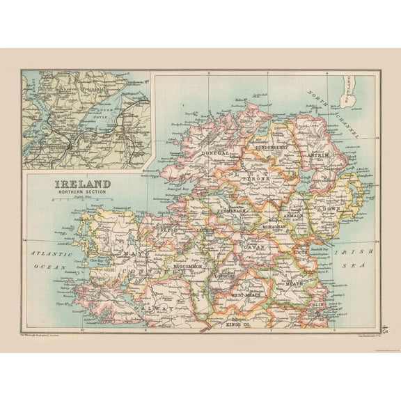
Historic Map - Ireland Northern - Bartholomew 1892 - 30.19 x 23 - Vintage Wall Art $45.95 $45.95/count
 $4595current price $45.95$45.95/count
Historic Map - Ireland Northern - Bartholomew 1892 - 30.19 x 23 - Vintage Wall Art


Customer ratings & reviews
0 ratings|0 reviews
This item does not have any reviews yet
