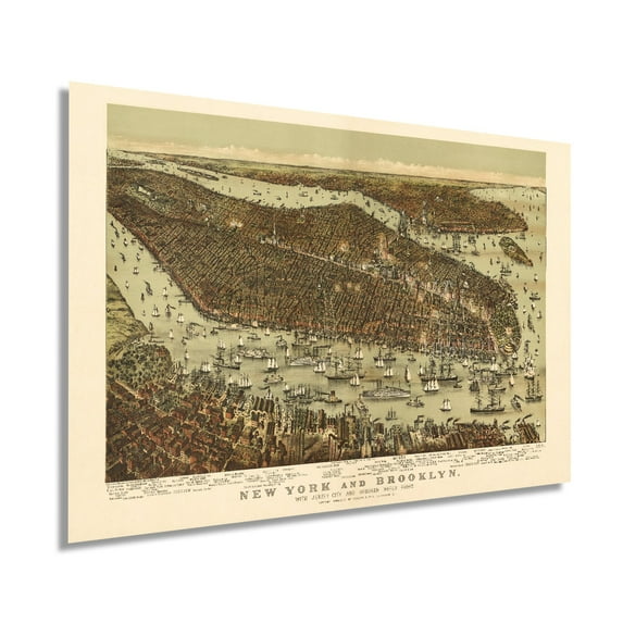
1892 Map of New York and Brooklyn with Jersey City and Hoboken Waterfront - NYC Vintage Map Wall Art Panoramic Birds Eye View Map of New York Poster - NYC Decor
Key item features
- Size: 24 x 36 Inches
- Museum-quality giclee print
- Printed using archival ink on premium heavyweight acid-free matte paper
- Shipped in a sturdy cardboard tube
- Makes a perfect gift
Specs
- Size24" x 36"
- OrientationHorizontal
- FramedY
- Frame materialCardboard
- BrandHISTORIX
- Photo paper finish configurationMatte
- Free shipping
 Free 30-day returns
How do you want your item?
About this item
Product details
Feature Points
- VINTAGE MAP REPRODUCTION: You’ll love this high quality historic reproduction of 1892 Map of New York and Brooklyn. Our museum quality maps are archival grade, which means it will look great and last without fading for over 100 years. Our print to order maps are made in the USA and each map is inspected for quality. This beautiful artwork is a perfect addition to your themed decor. Vintage maps look great in the home, study or office. They make a perfect gift as well.
- MUSEUM QUALITY: This high quality map print will be a great addition to your vintage-themed wall. Don't waste money on cheap-looking, thin paper posters. We use thick, fine art print quality matte paper. Our professional’s choice matte paper displays artwork in high detail without glare. The color is vibrant and text is easy to read. When framed, this map looks absolutely stunning.
- A LOOK BACK AT HISTORY: This is an impressive, historic reproduction of 1892 Map of New York and Brooklyn. This print is from an original found in the maps and geography division of the US Library of Congress. A true piece of history. See our product description section for more fascinating information about this historic map and its significance.
- READY TO FRAME: This print includes a 0.2 inch border for a perfect frame fit and look. Our maps are designed to fit easy-to-find standard frame sizes, saving you money from having to pay for a custom frame. Each map is inspected for quality and shipped in a rigid tube. Shipping is fast and free.
- HISTORIX: We love history and art. Sometimes old maps have tears, folds, separations and other blemishes. We digitally restore and enhance maps while keeping its historical character. All our maps are proudly made in the USA. We stand behind our products with a 100% satisfaction guarantee. Customers all over the world love our vintage maps and we know you will too.
Additional Information
This birds-eye perspective of New York City and Brooklyn, with Jersey City and Hoboken waterfront published in 1892 is a stunning depiction of the iconic American area in a time of great transition, growth, and prosperity. The bustling harbor and busy streets saw immigrants pouring into the city. The five boroughs had yet to be consolidated, and the city was transforming.
Modern steel and glass skyscrapers were introduced to the city in the 1890s, and the development of the modern-day department store had begun as well. By this time, New York had become the number one destination for tourists seeking entertainment, museums, and nightlife. The first of what would come to be known as nightclubs, the Webster Hall, opened in 1886.
1892 also marked the opening of Ellis Island, where the flood of immigrants would start embark on their journey in America. The Statue of Liberty was completed in 1886, becoming an immediately recognizable landmark and part of the new American identity.
Birdseye perspectives were published to allow residents and merchants alike to display their civic pride, and New Yorkers had many reasons to be proud. Produced and illustrated by the prolific Currier & Ives Lithographic company, the distinct aesthetic of these maps immediately transports the viewer back in time. The company had been creating unique images that represented significant moments and places in American History, and this map is no different. New York in the 1890s was a city full of life as immigrants mingled with locals and cultures learned to thrive and evolve into the diverse tapestry recognized today.
Our museum quality giclee print comes printed with archival ink on premium heavyweight matte paper. Shipped in a sturdy cardboard tube your print will arrive ready to be framed. This eye-catch
- Size: 24 x 36 Inches
- Museum-quality giclee print
- Printed using archival ink on premium heavyweight acid-free matte paper
- Shipped in a sturdy cardboard tube
- Makes a perfect gift
Specifications
Size
Orientation
Theme
Framed
Warranty
Warranty information
Similar items you might like
Based on what customers bought
1789 Plan of New York City Map Print - NYC Vintage Map Wall Art - Map of New York City Poster - NYC Map Wall Art - New York City Map Art $39.99
 2 optionsAvailable in additional 2 options$3999current price $39.99
1789 Plan of New York City Map Print - NYC Vintage Map Wall Art - Map of New York City Poster - NYC Map Wall Art - New York City Map Art
1870 Map of New York City Poster - Vintage Map Wall Art - Panoramic New York City Wall Map - NYC Vintage Map - Vintage New York Poster - NYC Map Wall Art $39.99
 2 optionsAvailable in additional 2 options$3999current price $39.99
1870 Map of New York City Poster - Vintage Map Wall Art - Panoramic New York City Wall Map - NYC Vintage Map - Vintage New York Poster - NYC Map Wall Art
HISTORIX Vintage 1914 Lincoln Highway Map Poster - Vintage Map Print of The Lincoln Highway Route from New York City to San Francisco $39.99
 2 optionsAvailable in additional 2 options$3999current price $39.99
HISTORIX Vintage 1914 Lincoln Highway Map Poster - Vintage Map Print of The Lincoln Highway Route from New York City to San Francisco
1879 Albany NY Map - Vintage Albany New York Wall Art - Old Albany New York Map - Bird's Eye View Map of Albany NY Poster - Historic Albany Map of New York $39.99
 2 optionsAvailable in additional 2 options$3999current price $39.99
1879 Albany NY Map - Vintage Albany New York Wall Art - Old Albany New York Map - Bird's Eye View Map of Albany NY Poster - Historic Albany Map of New York
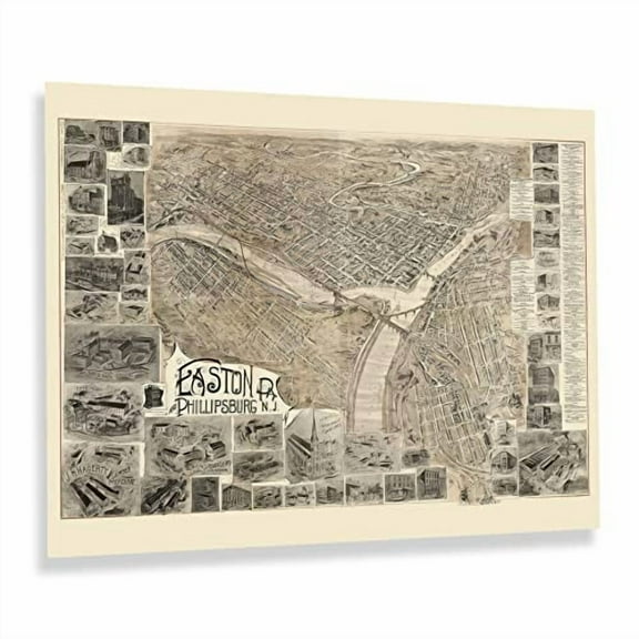
HISTORIX Vintage 1900 Easton Pennsylvania & Phillipsburg New Jersey Map Print - 18x24 Inch Bird's Eye View of Easton PA & Phillipsburg NJ Map Poster $39.99
 2 optionsAvailable in additional 2 options$3999current price $39.99
HISTORIX Vintage 1900 Easton Pennsylvania & Phillipsburg New Jersey Map Print - 18x24 Inch Bird's Eye View of Easton PA & Phillipsburg NJ Map Poster
1776 Plan of New York City Map Print - NYC Vintage Map Wall Art - Map of New York City Poster - New York City Map Art - Vintage New York Poster - NYC Map Art $39.99
 2 optionsAvailable in additional 2 options$3999current price $39.99
1776 Plan of New York City Map Print - NYC Vintage Map Wall Art - Map of New York City Poster - New York City Map Art - Vintage New York Poster - NYC Map Art
1859 Connecticut State Map with Portions of NY & Rhode Island - Vintage Map of CT Wall Art Poster $39.99
 2 optionsAvailable in additional 2 options$3999current price $39.99
1859 Connecticut State Map with Portions of NY & Rhode Island - Vintage Map of CT Wall Art Poster
HISTORIX Vintage 1776 Boston Map Poster - Plan of Boston and Its Environs Wall Art Print - Vintage Map of Boston and Its Environs $39.99
 2 optionsAvailable in additional 2 options$3999current price $39.99
HISTORIX Vintage 1776 Boston Map Poster - Plan of Boston and Its Environs Wall Art Print - Vintage Map of Boston and Its Environs
HISTORIX Vintage 1652 North America Map Poster - Old Map Print of America Septentrionalis - Vintage Map of North America Wall Art Print $39.99
 2 optionsAvailable in additional 2 options$3999current price $39.99
HISTORIX Vintage 1652 North America Map Poster - Old Map Print of America Septentrionalis - Vintage Map of North America Wall Art Print
1910 Map of Provincetown Massachusetts - Vintage Map Wall Art - Panoramic Birds Eye View of Provincetown Mass. - Provincetown Map - Provincetown Poster $39.99
 2 optionsAvailable in additional 2 options$3999current price $39.99
1910 Map of Provincetown Massachusetts - Vintage Map Wall Art - Panoramic Birds Eye View of Provincetown Mass. - Provincetown Map - Provincetown Poster
1922 Queens New York City Map Poster - Queens NYC Map Wall Art Decor - Old Metropolitan Map of New York City - Includes Inset of Rockaway Beach $39.99
 2 optionsAvailable in additional 2 options$3999current price $39.99
1922 Queens New York City Map Poster - Queens NYC Map Wall Art Decor - Old Metropolitan Map of New York City - Includes Inset of Rockaway Beach
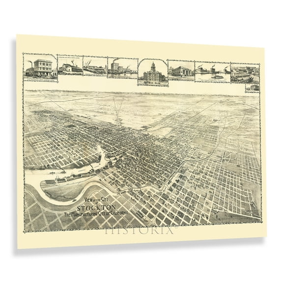
HISTORIX Vintage 1895 Stockton California Map Poster - 18x24 Inch Old View of Stockton City California Wall Map - Historic Map of California Poster $39.99
 2 optionsAvailable in additional 2 options$3999current price $39.99
HISTORIX Vintage 1895 Stockton California Map Poster - 18x24 Inch Old View of Stockton City California Wall Map - Historic Map of California Poster
1875 New York State Map - Vintage Map of New York Wall Art - Historic Map of New York - New York State Poster - New York Map Art - Map of New York Poster - NY Map $39.99
 2 optionsAvailable in additional 2 options$3999current price $39.99
1875 New York State Map - Vintage Map of New York Wall Art - Historic Map of New York - New York State Poster - New York Map Art - Map of New York Poster - NY Map
1865 New York City Map Print - NYC Vintage Map - New York City Map Wall Art - Map of New York City Poster - NYC Map Print $39.99
 2 optionsAvailable in additional 2 options$3999current price $39.99
1865 New York City Map Print - NYC Vintage Map - New York City Map Wall Art - Map of New York City Poster - NYC Map Print
1876 New York City Poster - NYC Map Wall Art - Vintage Map of New York City with Points of Interest - Historic Map of New York City Poster - Old NYC Map Print $39.99
 2 optionsAvailable in additional 2 options$3999current price $39.99
1876 New York City Poster - NYC Map Wall Art - Vintage Map of New York City with Points of Interest - Historic Map of New York City Poster - Old NYC Map Print
1860 York County Pennsylvania Map - Vintage Map of York Pennsylvania - History Map of York County PA - Old York County Map from Actual Surveys Wall Art Poster $37.99
 2 optionsAvailable in additional 2 options$3799current price $37.99
1860 York County Pennsylvania Map - Vintage Map of York Pennsylvania - History Map of York County PA - Old York County Map from Actual Surveys Wall Art Poster
Vintage 1876 New York City Poster NYC Map Wall Art - Vintage Map of New York City with Points of Interest - Historic Map of New York City Poster - Old NYC Map Print $13.51
 2 optionsAvailable in additional 2 options$1351current price $13.51
Vintage 1876 New York City Poster NYC Map Wall Art - Vintage Map of New York City with Points of Interest - Historic Map of New York City Poster - Old NYC Map Print
1855 Harrisburg Pennsylvania Map Poster - Vintage Harrisburg PA Map Wall Art - Old Harrisburg Pennsylvania Map - Historic Aerial View of Harrisburg Map Print $39.99
 2 optionsAvailable in additional 2 options$3999current price $39.99
1855 Harrisburg Pennsylvania Map Poster - Vintage Harrisburg PA Map Wall Art - Old Harrisburg Pennsylvania Map - Historic Aerial View of Harrisburg Map Print
1876 San Francisco Bay Area Map Art - Vintage Map Wall Art - Map of Bay Area Poster - San Francisco Map Poster - San Francisco Map Art - Bay Area Wall Map $39.99
 2 optionsAvailable in additional 2 options$3999current price $39.99
1876 San Francisco Bay Area Map Art - Vintage Map Wall Art - Map of Bay Area Poster - San Francisco Map Poster - San Francisco Map Art - Bay Area Wall Map
1877 Boston Map Wall Art View from the North - Vintage Map of City of Boston Wall Art - Vintage Boston Poster - Boston Map Poster - Map of Boston Massachusetts $39.99
 2 optionsAvailable in additional 2 options$3999current price $39.99
1877 Boston Map Wall Art View from the North - Vintage Map of City of Boston Wall Art - Vintage Boston Poster - Boston Map Poster - Map of Boston Massachusetts
Customer ratings & reviews

Related pages
- Mississippi Maps Decor
- Seattle Map Downtown
- Kansas Usa Maps
- Map Kansas City Kansas
- San Francisco Bay Area Map Poster
- Oregon Map Decor
- National Parks Posters
- World Map Wall Art
- Central America Travel Books, Maps & Guides
- General South America Travel Books, Maps & Guides
- Northeast United States Travel Books, Maps & Guides
- Southern United States Travel Books, Maps & Guides