
Hero image 0 of Historic State Map - Oklahoma Indian Territory - Bien 1887 - Vintage Wall Art, 0 of 4
Historic State Map - Oklahoma Indian Territory - Bien 1887 - Vintage Wall Art
(No ratings yet)
Historic State Map - Oklahoma Indian Territory - Bien 1887 - Vintage Wall ArtHistoric State Map Indiana Rathbun 1893 23 x 28 68 Vintage Wall ArtHistoric State Map Oklahoma Indian Territory Bien 1887 Vintage Wall ArtHistoric State Map Oklahoma Indian Territory Bien 1887 Vintage Wall Art
Material:Matte Art
Size:23.00 x 30.29
Key item features
- OWN A STATE MAP TODAY - If you are looking for a map of your state, or another specific state, to frame and hang on your wall, then look no further! Our state maps are also great for school projects. Our maps have a variety of uses, and they come in a variety of styles. We have every state map you could need!
- STATE MAPS PROVIDE IMPORTANT INFORMATION - State maps not only show you how the different counties and/or cities are divided up and where the borders can be found within a state, but it also highlights rivers, mountains, and other natural elements. Some of them may also provide
- ONLY ACCEPT THE BEST PRINT QUALITY FOR YOUR REPRODUCTIONS - There are many printers and print types available on the market, when purchasing a reproduction there is no finer quality reproduction than a reproduction using the Giclee Printing method. Giclee describes the technique or style of printing used, and it is revered as the highest quality printing because of the way it precisely sprays ink onto a surface. Trust nothing less than the best!
- GUARANTEED TO GET EXACTLY WHAT YOU ORDERED - All of our maps come rolled, wrapped, and shipped in a heavy gauge mailing tube to ensure it arrives intact.
- WHY CHOOSE MAPS OF THE PAST? - Maps of the Past is one of the single largest producers of different types of maps. They legally own the rights to the maps they sell, and provide them to you in clean, clear, and vibrant print. If you are looking for a high quality map print, then look no further than Maps of the Past!
Specs
- ColorMulticolor
- Decor styleIndustrial
- ThemeOld State Maps
- FramedN
- ShapeRectangle
- Art typePhotography
Current price is USDNow $40.95
You save $5.00
was $45.95$45.95
You save$5.00
Price when purchased online
- Free shipping
 Free 30-day returns
How do you want your item?
Columbus, 43215
Arrives between May 13 - May 16
|Sold and shipped by Maps of the Past
4.363636363636363 stars out of 5, based on 11 seller reviews(4.4)11 seller reviews
Free 30-day returns
About this item
Product details
Old State Map - Oklahoma Indian Territory - Bien 1887 - This is an exquisite full-color Reproduction printed on gloss paper or art paper.
Sites and Townships Specific To This Map Are: Cantonment, Cherakee Town, Stringtown, Wheelock, Bennington, and others.
The following towns are featured: Indian territory in the current state of Oklahoma. Tribes include the Kiowas Comanches & Apaches, Chickasaw Nation, Choctaw Nation, Cheyennes & Arrapahoes, Iowas, Kickapoos, Pottawatomies, Seminoles, Sac & Fox, Creek Country, Cheyennes & Arrapahoes, Poncas Otoes & Missourias, Pawnees, Kansas, Tonkawas, Osages, and Cherokees. A reference table shows the key to Subdivided townships, Capitals of Natiions, Towns-Villages, Military Reservations, Boundary of Indian Reservations, Roads & Trails, and Railroads (constructed & proposed).
This Map is Situated in: State of Oklahoma (OK).
SKU: OKZZ0005
Original Maps are often difficult to find and usually have fold lines, identifying stamps or markings, tears, ragged edges, and assorted other natural signs of age that detract from their beauty. All of our maps have been professionally restored to depict their original beauty, while keeping all historical data intact.
These maps are fabulous pieces of history full of information useful to Historians, Genealogists, Cartographers, Relic Hunters, & Others. They make fascinating conversation pieces and splendid works of art for the home or office.
- OWN A STATE MAP TODAY - If you are looking for a map of your state, or another specific state, to frame and hang on your wall, then look no further! Our state maps are also great for school projects. Our maps have a variety of uses, and they come in a variety of styles. We have every state map you could need!
- STATE MAPS PROVIDE IMPORTANT INFORMATION - State maps not only show you how the different counties and/or cities are divided up and where the borders can be found within a state, but it also highlights rivers, mountains, and other natural elements. Some of them may also provide
- ONLY ACCEPT THE BEST PRINT QUALITY FOR YOUR REPRODUCTIONS - There are many printers and print types available on the market, when purchasing a reproduction there is no finer quality reproduction than a reproduction using the Giclee Printing method. Giclee describes the technique or style of printing used, and it is revered as the highest quality printing because of the way it precisely sprays ink onto a surface. Trust nothing less than the best!
- GUARANTEED TO GET EXACTLY WHAT YOU ORDERED - All of our maps come rolled, wrapped, and shipped in a heavy gauge mailing tube to ensure it arrives intact.
- WHY CHOOSE MAPS OF THE PAST? - Maps of the Past is one of the single largest producers of different types of maps. They legally own the rights to the maps they sell, and provide them to you in clean, clear, and vibrant print. If you are looking for a high quality map print, then look no further than Maps of the Past!
info:
We aim to show you accurate product information. Manufacturers, suppliers and others provide what you see here, and we have not verified it.
Specifications
Color
Multicolor
Decor style
Industrial
Theme
Old State Maps
Framed
N
Warranty
Warranty information
Please be aware that the warranty terms on items offered for sale by third party Marketplace sellers may differ from those displayed in this section (if any). To confirm warranty terms on an item offered for sale by a third party Marketplace seller, please use the 'Contact seller' feature on the third party Marketplace seller's information page and request the item's warranty terms prior to purchase.
Similar items you might like
Based on what customers bought
Best seller My Texas House Botanical Sketches Framed Art 2pc Set 18x24 $73.97
Best seller $7397current price $73.97
My Texas House Botanical Sketches Framed Art 2pc Set 18x24
294.6 out of 5 Stars. 29 reviews100+ bought since yesterday Home Decor Collection Black Round Wall Art or Tabletop, White Rose Floral Print by Antoine Monnoyer with Gold Beaded Frame, Classic Decorative Artwork, 6x8 $7.83
100+ bought since yesterday $783current price $7.83
Home Decor Collection Black Round Wall Art or Tabletop, White Rose Floral Print by Antoine Monnoyer with Gold Beaded Frame, Classic Decorative Artwork, 6x8
2154.7 out of 5 Stars. 215 reviewsBest seller Home Decor Collection Moody Tulips with Watercolor Stripes Pine Green Vintage Antique Frame 10x12 Wall Art Decor, Rectangle Farmhouse Vintage Wall Art for Bedroom, Living Room, Bathroom, or Office $7.74
Best seller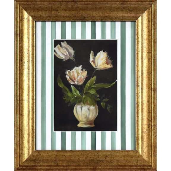 2 optionsAvailable in additional 2 options$774current price $7.74
Home Decor Collection Moody Tulips with Watercolor Stripes Pine Green Vintage Antique Frame 10x12 Wall Art Decor, Rectangle Farmhouse Vintage Wall Art for Bedroom, Living Room, Bathroom, or Office
1104.7 out of 5 Stars. 110 reviewsBest seller Home Decor Collection Gold Metro Beaded Oval Framed Landscape Wall Art, Vintage-Style Décor for Living Room, Entryway, Bedroom, or Office, 14x11 $7.49
Best seller $749current price $7.49
Home Decor Collection Gold Metro Beaded Oval Framed Landscape Wall Art, Vintage-Style Décor for Living Room, Entryway, Bedroom, or Office, 14x11
1924.3 out of 5 Stars. 192 reviewsBest seller Beautiful Classic Landscape Wall Art Set of 3, Vintage Framed Wall Décor, Gold Brushed Multi-Size Frames, Farmhouse Landscape Art for Living Room, Office, Entry $18.23
Best seller $1823current price $18.23
Beautiful Classic Landscape Wall Art Set of 3, Vintage Framed Wall Décor, Gold Brushed Multi-Size Frames, Farmhouse Landscape Art for Living Room, Office, Entry
1184.4 out of 5 Stars. 118 reviewsStupell Industries Vintage Garden Cabbage Food & Beverage Painting Unframed Art Print Wall Art, 11 x 14, Set of 4 $110.32
 $11032current price $110.32
Stupell Industries Vintage Garden Cabbage Food & Beverage Painting Unframed Art Print Wall Art, 11 x 14, Set of 4
Stupell Industries Blue Seashells on Beige Animals Painting Unframed Art Print Wall Art, 11 x 14, Set of 4 $117.99
 $11799current price $117.99
Stupell Industries Blue Seashells on Beige Animals Painting Unframed Art Print Wall Art, 11 x 14, Set of 4
Historic State Map - California - 1650 - 23 x 32.68 - Vintage Wall Art $40.95 $40.95/count
 $4095current price $40.95$40.95/count
Historic State Map - California - 1650 - 23 x 32.68 - Vintage Wall Art
old state map - connecticut - colton 1856 - 28 x 23 $45.95 Was $74.95 $45.95/count
 $4595current price $45.95, Was $74.95$74.95$45.95/count
old state map - connecticut - colton 1856 - 28 x 23
Stupell Industries Various Vintage Palm Leaves Floral Painting Unframed Art Print Wall Art, 11 x 14, Set of 4 $117.99
 $11799current price $117.99
Stupell Industries Various Vintage Palm Leaves Floral Painting Unframed Art Print Wall Art, 11 x 14, Set of 4
Historic State Map - Mississippi River Fort Le Assumption - Demarigny 1743 - 23 x 26 - Vintage Wall Art $40.95
 $4095current price $40.95
Historic State Map - Mississippi River Fort Le Assumption - Demarigny 1743 - 23 x 26 - Vintage Wall Art
Historic State Map - Oklahoma Indian Territory - Geographical Pub 1905 - Vintage Wall Art $36.95
 4 optionsAvailable in additional 4 options$3695current price $36.95
Historic State Map - Oklahoma Indian Territory - Geographical Pub 1905 - Vintage Wall Art
15 out of 5 Stars. 1 reviewsHistoric City Map - Hope Arkansas - Knobel 1916 - 23 x 25.75 - Vintage Wall Art $40.95 $40.95/count
 $4095current price $40.95$40.95/count
Historic City Map - Hope Arkansas - Knobel 1916 - 23 x 25.75 - Vintage Wall Art
Rollback SHENIFY Black Boho Wall Art Geometric Decor Bedroom Prints Ready To Hang for Bedroom 12x16in3pcs Black Framed $20.37 Was $23.97
Rollback


 $2037current price $20.37, Was $23.97$23.97
SHENIFY Black Boho Wall Art Geometric Decor Bedroom Prints Ready To Hang for Bedroom 12x16in3pcs Black Framed
1274.5 out of 5 Stars. 127 reviewsHistoric City Map - Abilene Kansas - Everts 1887 - 23.00 x 25.64 - Vintage Wall Art $45.95 Was $74.95
 $4595current price $45.95, Was $74.95$74.95
Historic City Map - Abilene Kansas - Everts 1887 - 23.00 x 25.64 - Vintage Wall Art
Historic State Map - North Carolina - Morse 1845 - 23 x 29.34 - Vintage Wall Art $45.95
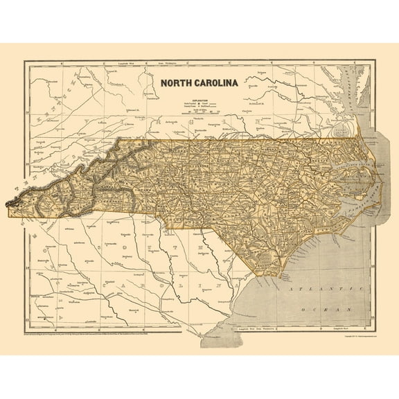 $4595current price $45.95
Historic State Map - North Carolina - Morse 1845 - 23 x 29.34 - Vintage Wall Art
Historic State Map - South Carolina - Rathbun 1893 - 23 x 28.43 - Vintage Wall Art $40.95 $40.95/count
 $4095current price $40.95$40.95/count
Historic State Map - South Carolina - Rathbun 1893 - 23 x 28.43 - Vintage Wall Art
Historic State Map - New York - Mitchell 1846 - 27.5 x 23 - Vintage Wall Art $45.95 $45.95/count
 $4595current price $45.95$45.95/count
Historic State Map - New York - Mitchell 1846 - 27.5 x 23 - Vintage Wall Art
Historic State Map - Virginia Maryland - Jefferys 1751 - 23 x 35.45 - Vintage Wall Art $40.95
 $4095current price $40.95
Historic State Map - Virginia Maryland - Jefferys 1751 - 23 x 35.45 - Vintage Wall Art
Historic State Map - Oklahoma Indian Territory - Gary 1873 - 23 x 29.10 - Vintage Wall Art $40.95 $40.95/count
 $4095current price $40.95$40.95/count
Historic State Map - Oklahoma Indian Territory - Gary 1873 - 23 x 29.10 - Vintage Wall Art
Customer ratings & reviews
0 ratings|0 reviews
This item does not have any reviews yet

Related pages
- Texas County Maps with Cities
- Texas Oklahoma Map
- Welcome To Massachusetts
- Colorado Flag Art
- Map Of Texas Counties
- Framed Antique Texas Maps
- National Parks Posters
- Western Canadian Provinces Travel Books, Maps & Guides
- Central America Travel Books, Maps & Guides
- Western United States Travel Books, Maps & Guides
- Cyprus Travel Books
- Ontario Travel Books, Maps & Guides