
Hero image 0 of Topographical Map - Lima Ohio Quad - USGS 1906, 0 of 4
Topographical Map - Lima Ohio Quad - USGS 1906
(No ratings yet)
Topographical Map - Lima Ohio Quad - USGS 1906Topographical Map Lima Ohio Quad USGS 1906 23 x 30 5 Vintage Wall ArtTopographical Map Lima Ohio Quad USGS 1906 23 x 30 5 Vintage Wall ArtTopographical Map Lima Ohio Quad USGS 1906Topographical Map Lima Ohio Quad USGS 1906
Material:Glossy Photo
Size:23 x 30.5
Key item features
- OWN A HISTORICAL TOPOGRAPHICAL MAP TODAY - Topographical maps provide you a birds-eye view of how the topography of certain pieces of land are mapped out. See how much today's maps have changed from centuries ago. See how waterways have shifted, or how forrests have become thralling cities. See how history has changed the landscape with a topographical map today!
- TOPOGRAPHICAL MAPS PROVIDE IMPORTANT INFORMATION -Topographical maps show you how the borders of a county are established and were they can be found. It also highlights rivers, mountains, and other natural elements, and it will show you where the cities are located within it.
- ONLY ACCEPT THE BEST PRINT QUALITY FOR YOUR REPRODUCTIONS - There are many printers and print types available on the market, when purchasing a reproduction there is no finer quality reproduction than a reproduction using the Giclee Printing method. Giclee describes the technique or style of printing used, and it is revered as the highest quality printing because of the way it precisely sprays ink onto a surface. Trust nothing less than the best!
- GUARANTEED TO GET EXACTLY WHAT YOU ORDERED - All of our maps come rolled, wrapped, and shipped in a heavy gauge mailing tube to ensure it arrives intact.
- WHY CHOOSE MAPS OF THE PAST? - Maps of the Past is one of the single largest producers of different types of maps. They legally own the rights to the maps they sell, and provide them to you in clean, clear, and vibrant print. If you are looking for a high quality map print, then look no further than Maps of the Past!
Specs
- ColorMulticolor
- Decor styleIndustrial
- ThemeHistoric Topographic Maps
- FramedN
- ShapeRectangle
- Art typePhotography
Current price is USD$40.95$40.95/count
Price when purchased online
- Free shipping
 Free 30-day returns
How do you want your item?
Columbus, 43215
Arrives by Tue, Apr 28
|Sold and shipped by Maps of the Past
4.363636363636363 stars out of 5, based on 11 seller reviews(4.4)11 seller reviews
Free 30-day returns
About this item
Product details
Topographical Map Print - Lima Ohio Quad - USGS 1906 - This is an exquisite full-color Reproduction printed on Satin Paper, Matte Art or Canvass.
Sites and Townships Specific To This Map Are: Townships of German, Amanda, Shawnee, Logan, Moulton, Douchouquet, Pushetta, Bath, Union, Other features include Erie & Western Railroad, Infirmary, Cincinnati Hamilton & Dayton Railroad, Western Ohio Electric Railroad, Toledo & Ohio Railroad, Oil Tanks, Cemeteries, McBeth Park, Crosley Ditch, Detroit Southern Railroad and Willow Creek.
The following towns are featured: Kepton, Hume, Cridersville, Wapakoneta, Fryburg, Cridersville, Lima, Uniopolis, St. Johns, Slater, Geyer and Rousculp.
This Map is Situated in: Allen and Auglaize Counties, New York (NY)
SKU: OHLI0001-2
Original Maps are often difficult to find and usually have fold lines, identifying stamps or markings, tears, ragged edges, and assorted other natural signs of age that detract from their beauty. All of our maps have been professionally restored to depict their original beauty, while keeping all historical data intact.
These maps are fabulous pieces of history full of information useful to Historians, Genealogists, Cartographers, Relic Hunters, & Others. They make fascinating conversation pieces and splendid works of art for the home or office.
- OWN A HISTORICAL TOPOGRAPHICAL MAP TODAY - Topographical maps provide you a birds-eye view of how the topography of certain pieces of land are mapped out. See how much today's maps have changed from centuries ago. See how waterways have shifted, or how forrests have become thralling cities. See how history has changed the landscape with a topographical map today!
- TOPOGRAPHICAL MAPS PROVIDE IMPORTANT INFORMATION -Topographical maps show you how the borders of a county are established and were they can be found. It also highlights rivers, mountains, and other natural elements, and it will show you where the cities are located within it.
- ONLY ACCEPT THE BEST PRINT QUALITY FOR YOUR REPRODUCTIONS - There are many printers and print types available on the market, when purchasing a reproduction there is no finer quality reproduction than a reproduction using the Giclee Printing method. Giclee describes the technique or style of printing used, and it is revered as the highest quality printing because of the way it precisely sprays ink onto a surface. Trust nothing less than the best!
- GUARANTEED TO GET EXACTLY WHAT YOU ORDERED - All of our maps come rolled, wrapped, and shipped in a heavy gauge mailing tube to ensure it arrives intact.
- WHY CHOOSE MAPS OF THE PAST? - Maps of the Past is one of the single largest producers of different types of maps. They legally own the rights to the maps they sell, and provide them to you in clean, clear, and vibrant print. If you are looking for a high quality map print, then look no further than Maps of the Past!
info:
We aim to show you accurate product information. Manufacturers, suppliers and others provide what you see here, and we have not verified it.
Specifications
Color
Multicolor
Decor style
Industrial
Theme
Historic Topographic Maps
Framed
N
Warranty
Warranty information
Please be aware that the warranty terms on items offered for sale by third party Marketplace sellers may differ from those displayed in this section (if any). To confirm warranty terms on an item offered for sale by a third party Marketplace seller, please use the 'Contact seller' feature on the third party Marketplace seller's information page and request the item's warranty terms prior to purchase.
Similar items you might like
Based on what customers bought
100+ bought since yesterday Home Decor Collection Black Round Wall Art or Tabletop, White Rose Floral Print by Antoine Monnoyer with Gold Beaded Frame, Classic Decorative Artwork, 6x8 $7.83
100+ bought since yesterday $783current price $7.83
Home Decor Collection Black Round Wall Art or Tabletop, White Rose Floral Print by Antoine Monnoyer with Gold Beaded Frame, Classic Decorative Artwork, 6x8
2014.7 out of 5 Stars. 201 reviewsTopographical Map - San Jose California Quad - USGS 1899 - Vintage Wall Art $36.95
 $3695current price $36.95
Topographical Map - San Jose California Quad - USGS 1899 - Vintage Wall Art
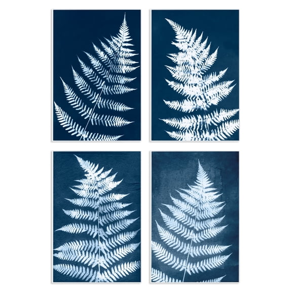
Stupell Industries Modern Fern Impressions Plants & Flowers Painting Unframed Art Print Wall Art, 10 x 15, Set of 4 $117.99
 2 optionsAvailable in additional 2 options$11799current price $117.99
Stupell Industries Modern Fern Impressions Plants & Flowers Painting Unframed Art Print Wall Art, 10 x 15, Set of 4
Historic City Map - Brecksville Ohio - Titus 1874- 26 x 23 - Vintage Wall Art $40.95 $40.95/count
 $4095current price $40.95$40.95/count
Historic City Map - Brecksville Ohio - Titus 1874- 26 x 23 - Vintage Wall Art
Stupell Industries Vintage Garden Cabbage Food & Beverage Painting Unframed Art Print Wall Art, 11 x 14, Set of 4 $117.99
 $11799current price $117.99
Stupell Industries Vintage Garden Cabbage Food & Beverage Painting Unframed Art Print Wall Art, 11 x 14, Set of 4
Historic City Map - Hope Arkansas - Knobel 1916 - 23 x 25.75 - Vintage Wall Art $40.95 $40.95/count
 $4095current price $40.95$40.95/count
Historic City Map - Hope Arkansas - Knobel 1916 - 23 x 25.75 - Vintage Wall Art
Stupell Industries Various Vintage Palm Leaves Floral Painting Unframed Art Print Wall Art, 11 x 14, Set of 4 $117.99
 $11799current price $117.99
Stupell Industries Various Vintage Palm Leaves Floral Painting Unframed Art Print Wall Art, 11 x 14, Set of 4
Stupell Industries Blue Seashells on Beige Animals Painting Unframed Art Print Wall Art, 11 x 14, Set of 4 $117.99
 $11799current price $117.99
Stupell Industries Blue Seashells on Beige Animals Painting Unframed Art Print Wall Art, 11 x 14, Set of 4
Best seller Drsoum Bohemian Flower Wall Decor for Bathroom Office Boho Leaf Artwork Ready to Hang 11x14in4pcs Black Framed $25.26
Best seller


 $2526current price $25.26
Drsoum Bohemian Flower Wall Decor for Bathroom Office Boho Leaf Artwork Ready to Hang 11x14in4pcs Black Framed
824.5 out of 5 Stars. 82 reviewsIn 25+ people's carts Style House 16"x 20" Contemporary Arch Framed Wall Art $13.90
In 25+ people's carts 2 optionsAvailable in additional 2 options$1390current price $13.90
Style House 16"x 20" Contemporary Arch Framed Wall Art
1954.7 out of 5 Stars. 195 reviewsHistoric State Map - Virginia - 1644 - 26.96 x 23 - Vintage Wall Art $40.95 $40.95/count
 $4095current price $40.95$40.95/count
Historic State Map - Virginia - 1644 - 26.96 x 23 - Vintage Wall Art
Topographical Map - Weed California Quad - USGS 1954 - 23 x 28.67 - Vintage Wall Art $40.95
 $4095current price $40.95
Topographical Map - Weed California Quad - USGS 1954 - 23 x 28.67 - Vintage Wall Art
Stupell Industries Musical Tropical Birds Entertainment Painting Unframed Art Print Wall Art, 10 x 15, Set of 4 $117.99
 2 optionsAvailable in additional 2 options$11799current price $117.99
Stupell Industries Musical Tropical Birds Entertainment Painting Unframed Art Print Wall Art, 10 x 15, Set of 4
Historic County Map - Ashtabula Geauga Lake Mahoning Portage Counties Ohio - Walling 1872 - 23 x 28 - Vintage Wall Art $40.95
 $4095current price $40.95
Historic County Map - Ashtabula Geauga Lake Mahoning Portage Counties Ohio - Walling 1872 - 23 x 28 - Vintage Wall Art
Topographical Map - Niceville Florida Quad - USGS 1936 - 23 x 27.49 - Vintage Wall Art $45.95 Was $74.95
 $4595current price $45.95, Was $74.95$74.95
Topographical Map - Niceville Florida Quad - USGS 1936 - 23 x 27.49 - Vintage Wall Art
Historic State Map - South Carolina - Rathbun 1893 - 23 x 28.43 - Vintage Wall Art $40.95 $40.95/count
 $4095current price $40.95$40.95/count
Historic State Map - South Carolina - Rathbun 1893 - 23 x 28.43 - Vintage Wall Art
Topographical Map - Milton Florida Quad - USGS 1943 - 23 x 28.92 - Vintage Wall Art $45.95 Was $74.95 $45.95/count
 $4595current price $45.95, Was $74.95$74.95$45.95/count
Topographical Map - Milton Florida Quad - USGS 1943 - 23 x 28.92 - Vintage Wall Art
Historic State Map - North Carolina - Meyer 1845 - 23 x 27.85 - Vintage Wall Art $45.95
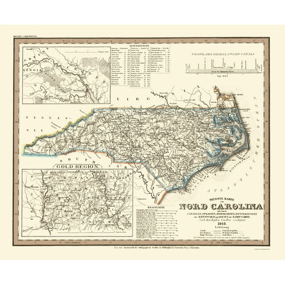 $4595current price $45.95
Historic State Map - North Carolina - Meyer 1845 - 23 x 27.85 - Vintage Wall Art
Topographical Map - Umpire Arkansas Quad - USGS 1960 - 23 x 27.39 - Vintage Wall Art $40.95
 $4095current price $40.95
Topographical Map - Umpire Arkansas Quad - USGS 1960 - 23 x 27.39 - Vintage Wall Art
Stupell Industries Minimal Shells & Anchor Nautical & Beach Painting Unframed Art Print Wall Art, 11 x 14, Set of 4 $117.99
 $11799current price $117.99
Stupell Industries Minimal Shells & Anchor Nautical & Beach Painting Unframed Art Print Wall Art, 11 x 14, Set of 4
Customer ratings & reviews
0 ratings|0 reviews
This item does not have any reviews yet

Related pages
- Map Illinois Highways
- Maps Of Illinois Cities & Towns
- Illinois Counties Map
- Interstate Highways Map
- West Virginia Maps By County
- Alabama County Map Roads
- Central America Travel Books, Maps & Guides
- Midwest United States Travel Books, Maps & Guides
- Northeast United States Travel Books, Maps & Guides
- Southern United States Travel Books, Maps & Guides
- National Parks Posters
- General South America Travel Books, Maps & Guides