
Hero image 0 of National Geographic Maps TI00000146 Uncompahgre Plateau South Map, 0 of 7
National Geographic Maps TI00000146 Uncompahgre Plateau South Map
(No ratings yet)
Key item features
Coverage includes the southeastern portion of the Plateau and Uncompahgre National Forest, as well as Ridgway State Park. On the reverse side of the map, the southwestern portion of Uncompahgre National Forest, including the Naturita Division, is featured as well as the Tabeguache Area, Roubideau Special Management Area, Unaweep/Tabeguache Scenic and Historic Byway, and Dry Creek Basin and Dan Noble State Wildlife Areas. Includes UTM grids for use with your GPS unit.
4" x 7.5" folded; 26" x 38" fully opened.
Scale: 1:63,360.- SKU: NAGGR401
Specs
- Size4" x 7.5"
- BrandNational Geographic
- ActivityCamping
- ColorForest
Current price is USD$13.38
Price when purchased online
Out of stock
How do you want your item?
Out of stock
About this item
Product details
Coverage includes the southeastern portion of the Plateau and Uncompahgre National Forest, as well as Ridgway State Park. On the reverse side of the map, the southwestern portion of Uncompahgre National Forest, including the Naturita Division, is featured as well as the Tabeguache Area, Roubideau Special Management Area, Unaweep/Tabeguache Scenic and Historic Byway, and Dry Creek Basin and Dan Noble State Wildlife Areas. Includes UTM grids for use with your GPS unit.
4" x 7.5" folded; 26" x 38" fully opened.
Scale: 1:63,360.- SKU: NAGGR401
info:
We aim to show you accurate product information. Manufacturers, suppliers and others provide what you see here, and we have not verified it.
Specifications
Size
4" x 7.5"
Brand
National Geographic
Activity
Camping
Color
Forest
Warranty
Warranty information
Please be aware that the warranty terms on items offered for sale by third party Marketplace sellers may differ from those displayed in this section (if any). To confirm warranty terms on an item offered for sale by a third party Marketplace seller, please use the 'Contact seller' feature on the third party Marketplace seller's information page and request the item's warranty terms prior to purchase.
Warnings
Warning Text
proposition 65 reasons:titanium dioxide, other chemicals
Similar items you might like
Based on what customers bought
National Geographic Midwest: Manistee National Forest South Map #759 - Michigan $22.89 $2.41/in
 $2289current price $22.89$2.41/in
National Geographic Midwest: Manistee National Forest South Map #759 - Michigan
National Geographic Trails Illustrated Map: Absaroka-Beartooth East #722 - Explore the Wyoming Rockies with Confidence! $22.89 $2.41/in
 $2289current price $22.89$2.41/in
National Geographic Trails Illustrated Map: Absaroka-Beartooth East #722 - Explore the Wyoming Rockies with Confidence!
National Geographic Continental Divide Trail Map, In Gift Box, 18" x 48" $30.35
 $3035current price $30.35
National Geographic Continental Divide Trail Map, In Gift Box, 18" x 48"
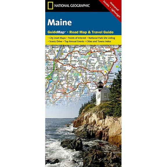
National Geographic GuideMaps: Maine - Folded Map $9.27
 $927current price $9.27
National Geographic GuideMaps: Maine - Folded Map
15 out of 5 Stars. 1 reviewsNational Geographic Adventure Travel Map Vietnam North $11.80 Was $13.93
 $1180current price $11.80, Was $13.93$13.93
National Geographic Adventure Travel Map Vietnam North
National geographic adventure travel maps: scotland adventure travel map (other): 9781566956451 $13.93
 $1393current price $13.93
National geographic adventure travel maps: scotland adventure travel map (other): 9781566956451
15 out of 5 Stars. 1 reviewsNational Geographic Adventure Map Sardinia Map [Italy], Book 3309, (Paperback) $13.93
![National Geographic Adventure Map Sardinia Map [Italy], Book 3309, (Paperback)](https://i5.walmartimages.com/asr/e32b5c7e-2fd5-45ec-9f94-91885492f3de.46fa063851b83d9ba5197264bf5351ef.jpeg?odnHeight=576&odnWidth=576&odnBg=FFFFFF) $1393current price $13.93
$1393current price $13.93National Geographic Adventure Map Sardinia Map [Italy], Book 3309, (Paperback)
National Geographic Adventure Map Egypt Map, Book 3202, (Paperback) $13.93
 $1393current price $13.93
National Geographic Adventure Map Egypt Map, Book 3202, (Paperback)
National geographic adventure map: united states, southeast - folded map: 9781566957205 $13.34
 $1334current price $13.34
National geographic adventure map: united states, southeast - folded map: 9781566957205
National geographic maps: trails illustrated: mount rainier national park - folded map: 9781566953450 $10.10
 $1010current price $10.10
National geographic maps: trails illustrated: mount rainier national park - folded map: 9781566953450
National Geographic Destination City Map Las Vegas Map, (Paperback) $9.95
 $995current price $9.95
National Geographic Destination City Map Las Vegas Map, (Paperback)
Everest Base Camp [Nepal] (National Geographic Adventure Map) - National Geographic $22.93
![Everest Base Camp [Nepal] (National Geographic Adventure Map) - National Geographic](https://i5.walmartimages.com/asr/0dcf6970-2f14-4e9a-9b87-20f3823a690c_1.b8704adf5ead065debbda2b5d4e1dba4.jpeg?odnHeight=576&odnWidth=576&odnBg=FFFFFF) $2293current price $22.93
$2293current price $22.93Everest Base Camp [Nepal] (National Geographic Adventure Map) - National Geographic
National Geographic Adventure Map Vancouver Island Map, Book 3128, (Paperback) $13.93
 $1393current price $13.93
National Geographic Adventure Map Vancouver Island Map, Book 3128, (Paperback)
Adventure map: peru - folded map: 9781566955485 $13.93
 $1393current price $13.93
Adventure map: peru - folded map: 9781566955485
National Geographic RE00622075 Map Of Mars - The Red Planet $44.26
 2 optionsAvailable in additional 2 options$4426current price $44.26
National Geographic RE00622075 Map Of Mars - The Red Planet
National geographic adventure travel maps: greece adventure travel map (other): 9781566956215 $13.93
 $1393current price $13.93
National geographic adventure travel maps: greece adventure travel map (other): 9781566956215
Adventure map: chile - folded map: 9781566955461 $13.62 Was $16.43
 $1362current price $13.62, Was $16.43$16.43
Adventure map: chile - folded map: 9781566955461
National Geographic Destination Map Pocono Mountains Map, (Paperback) $23.99
 $2399current price $23.99
National Geographic Destination Map Pocono Mountains Map, (Paperback)
National Geographic Maps: Trails Illustrated: Maroon Bells, Redstone, Marble - Folded Map $23.99
 $2399current price $23.99
National Geographic Maps: Trails Illustrated: Maroon Bells, Redstone, Marble - Folded Map
Adventure map: morocco - folded map: 9781566955300 $13.90
 $1390current price $13.90
Adventure map: morocco - folded map: 9781566955300
Customer ratings & reviews
0 ratings|0 reviews
This item does not have any reviews yet
