
Hero image 0 of Historic State Map - Aleutian Islands Alaska - Vandermaelen 1827 - Vintage Wall Art, 0 of 4
Historic State Map - Aleutian Islands Alaska - Vandermaelen 1827 - Vintage Wall Art
(No ratings yet)
Historic State Map - Aleutian Islands Alaska - Vandermaelen 1827 - Vintage Wall ArtHistoric State Map Aleutian Islands Alaska Vandermaelen 1827 23 x 28 87 Vintage Wall ArtHistoric State Map Aleutian Islands Alaska Vandermaelen 1827 23 x 28 87 Vintage Wall ArtHistoric State Map Aleutian Islands Alaska Vandermaelen 1827 Vintage Wall ArtHistoric State Map Aleutian Islands Alaska Vandermaelen 1827 Vintage Wall Art
Material:Glossy Photo
Size:23.00 x 28.87
Key item features
- HISTORICAL LOCAL MAPS MAKE GREAT WALL ART - Ever wonder what your country looked like during the early days of the USA? Well now you can find out! Maps of the Past provides maps from various time periods so you can track the history of your local city or town. These gorgiously detailed maps make for a great piece of art for your home or office. Own a piece of art and history today!
- LOCAL MAPS PROVIDE IMPORTANT INFORMATION - Local maps show you how the borders of a local are established and were they can be found. It also highlights rivers, mountains, and other natural element you may not know are there. Local maps can also show you transportation lanes across your local
- ONLY ACCEPT THE BEST PRINT QUALITY FOR YOUR REPRODUCTIONS - There are many printers and print types available on the market, when purchasing a reproduction there is no finer quality reproduction than a reproduction using the Giclee Printing method. Giclee describes the technique or style of printing used, and it is revered as the highest quality printing because of the way it precisely sprays ink onto a surface. Trust nothing less than the best!
- GUARANTEED TO GET EXACTLY WHAT YOU ORDERED - All of our maps come rolled, wrapped, and shipped in a heavy gauge mailing tube to ensure it arrives intact.
- WHY CHOOSE MAPS OF THE PAST? - Maps of the Past is one of the single largest producers of different types of maps. They legally own the rights to the maps they sell, and provide them to you in clean, clear, and vibrant print. If you are looking for a high quality map print, then look no further than Maps of the Past!
Specs
- ColorMulticolor
- Decor styleIndustrial
- ThemeOld State Maps
- FramedN
- ShapeRectangle
- Art typePhotography
Current price is USD$40.95$40.95/count
Price when purchased online
- Free shipping
 Free 30-day returns
How do you want your item?
Columbus, 43215
Arrives between May 2 - May 4
|Sold and shipped by Maps of the Past
4.363636363636363 stars out of 5, based on 11 seller reviews(4.4)11 seller reviews
Free 30-day returns
About this item
Product details
Old State Map - Aleutian Islands Alaska - Vandermaelen 1827 - This is an exquisite full-color Reproduction printed on gloss paper or art paper.
The following towns are featured: This is a Belgian map of the Aleutian Islands written in Dutch. The individual islands include: Tanaga, Kanaga, Atkha, Amelia, Segouam, Amoukta, Jounaska, Ouliaga, Tana, Tchouganok, Khagamill, Sarnalga, Ouiegakh, Oumnak, Onnalaska, Brulee and Amatonienak. Numerous explorers routes (with date of exploration) crisscross the map. Islands are surrounded in green, while the ocean is colored a light blue. Longitudinal and latitudinal degrees surround the the map.
This Map is Situated in: State of Alaska (AK).
SKU: AKZZ0017
Original Maps are often difficult to find and usually have fold lines, identifying stamps or markings, tears, ragged edges, and assorted other natural signs of age that detract from their beauty. All of our maps have been professionally restored to depict their original beauty, while keeping all historical data intact.
These maps are fabulous pieces of history full of information useful to Historians, Genealogists, Cartographers, Relic Hunters, & Others. They make fascinating conversation pieces and splendid works of art for the home or office.
- HISTORICAL LOCAL MAPS MAKE GREAT WALL ART - Ever wonder what your country looked like during the early days of the USA? Well now you can find out! Maps of the Past provides maps from various time periods so you can track the history of your local city or town. These gorgiously detailed maps make for a great piece of art for your home or office. Own a piece of art and history today!
- LOCAL MAPS PROVIDE IMPORTANT INFORMATION - Local maps show you how the borders of a local are established and were they can be found. It also highlights rivers, mountains, and other natural element you may not know are there. Local maps can also show you transportation lanes across your local
- ONLY ACCEPT THE BEST PRINT QUALITY FOR YOUR REPRODUCTIONS - There are many printers and print types available on the market, when purchasing a reproduction there is no finer quality reproduction than a reproduction using the Giclee Printing method. Giclee describes the technique or style of printing used, and it is revered as the highest quality printing because of the way it precisely sprays ink onto a surface. Trust nothing less than the best!
- GUARANTEED TO GET EXACTLY WHAT YOU ORDERED - All of our maps come rolled, wrapped, and shipped in a heavy gauge mailing tube to ensure it arrives intact.
- WHY CHOOSE MAPS OF THE PAST? - Maps of the Past is one of the single largest producers of different types of maps. They legally own the rights to the maps they sell, and provide them to you in clean, clear, and vibrant print. If you are looking for a high quality map print, then look no further than Maps of the Past!
info:
We aim to show you accurate product information. Manufacturers, suppliers and others provide what you see here, and we have not verified it.
Specifications
Color
Multicolor
Decor style
Industrial
Theme
Old State Maps
Framed
N
Warranty
Warranty information
Please be aware that the warranty terms on items offered for sale by third party Marketplace sellers may differ from those displayed in this section (if any). To confirm warranty terms on an item offered for sale by a third party Marketplace seller, please use the 'Contact seller' feature on the third party Marketplace seller's information page and request the item's warranty terms prior to purchase.
Similar items you might like
Based on what customers bought
100+ bought since yesterday Home Decor Collection Black Round Wall Art or Tabletop, White Rose Floral Print by Antoine Monnoyer with Gold Beaded Frame, Classic Decorative Artwork, 6x8 $7.83
100+ bought since yesterday $783current price $7.83
Home Decor Collection Black Round Wall Art or Tabletop, White Rose Floral Print by Antoine Monnoyer with Gold Beaded Frame, Classic Decorative Artwork, 6x8
2054.7 out of 5 Stars. 205 reviewsHistoric State Map - Missouri - Colton 1855 - Vintage Wall Art $36.95
 $3695current price $36.95
Historic State Map - Missouri - Colton 1855 - Vintage Wall Art
Stupell Industries Blue Seashells on Beige Animals Painting Unframed Art Print Wall Art, 11 x 14, Set of 4 $117.99
 $11799current price $117.99
Stupell Industries Blue Seashells on Beige Animals Painting Unframed Art Print Wall Art, 11 x 14, Set of 4
Historic Nautical Map - New England Coast - 1776 - 23 x 32.81 - Vintage Wall Art $94.95 $94.95/count
 $9495current price $94.95$94.95/count
Historic Nautical Map - New England Coast - 1776 - 23 x 32.81 - Vintage Wall Art
Historic State Map - Oregon - USGLO 1866 - Vintage Wall Art $36.95
 4 optionsAvailable in additional 4 options$3695current price $36.95
Historic State Map - Oregon - USGLO 1866 - Vintage Wall Art
Stupell Industries Vintage Farm Garden Vegetables Food & Beverage Painting Unframed Art Print Wall Art, 11 x 14, Set of 4 $117.99
 $11799current price $117.99
Stupell Industries Vintage Farm Garden Vegetables Food & Beverage Painting Unframed Art Print Wall Art, 11 x 14, Set of 4
Historic State Map - America Septentrionali - 1751 - Vintage Wall Art $36.95
 $3695current price $36.95
Historic State Map - America Septentrionali - 1751 - Vintage Wall Art
Rollback Drsoum Vintage Ocean Seascape Canvas Wall Art Seaside Coastal Scenery Classic Bathroom Office Decor 10x10in Natural Framed $8.04 Was $9.99
Rollback


 $804current price $8.04, Was $9.99$9.99
Drsoum Vintage Ocean Seascape Canvas Wall Art Seaside Coastal Scenery Classic Bathroom Office Decor 10x10in Natural Framed
2614.5 out of 5 Stars. 261 reviewsRollback SHENIFY Black Boho Wall Art Geometric Decor Bedroom Prints Ready To Hang for Bedroom 12x16in3pcs Black Framed $20.37 Was $23.97
Rollback


 $2037current price $20.37, Was $23.97$23.97
SHENIFY Black Boho Wall Art Geometric Decor Bedroom Prints Ready To Hang for Bedroom 12x16in3pcs Black Framed
1264.5 out of 5 Stars. 126 reviewsOld Travel Map - Alaska Excursion Steamers, N Pacific Railroad 1891 - 23 x 47 $94.95 $94.95/count
 2 optionsAvailable in additional 2 options$9495current price $94.95$94.95/count
Old Travel Map - Alaska Excursion Steamers, N Pacific Railroad 1891 - 23 x 47
Historic State Map - Virginia - 1644 - 26.96 x 23 - Vintage Wall Art $94.95 $94.95/count
 $9495current price $94.95$94.95/count
Historic State Map - Virginia - 1644 - 26.96 x 23 - Vintage Wall Art
Stupell Industries Various Vintage Palm Leaves Floral Painting Unframed Art Print Wall Art, 11 x 14, Set of 4 $117.99
 $11799current price $117.99
Stupell Industries Various Vintage Palm Leaves Floral Painting Unframed Art Print Wall Art, 11 x 14, Set of 4
Stupell Industries Rustic Heirloom Laundry Bath & Laundry Painting Unframed Art Print Wall Art, 11 x 14, Set of 4 $117.99
 $11799current price $117.99
Stupell Industries Rustic Heirloom Laundry Bath & Laundry Painting Unframed Art Print Wall Art, 11 x 14, Set of 4
Historic State Map - Louisiana - Carey 1814 - 25.5 x 23 - Vintage Wall Art $94.95 $94.95/count
 $9495current price $94.95$94.95/count
Historic State Map - Louisiana - Carey 1814 - 25.5 x 23 - Vintage Wall Art
Stupell Industries Musical Tropical Birds Entertainment Painting Unframed Art Print Wall Art, 10 x 15, Set of 4 $117.99
 2 optionsAvailable in additional 2 options$11799current price $117.99
Stupell Industries Musical Tropical Birds Entertainment Painting Unframed Art Print Wall Art, 10 x 15, Set of 4
Historic State Map - South Carolina - Rathbun 1893 - 23 x 28.43 - Vintage Wall Art $94.95 $94.95/count
 $9495current price $94.95$94.95/count
Historic State Map - South Carolina - Rathbun 1893 - 23 x 28.43 - Vintage Wall Art
Historic State Map - Wisconsin Territory - Mitchell 1846 - 23 x 28 - Vintage Wall Art $94.95
 $9495current price $94.95
Historic State Map - Wisconsin Territory - Mitchell 1846 - 23 x 28 - Vintage Wall Art
Historic State Map - Pennsylvania - Burr 1834 - 27.75 x 23 - Vintage Wall Art $94.95 $94.95/count
 $9495current price $94.95$94.95/count
Historic State Map - Pennsylvania - Burr 1834 - 27.75 x 23 - Vintage Wall Art
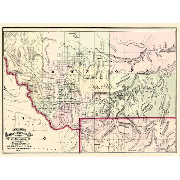
Historic State Map - Montana Territory - Cram 1875 - 31 x 23 - Vintage Wall Art $94.95 $94.95/count
 $9495current price $94.95$94.95/count
Historic State Map - Montana Territory - Cram 1875 - 31 x 23 - Vintage Wall Art
Historic State Map - Rhode Island - Strong 1841 - 23 x 28.87 - Vintage Wall Art $40.95
 $4095current price $40.95
Historic State Map - Rhode Island - Strong 1841 - 23 x 28.87 - Vintage Wall Art
Customer ratings & reviews
0 ratings|0 reviews
This item does not have any reviews yet

Related pages
- Louisiana Gulf Coast Map
- Milford Sound Zealand Map
- Map Wenatchee Wa
- Cape Cod Massachusetts Map
- Galveston Texas Map
- Boca Grande Florida Beaches
- National Parks Posters
- Caribbean & West Indies Travel Books, Maps & Guides
- Central America Travel Books, Maps & Guides
- Cyprus Travel Books
- Iceland & Greenland Travel Books
- General South America Travel Books, Maps & Guides