
Hero image 0 of Historic City Map - New Orleans Louisiana - Bellin 1744 - Vintage Wall Art, 0 of 4
Historic City Map - New Orleans Louisiana - Bellin 1744 - Vintage Wall Art
(No ratings yet)
Historic City Map - New Orleans Louisiana - Bellin 1744 - Vintage Wall ArtHistoric City Map New Orleans Louisiana Bellin 1744 23 x 29 44 Vintage Wall ArtHistoric City Map New Orleans Louisiana Bellin 1744 Vintage Wall ArtHistoric City Map New Orleans Louisiana Bellin 1744 Vintage Wall ArtHistoric City Map New Orleans Louisiana Bellin 1744 23 x 29 44 Vintage Wall Art
Material:Glossy Photo
Size:23.00 x 29.44
Key item features
- HISTORICAL LOCAL MAPS MAKE GREAT WALL ART - Ever wonder what your country looked like during the early days of the USA? Well now you can find out! Maps of the Past provides maps from various time periods so you can track the history of your local city or town. These gorgiously detailed maps make for a great piece of art for your home or office. Own a piece of art and history today!
- LOCAL MAPS PROVIDE IMPORTANT INFORMATION - Local maps show you how the borders of a local are established and were they can be found. It also highlights rivers, mountains, and other natural element you may not know are there. Local maps can also show you transportation lanes across your local
- ONLY ACCEPT THE BEST PRINT QUALITY FOR YOUR REPRODUCTIONS - There are many printers and print types available on the market, when purchasing a reproduction there is no finer quality reproduction than a reproduction using the Giclee Printing method. Giclee describes the technique or style of printing used, and it is revered as the highest quality printing because of the way it precisely sprays ink onto a surface. Trust nothing less than the best!
- GUARANTEED TO GET EXACTLY WHAT YOU ORDERED - All of our maps come rolled, wrapped, and shipped in a heavy gauge mailing tube to ensure it arrives intact.
- WHY CHOOSE MAPS OF THE PAST? - Maps of the Past is one of the single largest producers of different types of maps. They legally own the rights to the maps they sell, and provide them to you in clean, clear, and vibrant print. If you are looking for a high quality map print, then look no further than Maps of the Past!
Specs
- ColorMulticolor
- Decor styleIndustrial
- ThemeHistorical City Maps
- FramedN
- ShapeRectangle
- Art typePhotography
Current price is USD$40.95
Price when purchased online
- Free shipping
 Free 30-day returns
How do you want your item?
Columbus, 43215
Arrives between May 2 - May 4
|Sold and shipped by Maps of the Past
4.363636363636363 stars out of 5, based on 11 seller reviews(4.4)11 seller reviews
Free 30-day returns - in store or online
About this item
Product details
Old City Map - New Orleans Louisiana - Bellin 1744 - This is an exquisite full-color Reproduction printed on gloss paper or art paper.
Sites and Townships Specific To This Map Are: New Orleans.
The following towns are featured: the first state of Bellin's New Orleans, from Xavier Charlevoix's Histoire de la Nouvelle France. This first state is distinguishable from subsequent states by the inclusion of the date, the position of the title of the map, and the note in the lower right corner that the map was engraved by Dheulland. The map includes the earliest obtainable plan of New Orleans, complete with a key naming eighteen placenames. The plan names the streets and well over 100 buildings ar shown. A nice example of this important early map of New Orleans. The map is one of 3 maps included in Memorial Of The Mayor, Aldermen, And Inhabitants Of New Orleans.
This Map is Situated in: Orleans Parish, Louisiana (LA).
SKU: LANE0013
Original Maps are often difficult to find and usually have fold lines, identifying stamps or markings, tears, ragged edges, and assorted other natural signs of age that detract from their beauty. All of our maps have been professionally restored to depict their original beauty, while keeping all historical data intact.
These maps are fabulous pieces of history full of information useful to Historians, Genealogists, Cartographers, Relic Hunters, & Others. They make fascinating conversation pieces and splendid works of art for the home or office.
- HISTORICAL LOCAL MAPS MAKE GREAT WALL ART - Ever wonder what your country looked like during the early days of the USA? Well now you can find out! Maps of the Past provides maps from various time periods so you can track the history of your local city or town. These gorgiously detailed maps make for a great piece of art for your home or office. Own a piece of art and history today!
- LOCAL MAPS PROVIDE IMPORTANT INFORMATION - Local maps show you how the borders of a local are established and were they can be found. It also highlights rivers, mountains, and other natural element you may not know are there. Local maps can also show you transportation lanes across your local
- ONLY ACCEPT THE BEST PRINT QUALITY FOR YOUR REPRODUCTIONS - There are many printers and print types available on the market, when purchasing a reproduction there is no finer quality reproduction than a reproduction using the Giclee Printing method. Giclee describes the technique or style of printing used, and it is revered as the highest quality printing because of the way it precisely sprays ink onto a surface. Trust nothing less than the best!
- GUARANTEED TO GET EXACTLY WHAT YOU ORDERED - All of our maps come rolled, wrapped, and shipped in a heavy gauge mailing tube to ensure it arrives intact.
- WHY CHOOSE MAPS OF THE PAST? - Maps of the Past is one of the single largest producers of different types of maps. They legally own the rights to the maps they sell, and provide them to you in clean, clear, and vibrant print. If you are looking for a high quality map print, then look no further than Maps of the Past!
info:
We aim to show you accurate product information. Manufacturers, suppliers and others provide what you see here, and we have not verified it.
Specifications
Color
Multicolor
Decor style
Industrial
Theme
Historical City Maps
Framed
N
Warranty
Warranty information
Please be aware that the warranty terms on items offered for sale by third party Marketplace sellers may differ from those displayed in this section (if any). To confirm warranty terms on an item offered for sale by a third party Marketplace seller, please use the 'Contact seller' feature on the third party Marketplace seller's information page and request the item's warranty terms prior to purchase.
Similar items you might like
Based on what customers bought
Historic City Map - St Louis Missouri - Hutawa 1870 - 23 x 3267 - Vintage Wall Art $45.95 Was $74.95
 $4595current price $45.95, Was $74.95$74.95
Historic City Map - St Louis Missouri - Hutawa 1870 - 23 x 3267 - Vintage Wall Art
In 50+ people's carts Style House 16"x 20" Contemporary Arch Framed Wall Art $13.90
In 50+ people's carts 2 optionsAvailable in additional 2 options$1390current price $13.90
Style House 16"x 20" Contemporary Arch Framed Wall Art
1984.6 out of 5 Stars. 198 reviewsHistoric State Map - Mississippi River Fort Le Assumption - Demarigny 1743 - 23 x 26 - Vintage Wall Art $40.95
 $4095current price $40.95
Historic State Map - Mississippi River Fort Le Assumption - Demarigny 1743 - 23 x 26 - Vintage Wall Art
Historic State Map - Colorado - Thayer 1880 - 23 x 28.78 - Vintage Wall Art $40.95
 $4095current price $40.95
Historic State Map - Colorado - Thayer 1880 - 23 x 28.78 - Vintage Wall Art
Stupell Industries Vintage Garden Cabbage Food & Beverage Painting Unframed Art Print Wall Art, 11 x 14, Set of 4 $117.99
 $11799current price $117.99
Stupell Industries Vintage Garden Cabbage Food & Beverage Painting Unframed Art Print Wall Art, 11 x 14, Set of 4
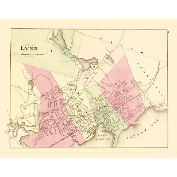
Historic City Map - Lynn Massachusetts - Walling 1871 - 23 x 29.18 - Vintage Wall Art $40.95 $40.95/count
 $4095current price $40.95$40.95/count
Historic City Map - Lynn Massachusetts - Walling 1871 - 23 x 29.18 - Vintage Wall Art
Historic Map - Dominica - Sayer 1768 - 23 x 30.49 - Vintage Wall Art $40.95
 $4095current price $40.95
Historic Map - Dominica - Sayer 1768 - 23 x 30.49 - Vintage Wall Art
Stupell Industries Fresh Vivid Blossoms Floral Painting Unframed Art Print Wall Art, 12 x 12, Set of 4 $117.99
 $11799current price $117.99
Stupell Industries Fresh Vivid Blossoms Floral Painting Unframed Art Print Wall Art, 12 x 12, Set of 4
Historic City Map - Kokomo Indiana - Baskin 1876 - 23 x 28.68 - Vintage Wall Art $45.95 $45.95/count
 $4595current price $45.95$45.95/count
Historic City Map - Kokomo Indiana - Baskin 1876 - 23 x 28.68 - Vintage Wall Art
Stupell Industries Blue Seashells on Beige Animals Painting Unframed Art Print Wall Art, 11 x 14, Set of 4 $117.99
 $11799current price $117.99
Stupell Industries Blue Seashells on Beige Animals Painting Unframed Art Print Wall Art, 11 x 14, Set of 4
Rollback SHENIFY Black Boho Wall Art Geometric Decor Bedroom Prints Ready To Hang for Bedroom 12x16in3pcs Black Framed $20.37 Was $23.97
Rollback


 $2037current price $20.37, Was $23.97$23.97
SHENIFY Black Boho Wall Art Geometric Decor Bedroom Prints Ready To Hang for Bedroom 12x16in3pcs Black Framed
1264.5 out of 5 Stars. 126 reviewsHistoric State Map - America Septentrionali - 1751 - Vintage Wall Art $36.95
 $3695current price $36.95
Historic State Map - America Septentrionali - 1751 - Vintage Wall Art
Historic City Map - Charleston South Carolina - Stanford 1861 - 23 x 29.44 - Vintage Wall Art $40.95 $40.95/count
 $4095current price $40.95$40.95/count
Historic City Map - Charleston South Carolina - Stanford 1861 - 23 x 29.44 - Vintage Wall Art
Stupell Industries Vintage Farm Garden Vegetables Food & Beverage Painting Unframed Art Print Wall Art, 11 x 14, Set of 4 $117.99
 $11799current price $117.99
Stupell Industries Vintage Farm Garden Vegetables Food & Beverage Painting Unframed Art Print Wall Art, 11 x 14, Set of 4
Stupell Industries Rustic Heirloom Laundry Bath & Laundry Painting Unframed Art Print Wall Art, 11 x 14, Set of 4 $117.99
 $11799current price $117.99
Stupell Industries Rustic Heirloom Laundry Bath & Laundry Painting Unframed Art Print Wall Art, 11 x 14, Set of 4
Historic State Map - Louisiana - Tanner 1833 - 28.5 x 23 - Vintage Wall Art $45.95 Was $74.95 $45.95/count
 $4595current price $45.95, Was $74.95$74.95$45.95/count
Historic State Map - Louisiana - Tanner 1833 - 28.5 x 23 - Vintage Wall Art
Historic City Map - Macedon New York - Beers 1874 - 23 x 28.62 - Vintage Wall Art $45.95
 $4595current price $45.95
Historic City Map - Macedon New York - Beers 1874 - 23 x 28.62 - Vintage Wall Art
Historic City Map - Mankato Minnesota - Andreas 1874 - 23 x 36.70 - Vintage Wall Art $40.95 $40.95/count
 $4095current price $40.95$40.95/count
Historic City Map - Mankato Minnesota - Andreas 1874 - 23 x 36.70 - Vintage Wall Art
Historic Map - South America - Stieler 1852 - 23 x 25.89 - Vintage Wall Art $45.95 $45.95/count
 2 optionsAvailable in additional 2 options$4595current price $45.95$45.95/count
Historic Map - South America - Stieler 1852 - 23 x 25.89 - Vintage Wall Art
Historic State Map - Louisiana - Carey 1814 - 25.5 x 23 - Vintage Wall Art $45.95 Was $74.95 $45.95/count
 $4595current price $45.95, Was $74.95$74.95$45.95/count
Historic State Map - Louisiana - Carey 1814 - 25.5 x 23 - Vintage Wall Art
Customer ratings & reviews
0 ratings|0 reviews
This item does not have any reviews yet

Related pages
- Map Brattleboro Vt
- Macon Georgia Map
- South Carolina State Maps
- Jacksonville Florida Map
- Council Bluffs Iowa Map
- Kentucky Counties Map
- National Parks Posters
- Central America Travel Books, Maps & Guides
- Northeast United States Travel Books, Maps & Guides
- General South America Travel Books, Maps & Guides
- Midwest United States Travel Books, Maps & Guides
- Ontario Travel Books, Maps & Guides