
Hero image 0 of 36x48 Colorado State Official Executive Laminated Wall Map, 0 of 1
36x48 Colorado State Official Executive Laminated Wall Map
(No ratings yet)
Key item features
The Swiftmaps.com updated Executive and Commercial State Wall Map series is produced by our own mapping team together with official geographical data from the State Department of Transportation, making this wall map ideal for anyone needing a comprehensive representation of the state for planning, routing, or reference. It's a great choice for business and sales strategy, urban development, social work outreach, education, and marketing. The executive wall map is printed with UV-resistant ink to help prevent color fading. Map details include state highways, federal highways, county highways, county boundaries, cities and towns, major waterways, state/national parks, campsites, rest areas, military installations, airports, golf courses, universities, and much more. You'll also find a city/county index on the map as well as inset maps of all major cities in much greater detail where applicable. State residents, businesses, and government offices are sure to find this wonderful reference tool irreplaceable. This map is laminated on both sides with a durable 3mil lamination which allows for dry-erase marker use. Ships rolled in a sturdy shipping tube.
Specs
- Size36 x 48
- FramedY
- Frame colorGray
- BrandSwiftmaps
- Photo paper finish configurationMatte
- Pieces1
Current price is USD$59.00
Price when purchased online
- Free shipping
 Free 30-day returns
How do you want your item?
Columbus, 43215
Arrives by Mon, Apr 20
|Sold and shipped by Reliable Map Company of Florida, LLC
4.621951219512195 stars out of 5, based on 82 seller reviews(4.6)82 seller reviews
Free 30-day returns - in store or online
About this item
Product details
The Swiftmaps.com updated Executive and Commercial State Wall Map series is produced by our own mapping team together with official geographical data from the State Department of Transportation, making this wall map ideal for anyone needing a comprehensive representation of the state for planning, routing, or reference. It's a great choice for business and sales strategy, urban development, social work outreach, education, and marketing. The executive wall map is printed with UV-resistant ink to help prevent color fading. Map details include state highways, federal highways, county highways, county boundaries, cities and towns, major waterways, state/national parks, campsites, rest areas, military installations, airports, golf courses, universities, and much more. You'll also find a city/county index on the map as well as inset maps of all major cities in much greater detail where applicable. State residents, businesses, and government offices are sure to find this wonderful reference
The Swiftmaps.com updated Executive and Commercial State Wall Map series is produced by our own mapping team together with official geographical data from the State Department of Transportation, making this wall map ideal for anyone needing a comprehensive representation of the state for planning, routing, or reference. It's a great choice for business and sales strategy, urban development, social work outreach, education, and marketing. The executive wall map is printed with UV-resistant ink to help prevent color fading. Map details include state highways, federal highways, county highways, county boundaries, cities and towns, major waterways, state/national parks, campsites, rest areas, military installations, airports, golf courses, universities, and much more. You'll also find a city/county index on the map as well as inset maps of all major cities in much greater detail where applicable. State residents, businesses, and government offices are sure to find this wonderful reference tool irreplaceable. This map is laminated on both sides with a durable 3mil lamination which allows for dry-erase marker use. Ships rolled in a sturdy shipping tube.
info:
We aim to show you accurate product information. Manufacturers, suppliers and others provide what you see here, and we have not verified it.
Specifications
Size
36 x 48
Framed
Y
Frame color
Gray
Brand
Swiftmaps
Warranty
Warranty information
Please be aware that the warranty terms on items offered for sale by third party Marketplace sellers may differ from those displayed in this section (if any). To confirm warranty terms on an item offered for sale by a third party Marketplace seller, please use the 'Contact seller' feature on the third party Marketplace seller's information page and request the item's warranty terms prior to purchase.
Similar items you might like
Based on what customers bought
Best seller Swiftmaps Laminated RMC Classic Edition World Wall Map Poster, 50" x 32" $19.99
Best seller $1999current price $19.99
Swiftmaps Laminated RMC Classic Edition World Wall Map Poster, 50" x 32"
334.4 out of 5 Stars. 33 reviewsMuppets Poster Giclee Print 27Inx40In for any room 27x40 Multi-Color Square Adults Best Posters $46.97
 $4697current price $46.97
Muppets Poster Giclee Print 27Inx40In for any room 27x40 Multi-Color Square Adults Best Posters
Malin Akerman Maxim Poster 27Inx40In for any room 27x40 Multi-Color Square Adults Poster Time $46.97
 $4697current price $46.97
Malin Akerman Maxim Poster 27Inx40In for any room 27x40 Multi-Color Square Adults Poster Time
North Dakota Tourism Map Poster - Image by Shutterstock, $39.99
 2 optionsAvailable in additional 2 options$3999current price $39.99
North Dakota Tourism Map Poster - Image by Shutterstock,
Never Forget How Far You Have Come - Inspirational Wall Art Print Motivational Wall Decor for Home, Office, Living Room, Studio & Classroom poster $13.95
 2 optionsAvailable in additional 2 options$1395current price $13.95
Never Forget How Far You Have Come - Inspirational Wall Art Print Motivational Wall Decor for Home, Office, Living Room, Studio & Classroom poster
2004 Dominican Republic Map Poster, Wall Art, Map Art $46.99
 4 optionsAvailable in additional 4 options$4699current price $46.99
2004 Dominican Republic Map Poster, Wall Art, Map Art
48x66 Colorado State Official Executive Laminated Wall Map $89.95
 $8995current price $89.95
48x66 Colorado State Official Executive Laminated Wall Map
Yosemite National Park, California Poster Wall Art, Modern Wall Decor For Living Room Bedroom, 24x36 UNFRAMED $32.49
 4 optionsAvailable in additional 4 options$3249current price $32.49
Yosemite National Park, California Poster Wall Art, Modern Wall Decor For Living Room Bedroom, 24x36 UNFRAMED
HAZ MAT IDENTIFICATION CHART POSTER $55.33
 $5533current price $55.33
HAZ MAT IDENTIFICATION CHART POSTER
Gymnast 02 Poster Wall Art, Modern Wall Decor, 8x12 UNFRAMED $16.49
 4 optionsAvailable in additional 4 options$1649current price $16.49
Gymnast 02 Poster Wall Art, Modern Wall Decor, 8x12 UNFRAMED
Outer Space Poster Wall Art, Modern Wall Decor, 8x12 UNFRAMED $28.99
 4 optionsAvailable in additional 4 options$2899current price $28.99
Outer Space Poster Wall Art, Modern Wall Decor, 8x12 UNFRAMED
Yellowstone National Park and-Drawn Map Poster - Authentic 18x24 Vintage-Style Wall Art - Lithographic Print with Soy-Based Inks - Made in USA $32.99 Was $37.26
 $3299current price $32.99, Was $37.26$37.26
Yellowstone National Park and-Drawn Map Poster - Authentic 18x24 Vintage-Style Wall Art - Lithographic Print with Soy-Based Inks - Made in USA
Mod Flower Series1 [Cp22101D] Poster Wall Art, Modern Wall Decor For Living Room Bedroom, 8x12 UNFRAMED $16.49
![Mod Flower Series1 [Cp22101D] Poster Wall Art, Modern Wall Decor For Living Room Bedroom, 8x12 UNFRAMED](https://i5.walmartimages.com/asr/a9a778aa-e99e-458e-bab6-4851446cda17.cdc87e7b48b96fdc34e2e35b9c93b195.jpeg?odnHeight=576&odnWidth=576&odnBg=FFFFFF) 4 optionsAvailable in additional 4 options$1649current price $16.49
4 optionsAvailable in additional 4 options$1649current price $16.49Mod Flower Series1 [Cp22101D] Poster Wall Art, Modern Wall Decor For Living Room Bedroom, 8x12 UNFRAMED
That's Not My Job - Motivational Wall Art Print, Sarcastic Typographic Wall Art Decor For Home, Office, Classroom and School Wall Decor poster $13.95
 2 optionsAvailable in additional 2 options$1395current price $13.95
That's Not My Job - Motivational Wall Art Print, Sarcastic Typographic Wall Art Decor For Home, Office, Classroom and School Wall Decor poster
The 12 Steps Poster Recovery Wall Art 2 Canvas Painting Wall Art $36.99
 4 optionsAvailable in additional 4 options$3699current price $36.99
The 12 Steps Poster Recovery Wall Art 2 Canvas Painting Wall Art
Mackinac Island Art - Michigan Wall Art - Us State Poster - Us Wall Art - For Traveller - Usa Travel Print - America Wall Art Decor, Unframed Poster Size 24x36 $35.99
 11 optionsAvailable in additional 11 options$3599current price $35.99
Mackinac Island Art - Michigan Wall Art - Us State Poster - Us Wall Art - For Traveller - Usa Travel Print - America Wall Art Decor, Unframed Poster Size 24x36
Stana Katic Poster Art Decor 27Inx40In for any room 27x40 Multi-Color Square Adults Best Posters $46.97
 $4697current price $46.97
Stana Katic Poster Art Decor 27Inx40In for any room 27x40 Multi-Color Square Adults Best Posters
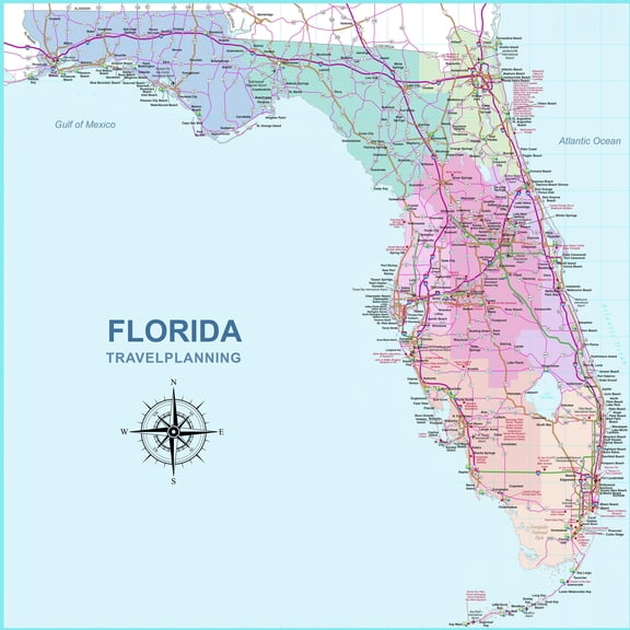
Florida Travel Planning Map Poster – Cartographic Art Style 【Photo Paper】 $36.19
 4 optionsAvailable in additional 4 options$3619current price $36.19
Florida Travel Planning Map Poster – Cartographic Art Style 【Photo Paper】
That's Not My Job - Motivational Wall Art Print, Sarcastic Typographic Wall Art Decor For Home, Office, Classroom and School Wall Decor poster $13.33
2 optionsAvailable in additional 2 options$1333current price $13.33That's Not My Job - Motivational Wall Art Print, Sarcastic Typographic Wall Art Decor For Home, Office, Classroom and School Wall Decor poster

Customer ratings & reviews
0 ratings|0 reviews
This item does not have any reviews yet

Related pages
- Washington Dc Museum Map
- Chicago World's Fair Map
- Georgetown Map Dc
- Map Of Iowa
- State Park Map
- Map Washington State
- National Parks Posters
- Central America Travel Books, Maps & Guides
- Midwest United States Travel Books, Maps & Guides
- Southern United States Travel Books, Maps & Guides
- Northeast United States Travel Books, Maps & Guides
- General South America Travel Books, Maps & Guides