
Hero image 0 of Historic County Map - Suffolk County New York - Burr 1829 - Vintage Wall Art, 0 of 4
Historic County Map - Suffolk County New York - Burr 1829 - Vintage Wall Art
(No ratings yet)
Historic County Map - Suffolk County New York - Burr 1829 - Vintage Wall ArtHistoric County Map Suffolk County New York Burr 1829 40 13 x 23 Vintage Wall ArtHistoric County Map Suffolk County New York Burr 1829 Vintage Wall ArtHistoric County Map Suffolk County New York Burr 1829 Vintage Wall ArtHistoric County Map Suffolk County New York Burr 1829 40 13 x 23 Vintage Wall Art
Material:Matte Art
Size:40.13 x 23
Key item features
- HISTORICAL LOCAL MAPS MAKE GREAT WALL ART - Ever wonder what your country looked like during the early days of the USA? Well now you can find out! Maps of the Past provides maps from various time periods so you can track the history of your local city or town. These gorgiously detailed maps make for a great piece of art for your home or office. Own a piece of art and history today!
- LOCAL MAPS PROVIDE IMPORTANT INFORMATION - Local maps show you how the borders of a local are established and were they can be found. It also highlights rivers, mountains, and other natural element you may not know are there. Local maps can also show you transportation lanes across your local
- ONLY ACCEPT THE BEST PRINT QUALITY FOR YOUR REPRODUCTIONS - There are many printers and print types available on the market, when purchasing a reproduction there is no finer quality reproduction than a reproduction using the Giclee Printing method. Giclee describes the technique or style of printing used, and it is revered as the highest quality printing because of the way it precisely sprays ink onto a surface. Trust nothing less than the best!
- GUARANTEED TO GET EXACTLY WHAT YOU ORDERED - All of our maps come rolled, wrapped, and shipped in a heavy gauge mailing tube to ensure it arrives intact.
- WHY CHOOSE MAPS OF THE PAST? - Maps of the Past is one of the single largest producers of different types of maps. They legally own the rights to the maps they sell, and provide them to you in clean, clear, and vibrant print. If you are looking for a high quality map print, then look no further than Maps of the Past!
Specs
- ColorMulticolor
- Decor styleIndustrial
- ThemeHistorical County Maps
- FramedN
- ShapeRectangle
- Art typePhotography
Current price is USD$45.95
Price when purchased online
- Free shipping
 Free 30-day returns
How do you want your item?
Columbus, 43215
Arrives between May 2 - May 5
|Sold and shipped by Maps of the Past
4.363636363636363 stars out of 5, based on 11 seller reviews(4.4)11 seller reviews
Free 30-day returns - in store or online
About this item
Product details
Old County Map - Suffolk New York - Burr 1829 - This is an exquisite full-color Reproduction printed on gloss paper or art paper.
Sites and Townships Specific To This Map Are: Coastal Area of Connecticut, Original Townships of: East Hampton, Smithtown, Hampton, Islip, Southold, Huntington, Riverhead, Brookhaven, Long Island Sound, Gardiner's Bay, Fishers Island, Hook Bond, South Bay, Crane Neck & Fort Pond.
The following towns are featured: Ameganset, Sagg Village, Mattatuck, Riverhead, Stoney Brook, Babylon, Floyd, Wainscott, Dix Hills & Flanders.
This Map is Situated in: Suffolk County, New York.
SKU: NYSU0001
Original Maps are often difficult to find and usually have fold lines, identifying stamps or markings, tears, ragged edges, and assorted other natural signs of age that detract from their beauty. All of our maps have been professionally restored to depict their original beauty, while keeping all historical data intact.
These maps are fabulous pieces of history full of information useful to Historians, Genealogists, Cartographers, Relic Hunters, & Others. They make fascinating conversation pieces and splendid works of art for the home or office.
- HISTORICAL LOCAL MAPS MAKE GREAT WALL ART - Ever wonder what your country looked like during the early days of the USA? Well now you can find out! Maps of the Past provides maps from various time periods so you can track the history of your local city or town. These gorgiously detailed maps make for a great piece of art for your home or office. Own a piece of art and history today!
- LOCAL MAPS PROVIDE IMPORTANT INFORMATION - Local maps show you how the borders of a local are established and were they can be found. It also highlights rivers, mountains, and other natural element you may not know are there. Local maps can also show you transportation lanes across your local
- ONLY ACCEPT THE BEST PRINT QUALITY FOR YOUR REPRODUCTIONS - There are many printers and print types available on the market, when purchasing a reproduction there is no finer quality reproduction than a reproduction using the Giclee Printing method. Giclee describes the technique or style of printing used, and it is revered as the highest quality printing because of the way it precisely sprays ink onto a surface. Trust nothing less than the best!
- GUARANTEED TO GET EXACTLY WHAT YOU ORDERED - All of our maps come rolled, wrapped, and shipped in a heavy gauge mailing tube to ensure it arrives intact.
- WHY CHOOSE MAPS OF THE PAST? - Maps of the Past is one of the single largest producers of different types of maps. They legally own the rights to the maps they sell, and provide them to you in clean, clear, and vibrant print. If you are looking for a high quality map print, then look no further than Maps of the Past!
info:
We aim to show you accurate product information. Manufacturers, suppliers and others provide what you see here, and we have not verified it.
Specifications
Color
Multicolor
Decor style
Industrial
Theme
Historical County Maps
Framed
N
Warranty
Warranty information
Please be aware that the warranty terms on items offered for sale by third party Marketplace sellers may differ from those displayed in this section (if any). To confirm warranty terms on an item offered for sale by a third party Marketplace seller, please use the 'Contact seller' feature on the third party Marketplace seller's information page and request the item's warranty terms prior to purchase.
Similar items you might like
Based on what customers bought
In 50+ people's carts Home Decor Collection Gold Metro Beaded Oval Framed Landscape Wall Art, Vintage-Style Décor for Living Room, Entryway, Bedroom, or Office, 14x11 $7.49
In 50+ people's carts $749current price $7.49
Home Decor Collection Gold Metro Beaded Oval Framed Landscape Wall Art, Vintage-Style Décor for Living Room, Entryway, Bedroom, or Office, 14x11
1864.4 out of 5 Stars. 186 reviewsIn 25+ people's carts Style House 16"x 20" Contemporary Arch Framed Wall Art $13.90
In 25+ people's carts 2 optionsAvailable in additional 2 options$1390current price $13.90
Style House 16"x 20" Contemporary Arch Framed Wall Art
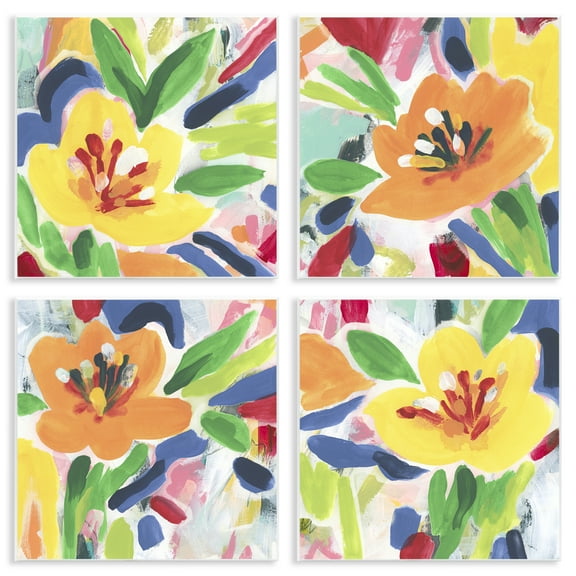
1984.6 out of 5 Stars. 198 reviewsStupell Industries Fresh Vivid Blossoms Floral Painting Unframed Art Print Wall Art, 12 x 12, Set of 4 $117.99
 $11799current price $117.99
Stupell Industries Fresh Vivid Blossoms Floral Painting Unframed Art Print Wall Art, 12 x 12, Set of 4
Historic County Map - Caroline County Maryland - Isler 1875 - 23 x 37.13 - Vintage Wall Art $45.95 Was $74.95 $45.95/count
 $4595current price $45.95, Was $74.95$74.95$45.95/count
Historic County Map - Caroline County Maryland - Isler 1875 - 23 x 37.13 - Vintage Wall Art
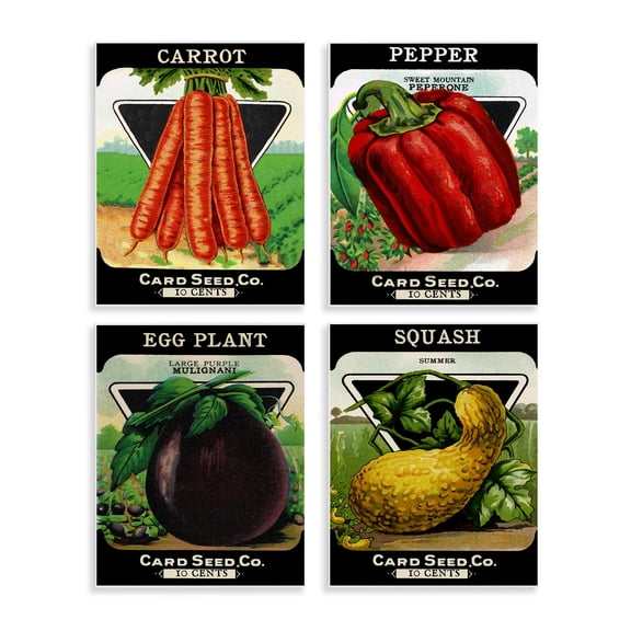
Stupell Industries Vintage Farm Garden Vegetables Food & Beverage Painting Unframed Art Print Wall Art, 11 x 14, Set of 4 $117.99
 $11799current price $117.99
Stupell Industries Vintage Farm Garden Vegetables Food & Beverage Painting Unframed Art Print Wall Art, 11 x 14, Set of 4
Stupell Industries Various Vintage Palm Leaves Floral Painting Unframed Art Print Wall Art, 11 x 14, Set of 4 $117.99
 $11799current price $117.99
Stupell Industries Various Vintage Palm Leaves Floral Painting Unframed Art Print Wall Art, 11 x 14, Set of 4
Stupell Industries Tampico Shells in Peach 4 Piece Wall Plaque Art Set, design by Paul Brent, 12 x 12 $117.99
 $11799current price $117.99
Stupell Industries Tampico Shells in Peach 4 Piece Wall Plaque Art Set, design by Paul Brent, 12 x 12
Historic County Map - Washington County Maryland - Martenet 1873 - 23 x 27.28 - Vintage Wall Art $40.95 $40.95/count
 $4095current price $40.95$40.95/count
Historic County Map - Washington County Maryland - Martenet 1873 - 23 x 27.28 - Vintage Wall Art
Stupell Industries Pastel Whimsical Landscapes Transportation Painting Unframed Art Print Wall Art, 12 x 12, Set of 4 $117.99
 $11799current price $117.99
Stupell Industries Pastel Whimsical Landscapes Transportation Painting Unframed Art Print Wall Art, 12 x 12, Set of 4
Historic City Map - Medford Massachusetts County - Walling 1855 - 23 x 24.39 - Vintage Wall Art $45.95 Was $74.95
 $4595current price $45.95, Was $74.95$74.95
Historic City Map - Medford Massachusetts County - Walling 1855 - 23 x 24.39 - Vintage Wall Art
Historic County Map - Culpeper County Virginia - 1865 - 36.56 x 23 - Vintage Wall Art $40.95
 $4095current price $40.95
Historic County Map - Culpeper County Virginia - 1865 - 36.56 x 23 - Vintage Wall Art
Stupell Industries Musical Tropical Birds Entertainment Painting Unframed Art Print Wall Art, 10 x 15, Set of 4 $117.99
 2 optionsAvailable in additional 2 options$11799current price $117.99
Stupell Industries Musical Tropical Birds Entertainment Painting Unframed Art Print Wall Art, 10 x 15, Set of 4
Historic County Map - Wyrhe Russel Counties West Virginia Survey - Hotchkiss 1884 - 23 x 27.83 - Vintage Wall Art $40.95 $40.95/count
 $4095current price $40.95$40.95/count
Historic County Map - Wyrhe Russel Counties West Virginia Survey - Hotchkiss 1884 - 23 x 27.83 - Vintage Wall Art
Historic County Map - Placer County California - Uren 1887 - 38.19 x 23 - Vintage Wall Art $40.95
 $4095current price $40.95
Historic County Map - Placer County California - Uren 1887 - 38.19 x 23 - Vintage Wall Art
Historic County Map - Charlevoix Antrim Counties Michigan - Walling 1873 - 23 x 29.69 - Vintage Wall Art $40.95 $40.95/count
 $4095current price $40.95$40.95/count
Historic County Map - Charlevoix Antrim Counties Michigan - Walling 1873 - 23 x 29.69 - Vintage Wall Art
Stupell Industries Minimal Shells & Anchor Nautical & Beach Painting Unframed Art Print Wall Art, 11 x 14, Set of 4 $117.99
 $11799current price $117.99
Stupell Industries Minimal Shells & Anchor Nautical & Beach Painting Unframed Art Print Wall Art, 11 x 14, Set of 4
Historic County Map - Elkhart County Indiana County - Andreas 1876 - 23 x 28.25 - Vintage Wall Art $40.95 $40.95/count
 $4095current price $40.95$40.95/count
Historic County Map - Elkhart County Indiana County - Andreas 1876 - 23 x 28.25 - Vintage Wall Art
Historic County Map - Orange County Indiana - Andreas 1876 - 23 x 28.31 - Vintage Wall Art $45.95
 $4595current price $45.95
Historic County Map - Orange County Indiana - Andreas 1876 - 23 x 28.31 - Vintage Wall Art
Historic County Map - Shasta County California - Denny 1904 - 31 x 23 - Vintage Wall Art $40.95 $40.95/count
 $4095current price $40.95$40.95/count
Historic County Map - Shasta County California - Denny 1904 - 31 x 23 - Vintage Wall Art
Historic County Map - Essex County New York - Burr 1829 - 23 x 27.5 - Vintage Wall Art $40.95 $40.95/count
 $4095current price $40.95$40.95/count
Historic County Map - Essex County New York - Burr 1829 - 23 x 27.5 - Vintage Wall Art
Check out these related products
Historic City Map - New Orleans Louisiana Plan - Jefferys 1759 - Vintage Wall Art $36.95
 4 optionsAvailable in additional 4 options$3695current price $36.95
Historic City Map - New Orleans Louisiana Plan - Jefferys 1759 - Vintage Wall Art
Topographical Map - Neneveh New York Quad - USGS 1905 - Vintage Wall Art $36.95
 $3695current price $36.95
Topographical Map - Neneveh New York Quad - USGS 1905 - Vintage Wall Art
Topographical Map - Salamanca New York Quad - USGS 1900 - Vintage Wall Art $36.95
 4 optionsAvailable in additional 4 options$3695current price $36.95
Topographical Map - Salamanca New York Quad - USGS 1900 - Vintage Wall Art
Topographical Map - Watertown New York Quad - USGS 1909 - Vintage Wall Art $36.95
 4 optionsAvailable in additional 4 options$3695current price $36.95
Topographical Map - Watertown New York Quad - USGS 1909 - Vintage Wall Art
Historic State Map - New York - Williams 1826 - Vintage Wall Art $36.95
 4 optionsAvailable in additional 4 options$3695current price $36.95
Historic State Map - New York - Williams 1826 - Vintage Wall Art
Topographical Map - Macedon New York Quad - USGS 1900 - Vintage Wall Art $36.95
 $3695current price $36.95
Topographical Map - Macedon New York Quad - USGS 1900 - Vintage Wall Art
Topographical Map - Shoharie New York Quad - USGS 1900 - Vintage Wall Art $36.95
 4 optionsAvailable in additional 4 options$3695current price $36.95
Topographical Map - Shoharie New York Quad - USGS 1900 - Vintage Wall Art
Topographical Map - Whitehall New York Vermont Quad - USGS 1902 - Vintage Wall Art $36.95
 $3695current price $36.95
Topographical Map - Whitehall New York Vermont Quad - USGS 1902 - Vintage Wall Art
Historic State Map - New York - Hoen 1896 - Vintage Wall Art $36.95
 4 optionsAvailable in additional 4 options$3695current price $36.95
Historic State Map - New York - Hoen 1896 - Vintage Wall Art
Topographical Map - Sangerfield New York Quad - USGS 1907 - Vintage Wall Art $36.95
 $3695current price $36.95
Topographical Map - Sangerfield New York Quad - USGS 1907 - Vintage Wall Art
Topographical Map - Cortland New York Quad - USGS 1903 - Vintage Wall Art $36.95
 $3695current price $36.95
Topographical Map - Cortland New York Quad - USGS 1903 - Vintage Wall Art
Topographical Map - Santa Clara New York Quad - USGS 1921 - Vintage Wall Art $36.95
 $3695current price $36.95
Topographical Map - Santa Clara New York Quad - USGS 1921 - Vintage Wall Art
Topographical Map - Mexico New York Quad - USGS 1905 - Vintage Wall Art $36.95
 $3695current price $36.95
Topographical Map - Mexico New York Quad - USGS 1905 - Vintage Wall Art
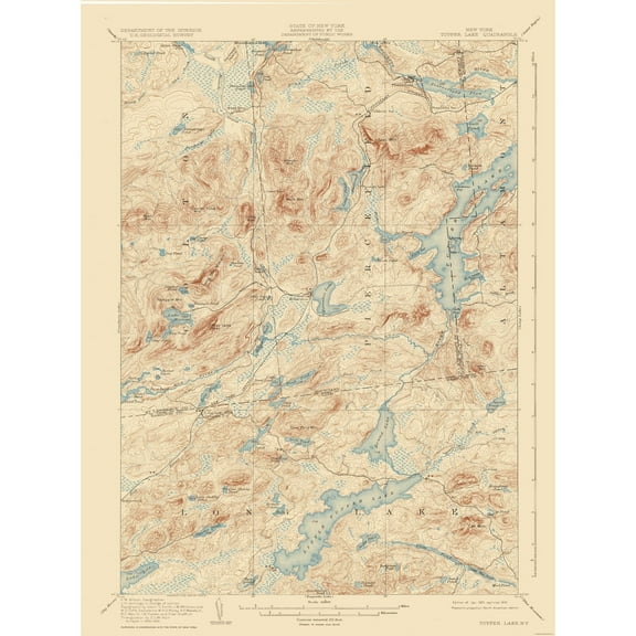
Topographical Map - Tupper Lake New York Quad - USGS 1907 - Vintage Wall Art $36.95
 4 optionsAvailable in additional 4 options$3695current price $36.95
Topographical Map - Tupper Lake New York Quad - USGS 1907 - Vintage Wall Art
Topographical Map - Indian Lake New York Quad - USGS 1902 - Vintage Wall Art $36.95
 $3695current price $36.95
Topographical Map - Indian Lake New York Quad - USGS 1902 - Vintage Wall Art
Historic County Map - Fluvanna County Virginia - Cassell 1863 - Vintage Wall Art $36.95
 $3695current price $36.95
Historic County Map - Fluvanna County Virginia - Cassell 1863 - Vintage Wall Art
Historic County Map - Union County Pennsylvania - Pasehall 1856 - Vintage Wall Art $36.95
 $3695current price $36.95
Historic County Map - Union County Pennsylvania - Pasehall 1856 - Vintage Wall Art
Historic State Map - New Hampshire Vermont - Johnson 1888 - Vintage Wall Art $36.95
 4 optionsAvailable in additional 4 options$3695current price $36.95
Historic State Map - New Hampshire Vermont - Johnson 1888 - Vintage Wall Art
Historic Map - D'Estaing Bay Russia - Robinson 1798 - Vintage Wall Art $36.95
 $3695current price $36.95
Historic Map - D'Estaing Bay Russia - Robinson 1798 - Vintage Wall Art
Historic State Map - Missouri - Johnson 1888 $36.95
 $3695current price $36.95
Historic State Map - Missouri - Johnson 1888
Customer ratings & reviews
0 ratings|0 reviews
This item does not have any reviews yet

Related pages
- Kentucky Counties Map
- Council Bluffs Iowa Map
- Colorado Springs Map
- Akron Ohio Map
- Macon Georgia Map
- Danville Il Map
- National Parks Posters
- Central America Travel Books, Maps & Guides
- Northeast United States Travel Books, Maps & Guides
- General South America Travel Books, Maps & Guides
- Midwest United States Travel Books, Maps & Guides
- Ontario Travel Books, Maps & Guides