Hero image 0 of Historic Map - United States Southwest Mexico - Brue 1840 - Vintage Wall Art, 0 of 4
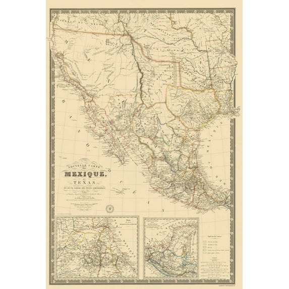
Historic Map - United States Southwest Mexico - Brue 1840 - Vintage Wall Art
(No ratings yet)
Historic Map - United States Southwest Mexico - Brue 1840 - Vintage Wall ArtHistoric Map United States Southwest Mexico Brue 1840 23 x 33 75 Vintage Wall ArtHistoric Map United States Southwest Mexico Brue 1840 Vintage Wall ArtHistoric Map United States Southwest Mexico Brue 1840 Vintage Wall ArtHistoric Map United States Southwest Mexico Brue 1840 23 x 33 75 Vintage Wall Art
Material:Matte Art
Size:23.00 x 33.75
Key item features
- BEAUTIFUL MAPS OF THE UNITED STATES - At Maps of the Past, we have all different types of US maps. From topographical to natural resources, we have exactly the type of US map you are looking for. Check out all of the different types of US maps that we have to offer. Easily find the one that is right for your needs.
- A UNITED STATES MAP FOR EVERY NEED - At Maps of the Past, we carry a variety of US maps. From exports and natural resources, to mines and railroads. We have maps of the US that cover any need. Check our wide selection of United States maps!
- ONLY ACCEPT THE BEST PRINT QUALITY FOR YOUR REPRODUCTIONS - There are many printers and print types available on the market, when purchasing a reproduction there is no finer quality reproduction than a reproduction using the Giclee Printing method. Giclee describes the technique or style of printing used, and it is revered as the highest quality printing because of the way it precisely sprays ink onto a surface. Trust nothing less than the best!
- GUARANTEED TO GET EXACTLY WHAT YOU ORDERED - All of our maps come rolled, wrapped, and shipped in a heavy gauge mailing tube to ensure it arrives intact.
- WHY CHOOSE MAPS OF THE PAST? - Maps of the Past is one of the single largest producers of different types of maps. They legally own the rights to the maps they sell, and provide them to you in clean, clear, and vibrant print. If you are looking for a high quality map print, then look no further than Maps of the Past!
Specs
- ColorMulticolor
- Decor styleIndustrial
- FramedN
- ShapeRectangle
- Art typePhotography
- Rec. roomOffice
Current price is USD$45.95
Price when purchased online
- Free shipping
 Free 30-day returns
How do you want your item?
Columbus, 43215
Arrives between May 9 - May 11
|Sold and shipped by Maps of the Past
4.363636363636363 stars out of 5, based on 11 seller reviews(4.4)11 seller reviews
Free 30-day returns - in store or online
About this item
Product details
Old North America Map - Mexico, Southwest United States - Brue 1840 - This is an exquisite full-color Reproduction printed on gloss paper or art paper.
The following towns are featured: an example of Brue's wall map of Texas, Upper California, and Mexico. It was frst issued in 1834, the map was revised in 1837, 1839, 1840, 1845 and 1848, keeping abreast of the changing landscape of the region and the political intrigues of the United States, England, France, Russia, and Mexico. The map contains one of the earliest obtainable depictions of the route of Jedidiah Smith. The Route de Smith en 1826 connects Lac Teguayo, to the R. Adams, Rock Salt Cavern and Seeds-Keeder River and San Diego and then extends north to M. St. Joseph. The information was derived from a letter from Smith published in the Nouvelles Annales des Voyages in 1828. A unique element of this edition of the map of tremendous interest is the identification of the Russian possessions. The map is of nearly equal importance for its treatment of Texas, naming Austin and showing nearly a dozen roads and many other pre-republic details. The
SKU: ITME0021
Original Maps are often difficult to find and usually have fold lines, identifying stamps or markings, tears, ragged edges, and assorted other natural signs of age that detract from their beauty. All of our maps have been professionally restored to depict their original beauty, while keeping all historical data intact.
These maps are fabulous pieces of history full of information useful to Historians, Genealogists, Cartographers, Relic Hunters, & Others. They make fascinating conversation pieces and splendid works of art for the home or office.
- BEAUTIFUL MAPS OF THE UNITED STATES - At Maps of the Past, we have all different types of US maps. From topographical to natural resources, we have exactly the type of US map you are looking for. Check out all of the different types of US maps that we have to offer. Easily find the one that is right for your needs.
- A UNITED STATES MAP FOR EVERY NEED - At Maps of the Past, we carry a variety of US maps. From exports and natural resources, to mines and railroads. We have maps of the US that cover any need. Check our wide selection of United States maps!
- ONLY ACCEPT THE BEST PRINT QUALITY FOR YOUR REPRODUCTIONS - There are many printers and print types available on the market, when purchasing a reproduction there is no finer quality reproduction than a reproduction using the Giclee Printing method. Giclee describes the technique or style of printing used, and it is revered as the highest quality printing because of the way it precisely sprays ink onto a surface. Trust nothing less than the best!
- GUARANTEED TO GET EXACTLY WHAT YOU ORDERED - All of our maps come rolled, wrapped, and shipped in a heavy gauge mailing tube to ensure it arrives intact.
- WHY CHOOSE MAPS OF THE PAST? - Maps of the Past is one of the single largest producers of different types of maps. They legally own the rights to the maps they sell, and provide them to you in clean, clear, and vibrant print. If you are looking for a high quality map print, then look no further than Maps of the Past!
info:
We aim to show you accurate product information. Manufacturers, suppliers and others provide what you see here, and we have not verified it.
Specifications
Color
Multicolor
Decor style
Industrial
Theme
Historical International Maps
Framed
N
Warranty
Warranty information
Please be aware that the warranty terms on items offered for sale by third party Marketplace sellers may differ from those displayed in this section (if any). To confirm warranty terms on an item offered for sale by a third party Marketplace seller, please use the 'Contact seller' feature on the third party Marketplace seller's information page and request the item's warranty terms prior to purchase.
Similar items you might like
Based on what customers bought
100+ bought since yesterday Home Decor Collection Black Round Wall Art or Tabletop, White Rose Floral Print by Antoine Monnoyer with Gold Beaded Frame, Classic Decorative Artwork, 6x8 $7.83
100+ bought since yesterday $783current price $7.83
Home Decor Collection Black Round Wall Art or Tabletop, White Rose Floral Print by Antoine Monnoyer with Gold Beaded Frame, Classic Decorative Artwork, 6x8
2074.7 out of 5 Stars. 207 reviewsHistoric State Map - Indiana - Rathbun 1893 - Vintage Wall Art $36.95
 $3695current price $36.95
Historic State Map - Indiana - Rathbun 1893 - Vintage Wall Art
Historic State Map - America Septentrionali Novi Belgii - Seutter 1730 - Vintage Wall Art $36.95
 $3695current price $36.95
Historic State Map - America Septentrionali Novi Belgii - Seutter 1730 - Vintage Wall Art
My Texas House The Singel Canal Framed Wall Art 36x18 $53.84
 $5384current price $53.84
My Texas House The Singel Canal Framed Wall Art 36x18
194.2 out of 5 Stars. 19 reviewsHistoric State Map - Arkansas - Rathbun 1893 - Vintage Wall Art $36.95
 $3695current price $36.95
Historic State Map - Arkansas - Rathbun 1893 - Vintage Wall Art
Historic Map - Western Hemisphere - Faden 1786 - Vintage Wall Art $36.95
 4 optionsAvailable in additional 4 options$3695current price $36.95
Historic Map - Western Hemisphere - Faden 1786 - Vintage Wall Art
Historic Map - Middle East Europe - De L'isle 1712 - Vintage Wall Art $36.95
 $3695current price $36.95
Historic Map - Middle East Europe - De L'isle 1712 - Vintage Wall Art
Historic State Map - New York - Rathbun 1893 - Vintage Wall Art $36.95
 4 optionsAvailable in additional 4 options$3695current price $36.95
Historic State Map - New York - Rathbun 1893 - Vintage Wall Art
Historic Map - Havana Cuba - May 1853 - Vintage Wall Art $36.95
 $3695current price $36.95
Historic Map - Havana Cuba - May 1853 - Vintage Wall Art
Historic State Map - Maine - 1890 - Vintage Wall Art $36.95
 $3695current price $36.95
Historic State Map - Maine - 1890 - Vintage Wall Art
Harbortown 9x24 Magnolia Glass Wall Art, 2-Piece Set, White Etched Print, Modern Farmhouse Decor $30.87
 $3087current price $30.87
Harbortown 9x24 Magnolia Glass Wall Art, 2-Piece Set, White Etched Print, Modern Farmhouse Decor
604.7 out of 5 Stars. 60 reviewsHistoric State Map - United States Eastern - Seutter 1734 - Vintage Wall Art $36.95
 $3695current price $36.95
Historic State Map - United States Eastern - Seutter 1734 - Vintage Wall Art
Best seller Florals in Vase set of 2 Black Print on Clear Framed Wall Decor 11" x 14" $29.96
Best seller $2996current price $29.96
Florals in Vase set of 2 Black Print on Clear Framed Wall Decor 11" x 14"
1364.7 out of 5 Stars. 136 reviewsHistoric State Map - Arkansas Territory - Long 1822 - Vintage Wall Art $36.95
 $3695current price $36.95
Historic State Map - Arkansas Territory - Long 1822 - Vintage Wall Art
Historic State Map - Pennsylvania - Greenleaf 1840 - Vintage Wall Art $36.95
 4 optionsAvailable in additional 4 options$3695current price $36.95
Historic State Map - Pennsylvania - Greenleaf 1840 - Vintage Wall Art
Rollback SHENIFY Black Boho Wall Art Geometric Decor Bedroom Prints Ready To Hang for Bedroom 12x16in3pcs Black Framed $20.37 Was $23.97
Rollback


 $2037current price $20.37, Was $23.97$23.97
SHENIFY Black Boho Wall Art Geometric Decor Bedroom Prints Ready To Hang for Bedroom 12x16in3pcs Black Framed
1264.5 out of 5 Stars. 126 reviewsHistoric Map - Africa - De Wit 1688 - Vintage Wall Art $36.95
 $3695current price $36.95
Historic Map - Africa - De Wit 1688 - Vintage Wall Art
Historic State Map - Kansas - Cram 1886 - Vintage Wall Art $36.95
 4 optionsAvailable in additional 4 options$3695current price $36.95
Historic State Map - Kansas - Cram 1886 - Vintage Wall Art
Historic State Map - Colorado Territory - Richards 1873 - Vintage Wall Art $36.95
 $3695current price $36.95
Historic State Map - Colorado Territory - Richards 1873 - Vintage Wall Art
Historic State Map - Illinois - Johnson 1860 - Vintage Wall Art $36.95
 $3695current price $36.95
Historic State Map - Illinois - Johnson 1860 - Vintage Wall Art
Check out these related products
Historic Map - Liege Province Belgium - Visscher 1681 - Vintage Wall Art $36.95
 $3695current price $36.95
Historic Map - Liege Province Belgium - Visscher 1681 - Vintage Wall Art
Historic City Map - East Cleveland Collinsville Ohio - Titus 1874 - Vintage Wall Art $36.95
 $3695current price $36.95
Historic City Map - East Cleveland Collinsville Ohio - Titus 1874 - Vintage Wall Art
Historic State Map - Texas - Railroad Commission 1908 - Vintage Wall Art $36.95
 $3695current price $36.95
Historic State Map - Texas - Railroad Commission 1908 - Vintage Wall Art
Historic County Map - Jefferson County Wisconsin - Snyder 1878 - Vintage Wall Art $36.95
 $3695current price $36.95
Historic County Map - Jefferson County Wisconsin - Snyder 1878 - Vintage Wall Art
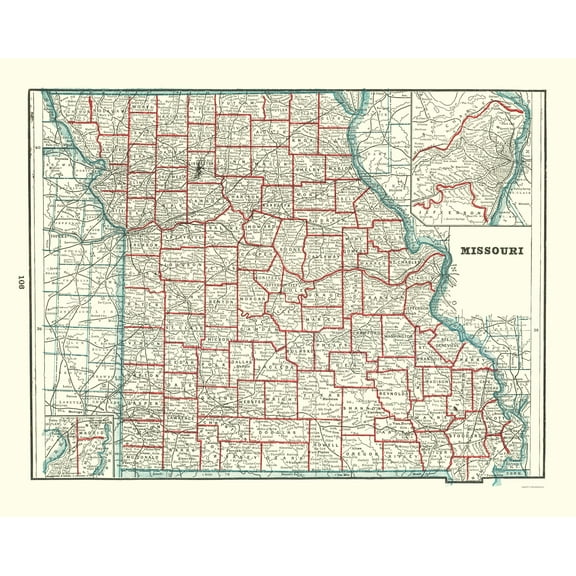
Historic State Map - Missouri - Rathbun 1893 - Vintage Wall Art $36.95
 $3695current price $36.95
Historic State Map - Missouri - Rathbun 1893 - Vintage Wall Art
Historic Map - British Posessions West - Bartholomew 1907 - Vintage Wall Art $36.95
 $3695current price $36.95
Historic Map - British Posessions West - Bartholomew 1907 - Vintage Wall Art
Historic City Map - Hilliar Ohio - Caldwell 1896 - Vintage Wall Art $36.95
 $3695current price $36.95
Historic City Map - Hilliar Ohio - Caldwell 1896 - Vintage Wall Art
Historic State Map - Arizona - Asher 1874 - Vintage Wall Art $36.95
 $3695current price $36.95
Historic State Map - Arizona - Asher 1874 - Vintage Wall Art
Historic City Map - Mayfield Ohio - Cram 1874 - Vintage Wall Art $36.95
 4 optionsAvailable in additional 4 options$3695current price $36.95
Historic City Map - Mayfield Ohio - Cram 1874 - Vintage Wall Art
Historic State Map - Florida - Tanner 1833 - Vintage Wall Art $36.95
 $3695current price $36.95
Historic State Map - Florida - Tanner 1833 - Vintage Wall Art
Historic County Map- Jasper Crawford Clay Lawrence Richland Illinois - Campbell 1870 $36.95
 4 optionsAvailable in additional 4 options$3695current price $36.95
Historic County Map- Jasper Crawford Clay Lawrence Richland Illinois - Campbell 1870
Historic County Map - Eau Claire County Wisconsin - Snyder 1878 - Vintage Wall Art $36.95
 4 optionsAvailable in additional 4 options$3695current price $36.95
Historic County Map - Eau Claire County Wisconsin - Snyder 1878 - Vintage Wall Art
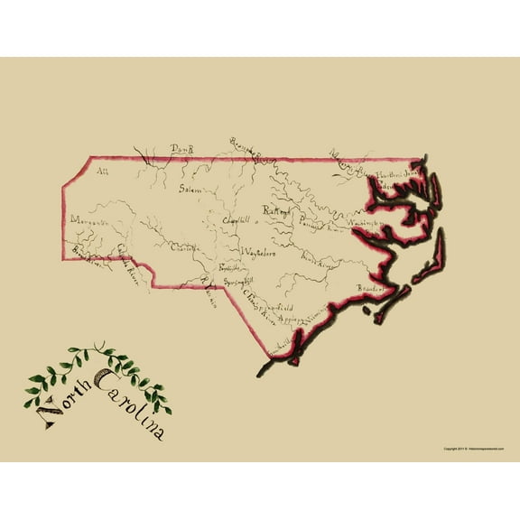
Historic State Map - North Carolina - Henshaw 1828 - Vintage Wall Art $36.95
 $3695current price $36.95
Historic State Map - North Carolina - Henshaw 1828 - Vintage Wall Art
Historic State Map - Arkansas - Colton 1855 - Vintage Wall Art $36.95
 4 optionsAvailable in additional 4 options$3695current price $36.95
Historic State Map - Arkansas - Colton 1855 - Vintage Wall Art
Historic City Map - Cleveland Ohio Index - Titus 1874 - Vintage Wall Art $36.95
 $3695current price $36.95
Historic City Map - Cleveland Ohio Index - Titus 1874 - Vintage Wall Art
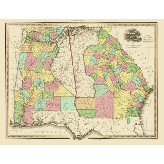
Historic State Map - Georgia Alabama - Tanner 1825 - Vintage Wall Art $36.95
 $3695current price $36.95
Historic State Map - Georgia Alabama - Tanner 1825 - Vintage Wall Art
Topographical Map - Redding California Quad - USGS 1956 - Vintage Wall Art $36.95
 $3695current price $36.95
Topographical Map - Redding California Quad - USGS 1956 - Vintage Wall Art
Historic Map - Egypt Japan West Africa China Import Export - Bartholomew 1907 $36.95
 $3695current price $36.95
Historic Map - Egypt Japan West Africa China Import Export - Bartholomew 1907
Historic County Map- Racine Kenosha Counties Wisconsin - Snyder 1878 - Vintage Wall Art $36.95
 $3695current price $36.95
Historic County Map- Racine Kenosha Counties Wisconsin - Snyder 1878 - Vintage Wall Art
Topographical Map - Gloucester Massachusetts Quad - USGS 1984 - Vintage Wall Art $36.95
 4 optionsAvailable in additional 4 options$3695current price $36.95
Topographical Map - Gloucester Massachusetts Quad - USGS 1984 - Vintage Wall Art
Customer ratings & reviews
0 ratings|0 reviews
This item does not have any reviews yet
