
Hero image 0 of Historic City Map - Cherry Tree Pennsylvania - Beers 1865 - Vintage Wall Art, 0 of 4
Historic City Map - Cherry Tree Pennsylvania - Beers 1865 - Vintage Wall Art
(No ratings yet)
Historic City Map - Cherry Tree Pennsylvania - Beers 1865 - Vintage Wall ArtHistoric City Map Cherry Tree Pennsylvania Beers 1865 26 63 x 23 Vintage Wall ArtHistoric City Map Cherry Tree Pennsylvania Beers 1865 26 63 x 23 Vintage Wall ArtHistoric City Map Cherry Tree Pennsylvania Beers 1865 Vintage Wall Art
Material:Matte Art
Size:26.63 x 23
Key item features
- HISTORICAL LOCAL MAPS MAKE GREAT WALL ART - Ever wonder what your country looked like during the early days of the USA? Well now you can find out! Maps of the Past provides maps from various time periods so you can track the history of your local city or town. These gorgiously detailed maps make for a great piece of art for your home or office. Own a piece of art and history today!
- LOCAL MAPS PROVIDE IMPORTANT INFORMATION - Local maps show you how the borders of a local are established and were they can be found. It also highlights rivers, mountains, and other natural element you may not know are there. Local maps can also show you transportation lanes across your local
- ONLY ACCEPT THE BEST PRINT QUALITY FOR YOUR REPRODUCTIONS - There are many printers and print types available on the market, when purchasing a reproduction there is no finer quality reproduction than a reproduction using the Giclee Printing method. Giclee describes the technique or style of printing used, and it is revered as the highest quality printing because of the way it precisely sprays ink onto a surface. Trust nothing less than the best!
- GUARANTEED TO GET EXACTLY WHAT YOU ORDERED - All of our maps come rolled, wrapped, and shipped in a heavy gauge mailing tube to ensure it arrives intact.
- WHY CHOOSE MAPS OF THE PAST? - Maps of the Past is one of the single largest producers of different types of maps. They legally own the rights to the maps they sell, and provide them to you in clean, clear, and vibrant print. If you are looking for a high quality map print, then look no further than Maps of the Past!
Specs
- ColorMulticolor
- Decor styleIndustrial
- ThemeHistorical City Maps
- FramedN
- ShapeRectangle
- Art typePhotography
Current price is USD$45.95$45.95/count
Price when purchased online
- Free shipping
 Free 30-day returns
How do you want your item?
Columbus, 43215
Arrives by Wed, May 6
|Sold and shipped by Maps of the Past
4.363636363636363 stars out of 5, based on 11 seller reviews(4.4)11 seller reviews
Free 30-day returns - in store or online
About this item
Product details
Old City Map - Cherry Tree Pennsylvania Landowner - 1865 - This is an exquisite full-color Reproduction printed on gloss paper or art paper.
Sites and Townships Specific To This Map Are: Insert of Business Directory of this time. Oil Creek Railroad, Little Sugar Creek, Wykie Run, Hundreds of Landowner Names, Schools Located, Cherry Tree Post Office, Churches Located, Watson Petroleum Company & Stores Located.
The following towns are featured: Cherry Tree Township.
This Map is Situated in: Allegheny County, Pennsylvania.
SKU: PACH0001
Original Maps are often difficult to find and usually have fold lines, identifying stamps or markings, tears, ragged edges, and assorted other natural signs of age that detract from their beauty. All of our maps have been professionally restored to depict their original beauty, while keeping all historical data intact.
These maps are fabulous pieces of history full of information useful to Historians, Genealogists, Cartographers, Relic Hunters, & Others. They make fascinating conversation pieces and splendid works of art for the home or office.
- HISTORICAL LOCAL MAPS MAKE GREAT WALL ART - Ever wonder what your country looked like during the early days of the USA? Well now you can find out! Maps of the Past provides maps from various time periods so you can track the history of your local city or town. These gorgiously detailed maps make for a great piece of art for your home or office. Own a piece of art and history today!
- LOCAL MAPS PROVIDE IMPORTANT INFORMATION - Local maps show you how the borders of a local are established and were they can be found. It also highlights rivers, mountains, and other natural element you may not know are there. Local maps can also show you transportation lanes across your local
- ONLY ACCEPT THE BEST PRINT QUALITY FOR YOUR REPRODUCTIONS - There are many printers and print types available on the market, when purchasing a reproduction there is no finer quality reproduction than a reproduction using the Giclee Printing method. Giclee describes the technique or style of printing used, and it is revered as the highest quality printing because of the way it precisely sprays ink onto a surface. Trust nothing less than the best!
- GUARANTEED TO GET EXACTLY WHAT YOU ORDERED - All of our maps come rolled, wrapped, and shipped in a heavy gauge mailing tube to ensure it arrives intact.
- WHY CHOOSE MAPS OF THE PAST? - Maps of the Past is one of the single largest producers of different types of maps. They legally own the rights to the maps they sell, and provide them to you in clean, clear, and vibrant print. If you are looking for a high quality map print, then look no further than Maps of the Past!
info:
We aim to show you accurate product information. Manufacturers, suppliers and others provide what you see here, and we have not verified it.
Specifications
Color
Multicolor
Decor style
Industrial
Theme
Historical City Maps
Framed
N
Warranty
Warranty information
Please be aware that the warranty terms on items offered for sale by third party Marketplace sellers may differ from those displayed in this section (if any). To confirm warranty terms on an item offered for sale by a third party Marketplace seller, please use the 'Contact seller' feature on the third party Marketplace seller's information page and request the item's warranty terms prior to purchase.
Similar items you might like
Based on what customers bought
In 50+ people's carts Home Decor Collection Gold Metro Beaded Oval Framed Landscape Wall Art, Vintage-Style Décor for Living Room, Entryway, Bedroom, or Office, 14x11 $7.49
In 50+ people's carts $749current price $7.49
Home Decor Collection Gold Metro Beaded Oval Framed Landscape Wall Art, Vintage-Style Décor for Living Room, Entryway, Bedroom, or Office, 14x11
1864.4 out of 5 Stars. 186 reviewsHistoric City Map - St Louis Missouri - Twichel 1844 - Vintage Wall Art $40.95 $40.95/count
 4 optionsAvailable in additional 4 options$4095current price $40.95$40.95/count
Historic City Map - St Louis Missouri - Twichel 1844 - Vintage Wall Art
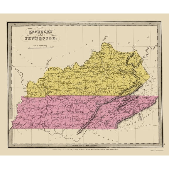
Historic State Map - Kentucky Tennessee - Illman 1834 - Vintage Wall Art $40.95 $40.95/count
 $4095current price $40.95$40.95/count
Historic State Map - Kentucky Tennessee - Illman 1834 - Vintage Wall Art
Historic State Map - Oregon - Cram 1875 - Vintage Wall Art $36.95
 $3695current price $36.95
Historic State Map - Oregon - Cram 1875 - Vintage Wall Art
Historic State Map - New England - Davenport 1883 - Vintage Wall Art $36.95
 4 optionsAvailable in additional 4 options$3695current price $36.95
Historic State Map - New England - Davenport 1883 - Vintage Wall Art
Historic State Map - Rhode Island - Bohn 1797 - Vintage Wall Art $40.95 $40.95/count
 4 optionsAvailable in additional 4 options$4095current price $40.95$40.95/count
Historic State Map - Rhode Island - Bohn 1797 - Vintage Wall Art
Rollback Drsoum Vintage Ocean Seascape Canvas Wall Art Seaside Coastal Scenery Classic Bathroom Office Decor 10x10in Natural Framed $8.04 Was $9.99
Rollback


 $804current price $8.04, Was $9.99$9.99
Drsoum Vintage Ocean Seascape Canvas Wall Art Seaside Coastal Scenery Classic Bathroom Office Decor 10x10in Natural Framed
2614.5 out of 5 Stars. 261 reviewsTopographical Map - Tennessee Outline Geographical - Mendenhall 1866 - Vintage Wall Art $36.95
 $3695current price $36.95
Topographical Map - Tennessee Outline Geographical - Mendenhall 1866 - Vintage Wall Art
Historic State Map - Oregon Upper California Territories - Preuss 1848 - Vintage Wall Art $40.95
 $4095current price $40.95
Historic State Map - Oregon Upper California Territories - Preuss 1848 - Vintage Wall Art
Historic City Map - Stuyvesant New York - Beers 1873 - Vintage Wall Art $40.95
 $4095current price $40.95
Historic City Map - Stuyvesant New York - Beers 1873 - Vintage Wall Art
Historic County Map - Chittenden County Vermont - Beers 1878 - Vintage Wall Art $40.95 $40.95/count
 3 optionsAvailable in additional 3 options$4095current price $40.95$40.95/count
Historic County Map - Chittenden County Vermont - Beers 1878 - Vintage Wall Art
Historic State Map - Arizona Territory - Bien 1887 - Vintage Wall Art $40.95
 $4095current price $40.95
Historic State Map - Arizona Territory - Bien 1887 - Vintage Wall Art
Historic State Map - Vermont - Colton 1855 - Vintage Wall Art $36.95
 $3695current price $36.95
Historic State Map - Vermont - Colton 1855 - Vintage Wall Art
Historic State Map - America Septentrionali Novi Belgii - Seutter 1730 - Vintage Wall Art $40.95 $40.95/count
 $4095current price $40.95$40.95/count
Historic State Map - America Septentrionali Novi Belgii - Seutter 1730 - Vintage Wall Art
Historic Map - Western Hemisphere - Faden 1786 - Vintage Wall Art $40.95
 4 optionsAvailable in additional 4 options$4095current price $40.95
Historic Map - Western Hemisphere - Faden 1786 - Vintage Wall Art
Historic State Map - Massachusetts Region - 1776 - Vintage Wall Art $40.95 $40.95/count
 $4095current price $40.95$40.95/count
Historic State Map - Massachusetts Region - 1776 - Vintage Wall Art
Historic State Map - Illinois - Mitchell 1846 - Vintage Wall Art $36.95
 $3695current price $36.95
Historic State Map - Illinois - Mitchell 1846 - Vintage Wall Art
Historic State Map - Idaho - 1874 - Vintage Wall Art $36.95
 $3695current price $36.95
Historic State Map - Idaho - 1874 - Vintage Wall Art
Historic City Map - Logansport Indiana - Baskin 1876 - Vintage Wall Art $40.95 $40.95/count
 $4095current price $40.95$40.95/count
Historic City Map - Logansport Indiana - Baskin 1876 - Vintage Wall Art
Historic State Map - Missouri - Burr 1835 - Vintage Wall Art $40.95
 $4095current price $40.95
Historic State Map - Missouri - Burr 1835 - Vintage Wall Art
Customer ratings & reviews
0 ratings|0 reviews
This item does not have any reviews yet
