Road Maps(51)
Uses item details. Price when purchased online
24"x27" Heavyweight Quality Paper :: Road Map - Minnesota graphicway Wall Map [Paper] From $24.94
![24"x27" Heavyweight Quality Paper :: Road Map - Minnesota graphicway Wall Map [Paper]](https://i5.walmartimages.com/seo/24-x27-Heavyweight-Quality-Paper-Road-Map-Minnesota-graphicway-Wall-Map-Paper_f71aab47-150d-40e6-9a99-0ea6f585ef9c.5007b4b1c6cc462725b4ca06953c964d.jpeg?odnHeight=576&odnWidth=576&odnBg=FFFFFF)
2 options
Available in additional 2 optionsFrom$2494
24"x27" Heavyweight Quality Paper :: Road Map - Minnesota graphicway Wall Map [Paper]
Michelin Paris Street Map + Index Map 54, (Paperback) $12.93
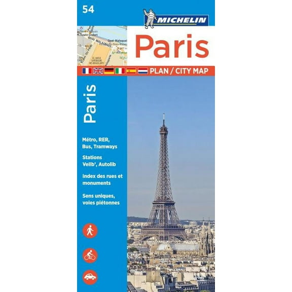
$1293
current price $12.93Michelin Paris Street Map + Index Map 54, (Paperback)
National Geographic Maps Antique Style 36 in x 24 in $18.59
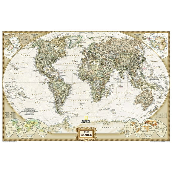
$1859
current price $18.59National Geographic Maps Antique Style 36 in x 24 in
45 out of 5 Stars. 4 reviews
Save with
Dallas - Fort Worth Metroplex Travel Map with Cities & Roads. Includes Dallas, Fort Worth, Plano, Arlington, Irving & More [24x36] 【Laminated】
![Dallas - Fort Worth Metroplex Travel Map with Cities & Roads. Includes Dallas, Fort Worth, Plano, Arlington, Irving & More [24x36] 【Laminated】](https://i5.walmartimages.com/seo/Dallas-Fort-Worth-Metroplex-Travel-Map-with-Cities-Roads-Includes-Dallas-Fort-Worth-Plano-Arlington-Irving-More-24x36-Laminated_a99752e0-b723-4bd4-8478-f4aa9ab8bc17.e3066d0601c6eaaea281264043195cd1.jpeg?odnHeight=576&odnWidth=576&odnBg=FFFFFF)
Dallas - Fort Worth Metroplex Travel Map with Cities & Roads. Includes Dallas, Fort Worth, Plano, Arlington, Irving & More [24x36] 【Laminated】
Michelin paris pocket map 50 - folded map: 9782067211520 $8.01
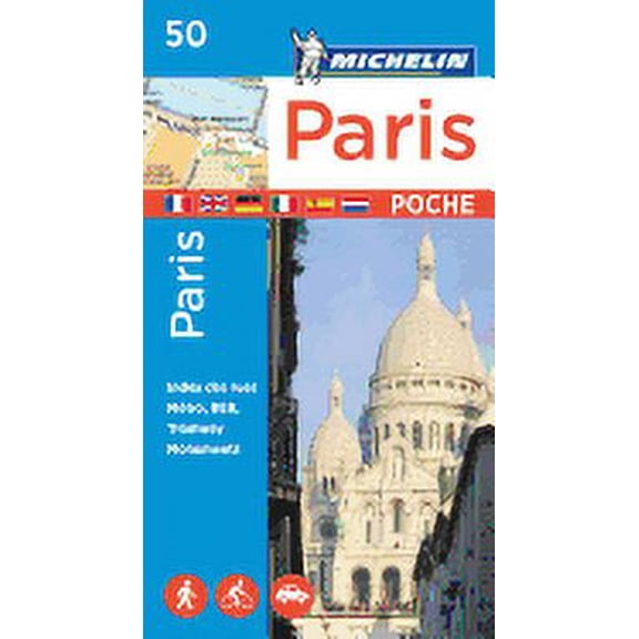
$801
current price $8.01Michelin paris pocket map 50 - folded map: 9782067211520
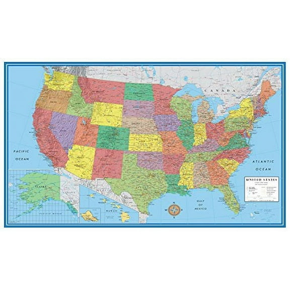
Swiftmaps United States Decorator Wall Map, 48x70 $49.99

$4999
current price $49.99Swiftmaps United States Decorator Wall Map, 48x70
Save with
36x64 New Jersey State Official Executive Laminated Wall Map $59.00

$5900
current price $59.0036x64 New Jersey State Official Executive Laminated Wall Map
Michelin Streetwise Maps: Streetwise Paris Map - Laminated City Center Street Map of Paris, France (Other) $8.95
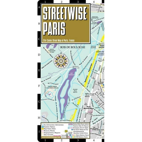
$895
current price $8.95Michelin Streetwise Maps: Streetwise Paris Map - Laminated City Center Street Map of Paris, France (Other)
Save with
Stupell Industries Kid's Cartoon Car Road Map Fun Playful Streets, 10 x 15, Designed by Daphne Polselli From $19.23

6 options
Available in additional 6 optionsFrom$1923
Stupell Industries Kid's Cartoon Car Road Map Fun Playful Streets, 10 x 15, Designed by Daphne Polselli
Save with
Honduras Map Poster, Honduras road Map Art Poster, Canvas, ,Modern Wall Art, Street Map Artwork, Honduras Map Canvas - 89AZ786


Honduras Map Poster, Honduras road Map Art Poster, Canvas, ,Modern Wall Art, Street Map Artwork, Honduras Map Canvas - 89AZ786
National Geographic Reference Map National Geographic Oregon Wall Map - Laminated (40.5 X 30.25 In), (Paperback) $27.76 Was $34.94

Now$2776
current price Now $27.76, Was $34.94$34.94
National Geographic Reference Map National Geographic Oregon Wall Map - Laminated (40.5 X 30.25 In), (Paperback)
Pre-Owned Webster's International Atlas (Paperback) 1596950196 9781596950191 $7.00

$700
current price $7.00Pre-Owned Webster's International Atlas (Paperback) 1596950196 9781596950191
Wall Art Impressions 24"x27" Poster :: Road Map - Road Tripping to Yellowstone National Park [Plain Coated Paper] From $24.94
![Wall Art Impressions 24"x27" Poster :: Road Map - Road Tripping to Yellowstone National Park [Plain Coated Paper]](https://i5.walmartimages.com/seo/Wall-Art-Impressions-35-x24-Heavyweight-Coated-Paper-Poster-Resource-Map-Hard-Times-Earth-Resources-Plain-Coated-Paper_8a9066ea-550a-4ca1-9b6b-b14a23b3bba5.2b8716676045f5b786bff75271d2e2cb.jpeg?odnHeight=576&odnWidth=576&odnBg=FFFFFF)
2 options
Available in additional 2 optionsFrom$2494
Wall Art Impressions 24"x27" Poster :: Road Map - Road Tripping to Yellowstone National Park [Plain Coated Paper]
Swiftmaps United States Classic Wall Map Poster 24" x 36" Framed $18.90
$1890
current price $18.90Swiftmaps United States Classic Wall Map Poster 24" x 36" Framed
73.7 out of 5 Stars. 7 reviews
Wall Art Impressions 76"x24" Photographic Quality Poster:: Resource Map - Tickets to Shop, Hop Top Package 96 hours Ticmate.co.uk [Laminated] From $40.49
![Wall Art Impressions 76"x24" Photographic Quality Poster:: Resource Map - Tickets to Shop, Hop Top Package 96 hours Ticmate.co.uk [Laminated]](https://i5.walmartimages.com/seo/Wall-Art-Impressions-76-x24-Photographic-Quality-Poster-Resource-Map-Tickets-to-Shop-Hop-Top-Package-96-hours-Ticmate-co-uk-Laminated_97bb6e9b-9d5d-4b2a-955b-34bc179dfe26.3aa7637db5ee9149a998cbf77ea8b499.jpeg?odnHeight=576&odnWidth=576&odnBg=FFFFFF)
2 options
Available in additional 2 optionsFrom$4049
Wall Art Impressions 76"x24" Photographic Quality Poster:: Resource Map - Tickets to Shop, Hop Top Package 96 hours Ticmate.co.uk [Laminated]
Popout Maps Paris Popout Map, (Paperback) $7.95
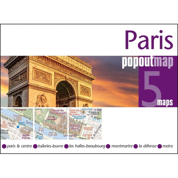
$795
current price $7.95Popout Maps Paris Popout Map, (Paperback)
Save with
Michelin Paris City Map: 9782067214217 $9.27

$927
current price $9.27Michelin Paris City Map: 9782067214217
Save with
24x31in Indiana District Road 【Coated Paper】 From $22.99

2 options
Available in additional 2 optionsFrom$2299
24x31in Indiana District Road 【Coated Paper】
Wall Art Impressions 24"x25" Heavyweight Photo Quality Paper :: Road Map - Large detailed roads and Photographicways map of Nevada state with national parks and all cities [Laminated] From $24.94
![Wall Art Impressions 24"x25" Heavyweight Photo Quality Paper :: Road Map - Large detailed roads and Photographicways map of Nevada state with national parks and all cities [Laminated]](https://i5.walmartimages.com/seo/Wall-Art-Impressions-24-x25-Heavyweight-Photo-Quality-Paper-Road-Map-Large-detailed-roads-Photographicways-map-Nevada-state-national-parks-cities-Lam_a843bda1-28d2-4d17-a2cb-b3870c64f45e.24a2dbe54200009de334c27720eed80b.jpeg?odnHeight=576&odnWidth=576&odnBg=FFFFFF)
2 options
Available in additional 2 optionsFrom$2494
Wall Art Impressions 24"x25" Heavyweight Photo Quality Paper :: Road Map - Large detailed roads and Photographicways map of Nevada state with national parks and all cities [Laminated]
Wall Art Impressions 32"x24" Laminated Poster :: Political Map - Maps of Armenia Detailed map of Armenia in English Tourist map of Armenia Road map

Wall Art Impressions 32"x24" Laminated Poster :: Political Map - Maps of Armenia Detailed map of Armenia in English Tourist map of Armenia Road map
24"x27" Heavyweight Quality Paper :: Road Map - Minnesota graphicway Wall Map [Paper] [Plain Coated Paper]
![24"x27" Heavyweight Quality Paper :: Road Map - Minnesota graphicway Wall Map [Paper] [Plain Coated Paper]](https://i5.walmartimages.com/seo/24-x27-Heavyweight-Quality-Paper-Road-Map-Minnesota-graphicway-Wall-Map-Paper-Plain-Coated-Paper_a5785553-4382-4653-be0c-93fb680fceb5.5e36754a89ae7bae9e524c33a2b860d4.jpeg?odnHeight=576&odnWidth=576&odnBg=FFFFFF)
24"x27" Heavyweight Quality Paper :: Road Map - Minnesota graphicway Wall Map [Paper] [Plain Coated Paper]
Swiftmaps USA Executive Antique-Tones Wall Map 24" x 36" Poster $21.90

$2190
current price $21.90Swiftmaps USA Executive Antique-Tones Wall Map 24" x 36" Poster
84.8 out of 5 Stars. 8 reviews
Benchmark Maps: New Mexico Recreation Wall Map - 26 x 33 inches - Rolled Canvas $73.39

$7339
current price $73.39Benchmark Maps: New Mexico Recreation Wall Map - 26 x 33 inches - Rolled Canvas
Big Sky Maps East Klickitat GMU Map 382 $17.02

$1702
current price $17.02Big Sky Maps East Klickitat GMU Map 382
National geographic: world decorator wall map - laminated (46 x 30.5 inches) (other): 9780792283096

National geographic: world decorator wall map - laminated (46 x 30.5 inches) (other): 9780792283096
15 out of 5 Stars. 1 reviews
Save with
Historic State Map - Western Motor Car Route Guide - 1915 - Vintage Wall Art From $36.95

2 options
Available in additional 2 optionsFrom$3695
Historic State Map - Western Motor Car Route Guide - 1915 - Vintage Wall Art
Wall Art Impressions 24"x28" Heavyweight Photo Quality Paper :: Political Map - Asia Map All Countries Asia Map With Country Names And Capitals Inspiring World Map Design [Laminated] From $24.94
![Wall Art Impressions 24"x28" Heavyweight Photo Quality Paper :: Political Map - Asia Map All Countries Asia Map With Country Names And Capitals Inspiring World Map Design [Laminated]](https://i5.walmartimages.com/seo/Wall-Art-Impressions-24-x28-Heavyweight-Photo-Quality-Paper-Political-Map-Asia-All-Countries-With-Country-Names-And-Capitals-Inspiring-World-Design-L_d01090c6-e656-400b-a1fc-cca81314a246.23e12cfd538f91c333796a0dd833d93c.jpeg?odnHeight=576&odnWidth=576&odnBg=FFFFFF)
2 options
Available in additional 2 optionsFrom$2494
Wall Art Impressions 24"x28" Heavyweight Photo Quality Paper :: Political Map - Asia Map All Countries Asia Map With Country Names And Capitals Inspiring World Map Design [Laminated]
Wall Art Impressions 35"x24" Heavyweight Photo Quality Paper :: Road Map - Description Maryland State Photographicway Map 1930" Jpg [Laminated] From $24.22
![Wall Art Impressions 35"x24" Heavyweight Photo Quality Paper :: Road Map - Description Maryland State Photographicway Map 1930" Jpg [Laminated]](https://i5.walmartimages.com/seo/Wall-Art-Impressions-35-x24-Heavyweight-Photo-Quality-Paper-Road-Map-Description-Maryland-State-Photographicway-Map-1930-Jpg-Laminated_3d5fb1d3-d7d2-4768-9f4a-4c9e8dd71b95.2cb60c76c2578ab107bd673eab7d498e.jpeg?odnHeight=576&odnWidth=576&odnBg=FFFFFF)
2 options
Available in additional 2 optionsFrom$2422
Wall Art Impressions 35"x24" Heavyweight Photo Quality Paper :: Road Map - Description Maryland State Photographicway Map 1930" Jpg [Laminated]
Wall Art Impressions 24"x31" Heavyweight Photo Quality Paper :: detailed vermont road map es [Laminated]
![Wall Art Impressions 24"x31" Heavyweight Photo Quality Paper :: detailed vermont road map es [Laminated]](https://i5.walmartimages.com/seo/Wall-Art-Impressions-24-x31-Heavyweight-Photo-Quality-Paper-detailed-vermont-road-map-es-Laminated_cf739978-1bd5-4bb1-952b-d4f7bffcc598.080c97ce1d723f439909a2286c5edafe.jpeg?odnHeight=576&odnWidth=576&odnBg=FFFFFF)
Wall Art Impressions 24"x31" Heavyweight Photo Quality Paper :: detailed vermont road map es [Laminated]
Wall Art Impressions 28"x24" Heavyweight Quality Paper :: Detailed road map of Tehran city. Tehran city detailed road map [Plain Coated Paper]
![Wall Art Impressions 28"x24" Heavyweight Quality Paper :: Detailed road map of Tehran city. Tehran city detailed road map [Plain Coated Paper]](https://i5.walmartimages.com/seo/Wall-Art-Impressions-31-x24-Heavyweight-Quality-Paper-Resource-Map-Provincial-Maps-Category-Activity-201213-Province-British-Columbia-Paper-Plain-Coa_8844f65c-d3b8-4b2e-bcd6-dc9f069fdd9e.b2441db4078b274aac8a6e18f5510023.jpeg?odnHeight=576&odnWidth=576&odnBg=FFFFFF)
Wall Art Impressions 28"x24" Heavyweight Quality Paper :: Detailed road map of Tehran city. Tehran city detailed road map [Plain Coated Paper]
Passau Map Poster, Germany Map Art Poster, Canvas, Passau Map City vintage Poster, Street Map Artwork Poster, Passau Map Canvas - 89AZ325


Passau Map Poster, Germany Map Art Poster, Canvas, Passau Map City vintage Poster, Street Map Artwork Poster, Passau Map Canvas - 89AZ325
LC Sportsmap 556/554 Toutle/Yale $20.16

$2016
current price $20.16LC Sportsmap 556/554 Toutle/Yale
Save with
Political Map of Iceland Poster - Geographic Road Atlas 【Laminated】 From $40.19

2 options
Available in additional 2 optionsFrom$4019
Political Map of Iceland Poster - Geographic Road Atlas 【Laminated】
Pocket Travel Guide DK Paris Mini Map and Guide, (Paperback) $8.99

$899
current price $8.99Pocket Travel Guide DK Paris Mini Map and Guide, (Paperback)
Save with
Benchmark Maps: Utah Recreation Wall Map - 26 x 33 inches - Rolled Canvas $73.39

$7339
current price $73.39Benchmark Maps: Utah Recreation Wall Map - 26 x 33 inches - Rolled Canvas
Wall Art Impressions 33"x24" Poster :: Road Map - Bonita Costa Rica - Geography of Costa Rica [Laminated] From $24.94
![Wall Art Impressions 33"x24" Poster :: Road Map - Bonita Costa Rica - Geography of Costa Rica [Laminated]](https://i5.walmartimages.com/seo/Wall-Art-Impressions-33-x24-Heavyweight-Photo-Quality-Paper-Road-Map-BonitaCostaRica-Geography-of-Costa-Rica-Laminated_a9a02a5b-c348-4501-9a23-b803c8f170f1.2f4d39a7c493d975dc7f96b98d92133b.jpeg?odnHeight=576&odnWidth=576&odnBg=FFFFFF)
3 options
Available in additional 3 optionsFrom$2494
Wall Art Impressions 33"x24" Poster :: Road Map - Bonita Costa Rica - Geography of Costa Rica [Laminated]
Paris Metro Architecture & Design Map $12.12 Was $16.07

Now$1212
current price Now $12.12, Was $16.07$16.07
Paris Metro Architecture & Design Map
SHAPES ETC. U.S. Practice Map Double Combo Pack- 9 x 19 $42.98

$4298
current price $42.98SHAPES ETC. U.S. Practice Map Double Combo Pack- 9 x 19
Compact City Planning Maps Lonely Planet Paris City Map: Durable, Waterproof, Easy-Fold Planning Map with Attractions & Walking Tours, (Paperback) $9.31
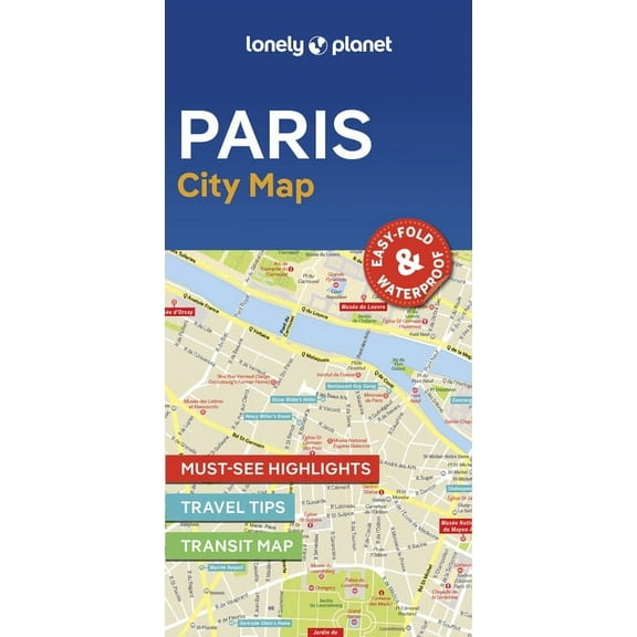
$931
current price $9.31Compact City Planning Maps Lonely Planet Paris City Map: Durable, Waterproof, Easy-Fold Planning Map with Attractions & Walking Tours, (Paperback)
Save with
Other options to consider(29)
Popular in Explore Diverse Road Maps and City Posters for Your Home Decor
- Road Map
- Vintage Road Maps
- 1870 United States Map
- 13 Colonies Map
- Interstate Road Map
- Interstate Maps
- National Parks Posters
- World Map Wall Art
- Central America Travel Books, Maps & Guides
- Southern United States Travel Books, Maps & Guides
- General United States Travel Books, Maps & Guides
- Northeast United States Travel Books, Maps & Guides
Related Products
Historic Print, PA Apollo 1896 MAP, 16" x 20"
 Historic Print, PA Apollo 1896 MAP, 16" x 20"$57.00current price $57.00
Vintage New Hampshire Map Poster: Us State Wall Art, Unframed Canvas Size 8x12
 Vintage New Hampshire Map Poster: Us State Wall Art, Unframed Canvas Size 8x12$24.99current price $24.99
Cardiff Cityscape Art Poster, Travel Wall Decor, Illustrated City Map, Home Office Decoration Wall Art, Modern Wall Decor, 16x24 UNFRAMED
 Cardiff Cityscape Art Poster, Travel Wall Decor, Illustrated City Map, Home Office Decoration Wall Art, Modern Wall Decor, 16x24 UNFRAMED$28.99current price $28.99
Historic Print, MN Faribault 1869 MAP, 16" x 20"
 Historic Print, MN Faribault 1869 MAP, 16" x 20"$57.00current price $57.00
New York City Map Wall Art, Nyc Map Posters, New York Map Poster, New York Map Wall Art, New York Poster, Nyc Poster, New York City, Unframed Canvas Size 8x12
 New York City Map Wall Art, Nyc Map Posters, New York Map Poster, New York Map Wall Art, New York Poster, Nyc Poster, New York City, Unframed Canvas Size 8x12$24.99current price $24.99
Historic Print, WI Jefferson 1870 MAP, 18" x 24"
 Historic Print, WI Jefferson 1870 MAP, 18" x 24"$71.00current price $71.00
Old Glacier National Park Map (1925) Vintage Montana Natural Reserve Atlas Poster Wall Art, Modern Wall Decor For Living Room Bedroom, 12x18 UNFRAMED
 Old Glacier National Park Map (1925) Vintage Montana Natural Reserve Atlas Poster Wall Art, Modern Wall Decor For Living Room Bedroom, 12x18 UNFRAMED$24.99current price $24.99
London Map, London Poster, London Map Poster, London Wall Art, London City Poster, London Poster, London Poster,, Unframed Poster Size 16x24
 London Map, London Poster, London Map Poster, London Wall Art, London City Poster, London Poster, London Poster,, Unframed Poster Size 16x24$28.99current price $28.99
431 National Park System Units Map 24x36 Poster
 431 National Park System Units Map 24x36 Poster$31.97current price $31.97
1865 New York City Map Print - NYC Vintage Map - New York City Map Wall Art - Map of New York City Poster - NYC Map Print
 1865 New York City Map Print - NYC Vintage Map - New York City Map Wall Art - Map of New York City Poster - NYC Map Print$39.99current price $39.99
USA National Parks, Monuments & Forests Map 24x36 Poster
 USA National Parks, Monuments & Forests Map 24x36 Poster$31.97current price $31.97
42x63 Poster; New And Correct Map Of The World 1702
 42x63 Poster; New And Correct Map Of The World 1702$63.95current price $63.95
1875 Graphic Chart of San Francisco Map Print with Index to Points of Interest - Vintage Map of Bay Area Poster - San Francisco Map Poster - San Francisco Map Art
 1875 Graphic Chart of San Francisco Map Print with Index to Points of Interest - Vintage Map of Bay Area Poster - San Francisco Map Poster - San Francisco Map Art$39.99current price $39.99
HISTORIX 1876 Arizona Territory Map Vintage Poster Wall Art Print, 18 x 24 Inch
 HISTORIX 1876 Arizona Territory Map Vintage Poster Wall Art Print, 18 x 24 Inch$39.99current price $39.99
1876 New York City Poster - NYC Map Wall Art - Vintage Map of New York City with Points of Interest - Historic Map of New York City Poster - Old NYC Map Print
 1876 New York City Poster - NYC Map Wall Art - Vintage Map of New York City with Points of Interest - Historic Map of New York City Poster - Old NYC Map Print$59.99current price $59.99