Maps Major Cities(156)
Uses item details. Price when purchased online
Flash Deal BSHAPPLUS 15.4'' Tall Globe,Globe of the World with Stainless Stand,720 Spin World Globe for Kids Learning $42.99 Was $79.89

Sponsored
Now$4299
current price Now $42.99, Was $79.89$79.89
BSHAPPLUS 15.4'' Tall Globe,Globe of the World with Stainless Stand,720 Spin World Globe for Kids Learning
2484.5 out of 5 Stars. 248 reviews
TCP Global 6" Blue Ocean World Globe with Black Base - Compact Mini Political Globe, Vertical Axis Rotation - Fun, Educational, Learn Earth Geography - Kids School, Home Office, Shelf Desktop Display $14.99

Sponsored
$1499
current price $14.99TCP Global 6" Blue Ocean World Globe with Black Base - Compact Mini Political Globe, Vertical Axis Rotation - Fun, Educational, Learn Earth Geography - Kids School, Home Office, Shelf Desktop Display
843.7 out of 5 Stars. 84 reviews
Flash Deal BSHAPPLUS 8" Globe,Globe of the World with Stand,360 Spin World Globe for Kids Learning,World Globes for Adults $16.00 Was $29.99

Sponsored
Now$1600
current price Now $16.00, Was $29.99$29.99
BSHAPPLUS 8" Globe,Globe of the World with Stand,360 Spin World Globe for Kids Learning,World Globes for Adults
1234.2 out of 5 Stars. 123 reviews
Flash Deal BSHAPPLUS® 13'' World Globe,Globe for Kids,World Globe with stand,World Globes for Adults,Blue $35.05 Was $69.99

Sponsored
Now$3505
current price Now $35.05, Was $69.99$69.99
BSHAPPLUS® 13'' World Globe,Globe for Kids,World Globe with stand,World Globes for Adults,Blue
3624.1 out of 5 Stars. 362 reviews
Superior Mapping Company United States Poster Size Wall Map 40" x 28" With Cities (1 Map) $8.00

$800
current price $8.00Superior Mapping Company United States Poster Size Wall Map 40" x 28" With Cities (1 Map)
234.7 out of 5 Stars. 23 reviews
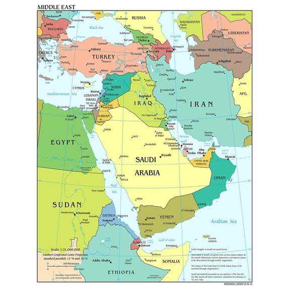
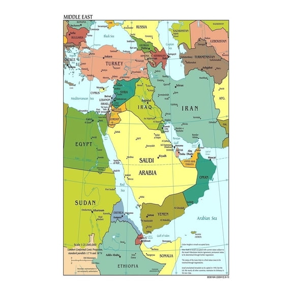
Political Map of The Middle East Wall Chart Educational Geography Poster with Major Cities and Capitals for School Office and Home Decor From $8.90


From$890
Political Map of The Middle East Wall Chart Educational Geography Poster with Major Cities and Capitals for School Office and Home Decor


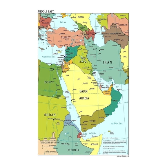
Poster: Large scale detailed political map of the middle east with major cities and capitals From $12.99

From$1299
Poster: Large scale detailed political map of the middle east with major cities and capitals
Poster: Large detailed political and administrative map of poland with roads railroads major cities and airports From $12.99


From$1299
Poster: Large detailed political and administrative map of poland with roads railroads major cities and airports
Poster: Large political and administrative map of belize with roads railroads and major cities From $12.99


From$1299
Poster: Large political and administrative map of belize with roads railroads and major cities
Poster: Large scale political and administrative map of india with roads railroads and major cities From $12.99


From$1299
Poster: Large scale political and administrative map of india with roads railroads and major cities
Poster: Large political and administrative map of dominican republic with roads railroads and major cities From $12.99


From$1299
Poster: Large political and administrative map of dominican republic with roads railroads and major cities
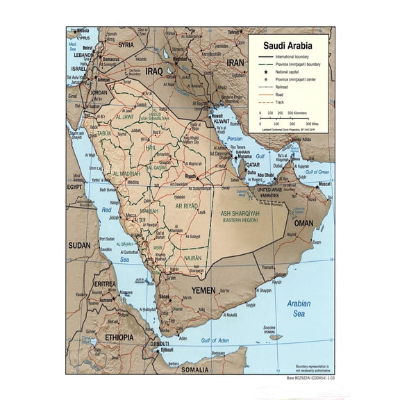
Poster: Large detailed political and administrative map of saudi arabia with relief roads railroads and major cities From $12.99

From$1299
Poster: Large detailed political and administrative map of saudi arabia with relief roads railroads and major cities
Large Scale Political Map of The Middle East Poster Detailed Wall Chart with Major Cities Capitals and Country Borders for Classroom and Office Decor From $8.90

From$890
Large Scale Political Map of The Middle East Poster Detailed Wall Chart with Major Cities Capitals and Country Borders for Classroom and Office Decor

Poster: Large detailed political map of southwest asia with capitals and major cities From $12.99


From$1299
Poster: Large detailed political map of southwest asia with capitals and major cities
Poster: Large detailed political map of switzerland with roads railroads and major cities From $12.99


From$1299
Poster: Large detailed political map of switzerland with roads railroads and major cities
Poster: South Asia Large detailed political map of south asia with major cities and capitals From $12.99


From$1299
Poster: South Asia Large detailed political map of south asia with major cities and capitals


48x66 Arkansas State Official Executive Laminated Wall Map $89.95

$8995
current price $89.9548x66 Arkansas State Official Executive Laminated Wall Map
Pack of 4 Superior Mapping Company United States Poster Size Wall Map 40" x 28" With Cities (4 Maps) $9.99

$999
current price $9.99Pack of 4 Superior Mapping Company United States Poster Size Wall Map 40" x 28" With Cities (4 Maps)
Middle East Political Map Updated Geography Chart with Major Cities Borders Educational Resource for Students Teachers Researchers From $8.90

From$890
Middle East Political Map Updated Geography Chart with Major Cities Borders Educational Resource for Students Teachers Researchers


Poster: Large detailed political map of thailand with roads railroads major cities and airports From $12.99


From$1299
Poster: Large detailed political map of thailand with roads railroads major cities and airports
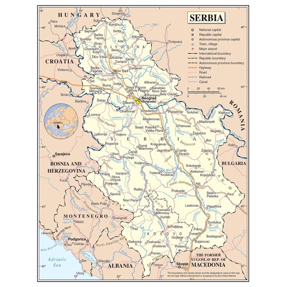
Poster: Large political map of serbia with roads railroads major cities and airports From $12.99

From$1299
Poster: Large political map of serbia with roads railroads major cities and airports
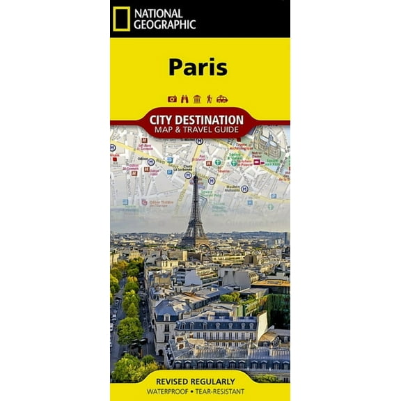
National Geographic Destination City Map Paris Map, (Paperback) $9.27
$927
current price $9.27National Geographic Destination City Map Paris Map, (Paperback)
15 out of 5 Stars. 1 reviews


31x24in Arizona detailed map of with boundaries, state capital Phoenix, major cities 【Coated Paper】 From $22.99

3 options
Available in additional 3 optionsFrom$2299
31x24in Arizona detailed map of with boundaries, state capital Phoenix, major cities 【Coated Paper】
15 out of 5 Stars. 1 reviews
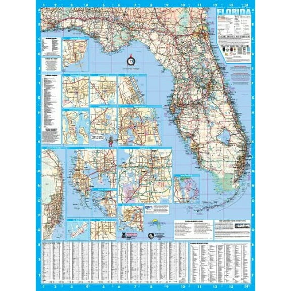
Swiftmaps Florida State Laminated Wall Map 36" x 48" Poster $48.00
$4800
current price $48.00Swiftmaps Florida State Laminated Wall Map 36" x 48" Poster
Middle East Political Map Large Scale Detailed Educational Poster with Capitals Major Cities and Country Borders for Geography Classroom and Office From $8.90
From$890
Middle East Political Map Large Scale Detailed Educational Poster with Capitals Major Cities and Country Borders for Geography Classroom and Office
Poster: Large detailed political and administrative map of romania with roads railroads major cities and airports From $12.99


From$1299
Poster: Large detailed political and administrative map of romania with roads railroads major cities and airports
48x68 Pennsylvania State Official Executive Laminated Wall Map $89.95

$8995
current price $89.9548x68 Pennsylvania State Official Executive Laminated Wall Map
Historic Map - United States Major Cities - Bartholomew 1892 - Vintage Wall Art From $36.95

2 options
Available in additional 2 optionsFrom$3695
Historic Map - United States Major Cities - Bartholomew 1892 - Vintage Wall Art
Poster: Large detailed political and administrative map of cambodia with roads railroads major cities and airports From $12.99


From$1299
Poster: Large detailed political and administrative map of cambodia with roads railroads major cities and airports


24x24in California detailed map of with boundaries, state capital Sacramento, major cities 【Coated Paper】 From $21.99

2 options
Available in additional 2 optionsFrom$2199
24x24in California detailed map of with boundaries, state capital Sacramento, major cities 【Coated Paper】
Historic Map - Major Cities United Kingdom - Bartholomew 1892 - Vintage Wall Art From $36.95

2 options
Available in additional 2 optionsFrom$3695
Historic Map - Major Cities United Kingdom - Bartholomew 1892 - Vintage Wall Art
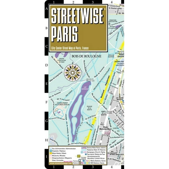
Michelin Streetwise Maps: Streetwise Paris Map - Laminated City Center Street Map of Paris, France (Other) $8.95
$895
current price $8.95Michelin Streetwise Maps: Streetwise Paris Map - Laminated City Center Street Map of Paris, France (Other)
Birdy Boutique New York Map Tapestry – 60" x 40" Educational Wall Hanging for Kids – State Landmarks, Cities, & Fun Facts – Lightweight & Easy to Hang Classroom or Homeschool Decor

14 options
Available in additional 14 optionsBirdy Boutique New York Map Tapestry – 60" x 40" Educational Wall Hanging for Kids – State Landmarks, Cities, & Fun Facts – Lightweight & Easy to Hang Classroom or Homeschool Decor
Swiftmaps Florida State Laminated Wall Map 48 x 64 Poster $89.95
$8995
current price $89.95Swiftmaps Florida State Laminated Wall Map 48 x 64 Poster
Autua World Map Countries Major Cities Tapestry Wall Hanging Unique Style for Home Wall Decor Art Living Room Bedroom Dorm Apartment Farmhouse 60x50inch From $9.49
2 options
Available in additional 2 optionsFrom$949
Autua World Map Countries Major Cities Tapestry Wall Hanging Unique Style for Home Wall Decor Art Living Room Bedroom Dorm Apartment Farmhouse 60x50inch
11 out of 5 Stars. 1 reviews
36x54 Indiana State Official Executive Laminated Wall Map $59.00
$5900
current price $59.0036x54 Indiana State Official Executive Laminated Wall Map
Poster: Large detailed political map of bhutan with roads railroads major cities and airports From $12.99


From$1299
Poster: Large detailed political map of bhutan with roads railroads major cities and airports
Political Map of USA with Major Cities Poster - Educational Wall Art | Home Decor 【Laminated】 From $33.19

2 options
Available in additional 2 optionsFrom$3319
Political Map of USA with Major Cities Poster - Educational Wall Art | Home Decor 【Laminated】
Other options to consider(46)
Popular in Maps Major Cities
Related Products
World Traveler Poster Wall Art, Modern Wall Decor, 16x24 UNFRAMED
 World Traveler Poster Wall Art, Modern Wall Decor, 16x24 UNFRAMED$28.99current price $28.99
Bloom Theory World Traveler Poster Wall Art, Modern Wall Decor, 12x18 UNFRAMED
 Bloom Theory World Traveler Poster Wall Art, Modern Wall Decor, 12x18 UNFRAMED$24.49current price $24.49
Antique Maps Poster #7 16in x 24in Poster Multi-Color Square Adults Western Graphic
 Antique Maps Poster #7 16in x 24in Poster Multi-Color Square Adults Western Graphic$20.95current price $20.95
Antique Maps Poster #5 16in x 24in Poster Multi-Color Square Adults Western Graphic
 Antique Maps Poster #5 16in x 24in Poster Multi-Color Square Adults Western Graphic$20.95current price $20.95
Palmetto Posters 23x18 Laminated Poster: Large political map of north africa and the middle east with capitals
Palmetto Posters 23x18 Laminated Poster: Large political map of north africa and the middle east with capitals
Historic Map - Southern Hemisphere - Bartholomew 1892 - Vintage Wall Art
 Historic Map - Southern Hemisphere - Bartholomew 1892 - Vintage Wall Art$40.95current price $40.95
Iconic Arts Laminated 36x24 Poster: Oceania-map 1-41000000
Iconic Arts Laminated 36x24 Poster: Oceania-map 1-41000000
431 National Park System Units Map 24x36 Poster
 431 National Park System Units Map 24x36 Poster$31.97current price $31.97
USA National Parks, Monuments & Forests Map 24x36 Poster
 USA National Parks, Monuments & Forests Map 24x36 Poster$31.97current price $31.97
HISTORIX 1901 Map of Iceland Vintage Poster Wall Art Print, 18 x 24 Inch
 HISTORIX 1901 Map of Iceland Vintage Poster Wall Art Print, 18 x 24 Inch$39.99current price $39.99